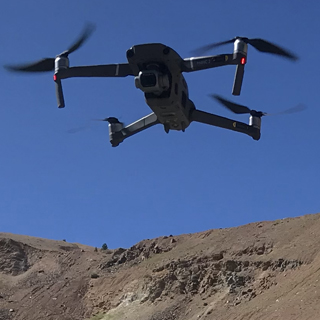
Drone Week
November 26-30, 2018
Join us to learn how UM faculty, staff and students are using unmanned aircraft systems in research and how you can too with UM's Autonomous Aerial Systems Office.
All talks are in University Center room 332
Monday, November 26
- 10 -10:50 am Drones, NDVI and Lessons Learned - Bart Bauer, Wildlife Biology student
- 2 - 2:50 pm Drones and Wildlife: Sharing the Airspace Safely - Dr. Erick Greene, Division of Biological Sciences
Wednesday, November 28
- 10 - 10:50 am Using UAVs to Map Terrestrial Lichen Cover Within Caribou Ranges - Eric Palm, PhD student, Wildlife Biology
- 2 - 2:50 pm Drones in TV, Film, News and Social Media - Tyson Dupuis, UAV World Systems
- 3 - 5 pm Come fly a drone in Schreiber Gym!
Thursday, November 29
- 10 -10:50 am UAS Platform Development For Gathering Weather Data - Fred Bunt, MS Student, Computer Science
Friday, November 30
- 10 - 10:50 am Evolution of Unmanned Aerial Systems in Fire - Dr. LLoyd Queen, Dr. Carl Seielstad, FireCenter, UM
- 2 - 2:50 pm UAVs for Freshwater Ecology - Diane Whited, Flathead Lake Biological Station
- 3 - 5:30 pm AASO Open House - Interdisciplinary Science Building (ISB) 107. Join us for drinks, hors d'oeuvres and a chance to check out UM's drone resources
Drone Week Talk Abstracts
Drones, NDVI and Lessons Learned
Bart Bauer, Wildlife Biology student
Our project utilized drones, multispectral sensors and automated flight controls to gather high resolution data, for NDVI analysis, over time. This project was conducted between July-August of 2018, utilizing a DJI Inspire drone, a Micasense RedEdge multispectral sensor, DJI Ground Station Pro and Pix4d to capture high resolution (8cm/pixel) multiband imagery, for computing weekly NDVIs of the study sites. Deer Lodge Prison served as the location for all study sites, ranging from ~50 acres and smaller.
Techniques, procedures, environmental conditions and altitudes were tested and evaluated to determine feasibility and workflows. Data and procedures were evaluated to determine best practices, limitations and resources needed, for future projects.
This was a proof of concept project, funded by the Montana Space Grant Consortium, in collaboration with the Autonomous Aerial Systems Office, to determine best practices, work flows and limitations, of sensors and drone capabilities.
Drones and Wildlife: Sharing the Airspace Safely
Dr. Erick Greene, Division of Biological Sciences
Drones are often used in areas that are close to wildlife. Drone operators typically are not aware of the negative impacts they may have on wildlife. The most risky encounters (both for the wildlife and the drone) involve interactions between raptors (hawks, falcons, eagles) and drones. I will talk about how to fly drones safely in areas with raptors (which is just about everywhere) and other wildlife.Using UAVs to Map Terrestrial Lichen Cover Within Caribou Ranges
Eric Palm, PhD candidate, Wildlife Biology
Increases in future fire frequency and severity in northern boreal forests of Alaska and Yukon have the potential to alter caribou resource selection patterns and limit their food availability, leading to declines in body condition, recruitment and population sizes. To understand the mechanisms by which fires may affect caribou habitat selection and demography, we require better data on the spatial distribution and abundance of terrestrial lichen, a major caribou food source that takes decades to recover post fire. Data from unmanned aerial vehicles (UAVs) bridge the gap between in situ ground measurements and satellite remote sensing data by providing cost-effective, high-resolution imagery that allow for interpretation of lichen and vegetation features. We used consumer UAVs and in situ ground cover measurements to sample lichen cover at 57 sites across eight caribou ranges in interior Alaska and Yukon. We classified ~1 cm pixels from UAV orthomosaic images as either light-colored terrestrial lichen or not using ground-based plot photos as references. We aggregated UAV imagery to produce fractional lichen cover estimates for 30 m pixels. These data trained and validated models that used Landsat reflectance composites and spectral metrics to estimate lichen cover for the Fortymile caribou range and adjacent ranges in the Yukon Territory.Evolution of Unmanned Aerial Systems in Fire
Dr. LLoyd Queen, Dr. Carl Seielstad, FireCenter - College of Forestry and Conservation
In 2016 the State of Montana funded the Montana Research and Economic Development Initiative (MREDI) as an investment to leverage university-based research into strategic advances for Montana’s economy. In partnership with UM’s Autonomous Aerial Systems Office and several nascent UAS companies, the FireCenter led an effort to establish “DroneFire,” aimed at development of a drone economy in Montana.Our seminar will focus on one DroneFire goal; namely development of operational use cases for UAS in fire science and management. We will discuss progress to-date on access to national airspace, building and maintaining UAS platforms, sensors and data management systems, hi-lite applications in wildfire and BAER support, and present research applications of UAS-based remote sensing. Instances of UAS deployments from 2017 wildfires and prescribed fire science campaigns in MT, GA, FL and OR will be showcased.
UAVs for Freshwater Ecology
Dr. Diane Whited, Flathead Lake Biological Station
The rapid growth of Unmanned Aerial Vehicles (UAVs) has provided a readily accessible tool to collect remotely sensed ecological data. This has created a strong need for application based education on the planning, acquisition, and analyses of high resolution imagery collected from UAVs. In particular, UAVs offer a flexible and efficient option for assessing and monitoring aquatic habitats. We provide an overview of the UAV Remote Sensing for Freshwater Ecology summer course taught at the Flathead Lake Biological Station. In addition, applications of UAVs for effective monitoring of floodplain habitats in Switzerland are highlighted.