Montana's Pryor Mountains Offer Diverse Landscapes
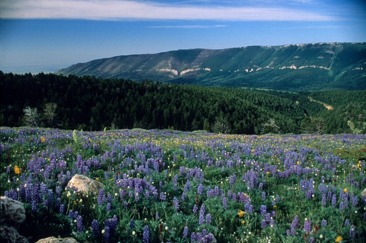 Wildflowers bloom in the Pryor Mountains. (Photo by Rick and Susie Graetz)
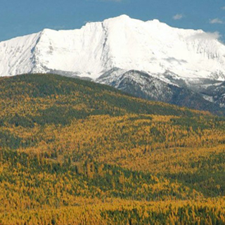
Red desert, ice caves and wild horses are symbols of a most unique piece of Montana’s mountain country – the island-like Pryor Mountains of south-central Montana.
From the Yellowstone River Valley and the big-little town of Billings, these Pryors appear as hills when compared to the towering Beartooths 30 miles to the west. Looks are deceiving, though. Flying just beyond their flanks, especially along the east face, reveals a steep, rugged and high landscape.
Named after Nathaniel Pryor of the Lewis and Clark Expedition, the Pryors rise from the heart of traditional Crow Country. Still used for vision quests today, this treasured land contains sacred sights and ancestral burial grounds. So that these cultural and religious sights can be safeguarded, the segment of the mountains located on the Crow Indian Reservation is closed to nontribal members.
The Pryors are made up of two high ridges, each about 20 miles across. The northern stretch is within the boundaries of the Crow Reservation. Here the highest points, a little over 7,300 feet, descend gradually into lower timbered buttes.
Ice caves and the 31,000-acre Pryor Mountain National Wild Horse Range highlight the southern part, where the summits top out over 8,700 feet. A dramatic plunge of 5,000 feet to a desert environment exists at the southern-most tip. This area is public ground.
An 8,500-foot high reef of limestone with sharp drop-offs makes up most of the west side of the range. The eastern perimeter declines from wooded ridges to lower hills that are abruptly ended by the sheer walls of the Big Horn Canyon National Recreation Area, a place of reefs, mesas and deep canyons.
This raised landscape is unlike any other place in the state. Its diversity is unequaled, ranging from high desert to sub-alpine terrain in a short distance. Places such as Dry Limestone Canyon, Big Coulee and Burnt Timber Canyon, all on the western edge and in public ownership, are textbook examples of varied vegetation and landforms in a compact area.
Twenty inches of moisture falls annually in the heights, while less than 7 inches sprinkles the lower dry country. Owing to just enough precipitation and snow cover, the upper Pryor meadows display a colorful warm weather show of many wildflowers, while desert blossoms, watered by thunderstorms, show off in the spring and early summer months.
From 140 to 180 wild mustangs roam the protected Wild Horse Range. The origin of these horses is somewhat uncertain. Many feel they are descendants of Spanish steeds that arrived in these parts through the Indians in the early 1700's. However the most ancient record keepers have never mentioned them in their notes. The important factor is they live here and run free.
Before the onslaught of early day hunting and disease wiped them out, bighorn sheep roamed the ridges. In 1972, the animals were reintroduced to the nearby Bighorn Mountains. Not too long after, they crossed the frozen Bighorn River and moved back up into the Pryors. Today, there are about 200 sheep making a living along the east and southern escarpment of the Pryor Mountains.
Ice caves of the Pryors are a unique feature. The largest, Big Ice Cave, is an underground chamber insulated by walls that allow its icy floors to remain frozen throughout the summer. It, as well as the other ice box caverns, is in the heart of the southern tier of the range. A few other caves are hidden along the southeastern edge of the Wild Horse reserve.
Several routes lead to the Big Ice Cave, but most are only useable by 4x4 outfits with clearance. My Subaru Outback, for instance, can handle most of them. One road, suitable for a highway car, does lead to the main cave, and others can be reached by foot. Driving in the Pryors is on rough dirt roads that are only passable in dry weather. Hiking is perhaps the most reliable way to explore this unusual country.
Most of the canyons of this desert-like topography receive little walking use. Places such as Lost Water Canyon run the gauntlet of a prairie ecosystem and offer the foot traveler tough, but worthwhile wilderness experiences. Crooked Creek, the largest canyon in the Pryors, is 15 miles long and can be entered on either opening, but once in, it’s very difficult to get out until the other end is attained. Other highlights of these mountains are the Dry Head Overlook and a fantastic view of the Bighorn Canyon, the wildlife haven of King Canyon, Commissary and Island Ridges (easy hikes) and the Bear Canyon walk to Big Pryor Mountain and the heart of the uplift.
Access to most of the Pryor-Wild Horse Range-Bighorn Canyon complex is through Bridger, Montana, and Lovell, Wyoming. The Bighorn Canyon Visitor Center at Lovell (307-548-2251) is the best starting point. They can provide trail and byway information and have maps.
Rick and Susie Graetz | Department of Geography | University of Montana