Sapphire Mountains Are One of Montana's Gems
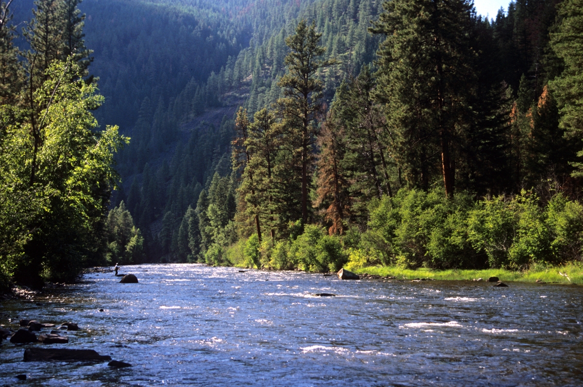 A fisherman tries his luck on Rock Creek – a blue ribbon trout stream and popular recreation area in the Sapphire Mountains. (Photo by the Rick and Susie Graetz)
Seemingly towering above the University of Montana campus, Mount Sentinel’s actual rise is only 5,158 feet. To the folks in Missoula, it is just UM’s mountain with the big M on it. But in the scheme of Montana geography, this big “hill” is the northernmost point of the Sapphire Range, an 85-mile-long massif that forms the eastern perimeter of the Bitterroot Valley. On the south, part of the Sapphire’s boundary terminates with the East Fork of the Bitterroot River while the rest of the summits of the southern edge butt up against the Anaconda-Pintlers. Upper Willow Creek and Rock Creek separate the Sapphires from the John Long Mountains on the east. The range is about 50 miles across at its widest points.
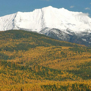
By Montana standards, these mountains aren’t very high. None of the summits match the rugged Bitterroots off to the west. Many of its tops and ridgelines exceed 8,000 feet, and Kent Peak, at just a bit over 9,000 feet, is the tallest.
Although the Sapphires have ample roads and logged-over areas, they are also blessed with at least 320,000 roadless acres and 29,235 acres of designated wilderness ensuring plenty of opportunities for solitude. The roadless places are still awaiting a wilderness bill from Congress to protect them permanently.
The Welcome Creek Wilderness, a lower elevation forest, was established in 1978. Situated in the northern end of the Sapphires, it extends east from the Bitterroot watershed divide to Rock Creek Canyon. Full of old growth stands of lodgepole pine and a plentiful supply of wildlife, its highest point is 7,720-foot Welcome Peak. Thirty miles of trails encourage exploration of this wild country.
At 103,172 acres, Stoney Mountain is the largest of the roadless areas. According to Bill Cunningham in his book “Wild Montana,” no mountain named Stoney exists within or anywhere near this piece of ground. Easily reached from the Skalkaho Pass, as well as from other points along Rock Creek, 73 miles of trails crisscross the landscape. Its highest mountain, and one well worth climbing for the view, is 8,656-foot Dome Shaped Mountain, rising above Stoney Lake. The 25,000-acre Skalkaho Game Preserve, a great place to watch wildlife, especially elk, goats and deer, is included in the Stoney Mountain area of the Sapphire Range.
Fifty miles of trails provide access throughout the 77,000-acre Quigg, the second-largest roadless area in this range. Footpaths leaving from the west bank of Rock Creek lead to 8,419-foot Quigg and 8,480-foot East Quigg peaks. Ridgetop hiking, distance views and few people characterize this wild land.
Rock Creek, one of Montana’s famous blue ribbon trout streams, slices through the northeast reaches of the Sapphires. It surges for 50 miles from the confluence of its middle and west forks to the Clark Fork River, 25 miles east of Missoula. After the forks join, this beautiful river wanders through open prairie-like topography. Here the flow is somewhat gentle, accelerating when its waters reach the deeper canyons within the mountains. A gravel and dirt road follows Rock Creek from the Clark Fork Valley to State Road 38, the Skalkaho Highway.
Climbing steeply out of the Bitterroot Valley a few miles south of Hamilton, the scenic Skalkaho Road crosses the heart of the Sapphires for 50 miles to its junction with Highway 1 in the Flint Creek Valley south of Phillipsburg. Below and just west of 7,250-foot Skalkaho Pass, Skalkaho Falls presents quite a show. This route provides a good look at some very diverse southwestern Montana terrain, ranging from the precipitous west side to the gentler east slope where the road follows the upper stretch of Rock Creek. Several U.S. Forest Service campgrounds are found along the way.
Named for the valuable stones found here, these mountains are well worth a visit. The Montana Atlas and Gazetteer is a good map for guidance. To cover the area with the necessary Forest Service sheets, you will need the maps of the Lolo, Bitterroot and Deerlodge-Beaverhead National forests.
Rick and Susie Graetz | Department of Geography | University of Montana