Capabilities
UAS platforms
AASO has a wide variety of platforms and sensors including DJI and non-DJI UAS.
DJI
- Phantom 4
- Mavic 2 Pro
- M100 with Micasense 10-band
- M600 with Resonon Pika L Hyperspectral sensor
- Inspire with Zenmuse XT FLIR thermal sensor
- Inspire with X3 and X5 Optical cameras
Custom/Non-DJI
- "Weather Quad" - PIxhawk based custom quadrocopter with weather sensor mount as well as the ablility to be programmed for autonomous flight using the DroneKit API and Python
- "Hex" - Pixhawk based custom hexacopter with FLIR Vue Pro R and FPV camera
- Vision Aerial Vector Hexacopter
- Precision Hawk Lancaster (fixed wing)
- SenseFly eBee with thermal and RGB
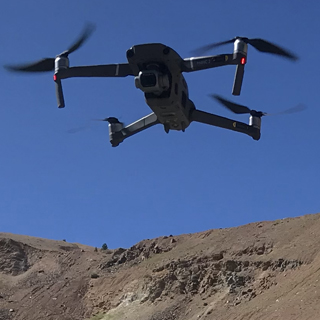
- Skydio 2
Projects
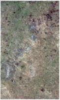
A collaboration with The Nature Conservancy and the Matador Ranch in Eastern MT involves thermal and night vision imagery to improve sage grouse population counts and gender differentiation. Preliminary work with machine learning algorithms are being done to detect the grouse automatically from the aerial imagery.
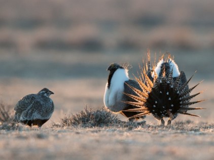
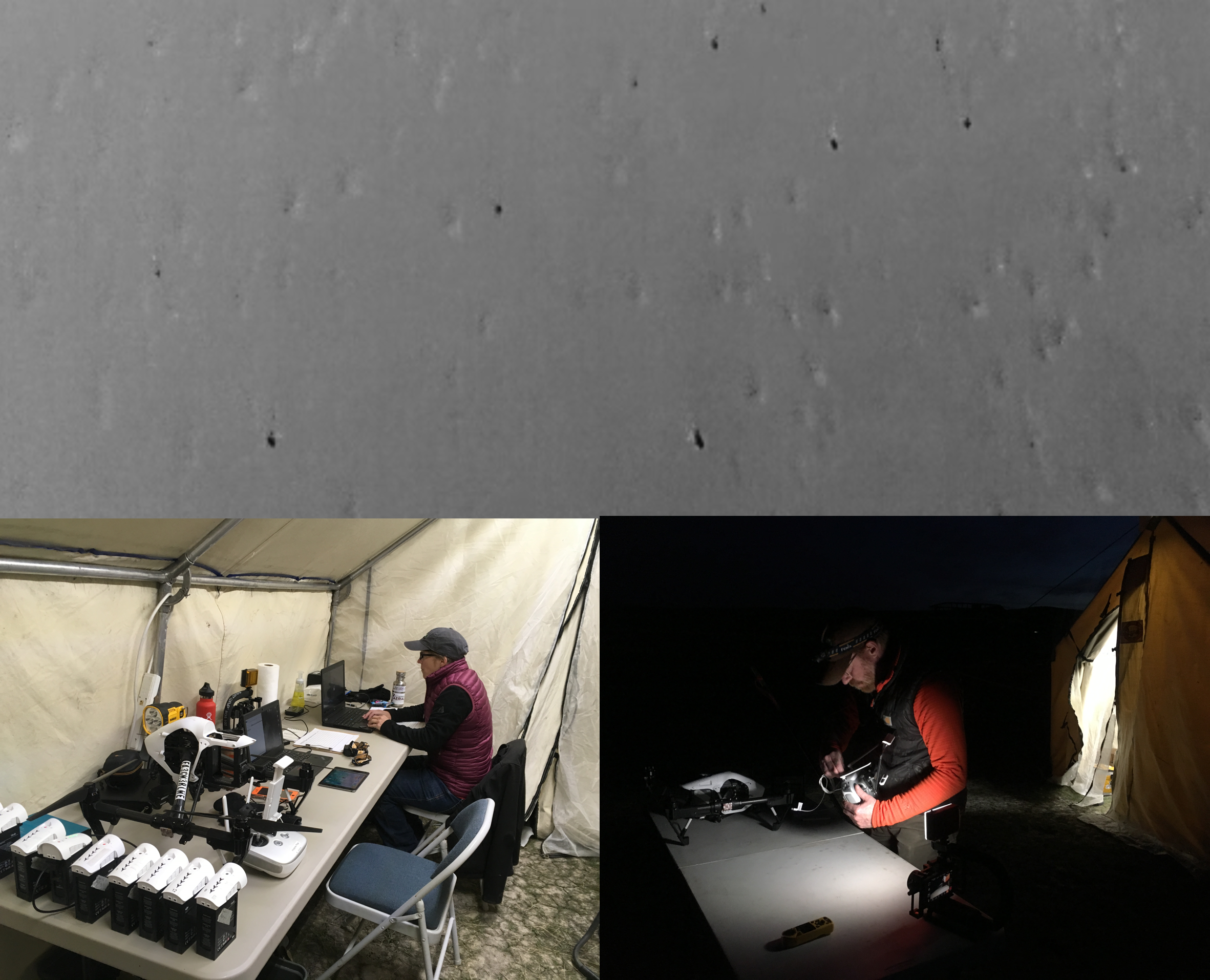
Thermal imagery of sage grouse from
150 feet altitude
Wildfire management
Working with UM's FireCenter, workflows and algorithms are developed to increase fire management effectiveness.
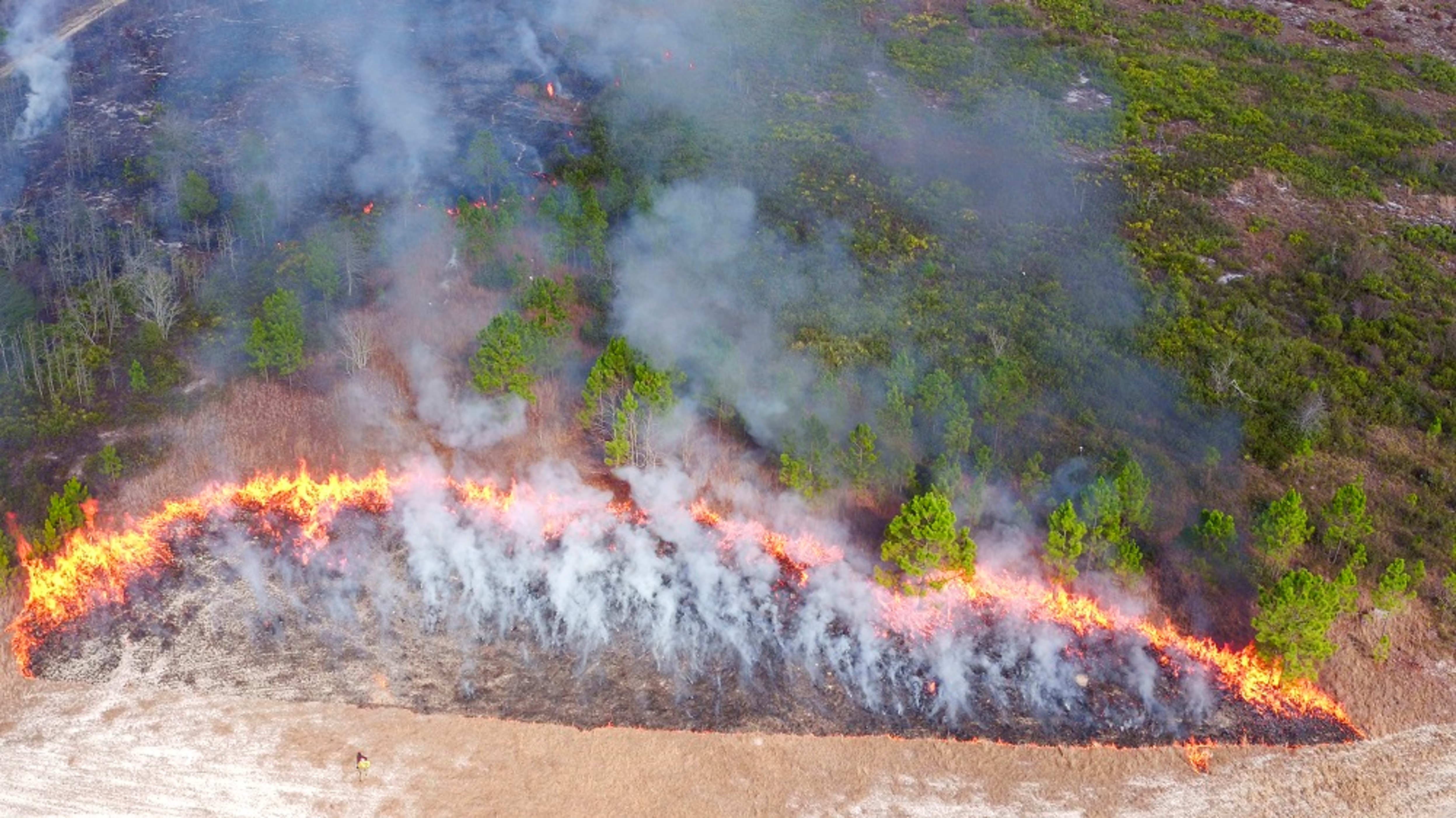
FireCenter team members light off a patch of fuel near
on-the-ground heat flux packages, which are designed to
characterize heat change through time as the fire's
flaming front advances through vegetation
Atmospheric Sounding Studies
Using multiple platforms - fixed wing, quadcopter and high altitude balloons, we have been working for several years to develop a practical solution for flying radiosondes on UAS to supplement balloon-borne radiosonde flights and increase spatial and temporal resolution of this data.
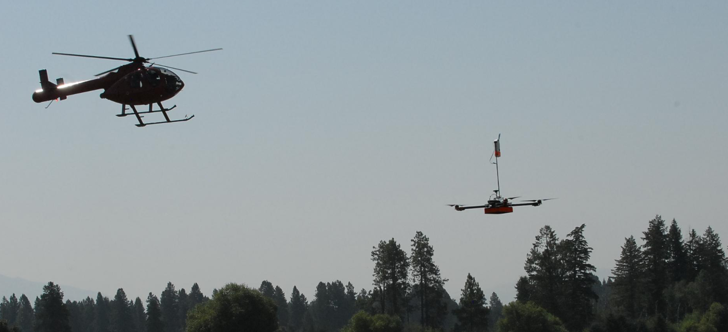
Weather quad on its way to 9500' above sea level
in a comparison test with balloon-borne radiosondes.
Chase helicopter was required in our FAA Certificate of
Authorization
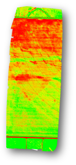
Agriculture Studies
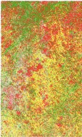
In collaboration with the Montana State Prison, we used a multispectral camera to investigate the effectiveness of different types of irrigation (wheel line, pivot, hand line) throughout the season. Normalized Difference Vegetation Index (NDVI) image shown below.
NDVI = (NIR-Red)/(NIR+Red) where NIR is near infrared (842 nm) and Red is 668 nm. Green generally represents healthier vegetation.
This project worked to assess the presence of ice on a roadway under a grant with the Montana Department of Transportation.
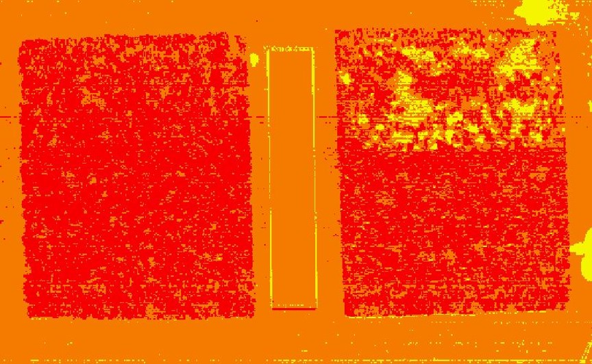
side by side. Principal component analysis
performed to reduce complexity of data.Yellow
pixels indicate areas of snow and ice.
Classification Projects - Vegetation
For one project, nearly 50 acres were mapped using the multispectral sensor and an optical camera. The goal was to classify the terrain as rock, vegetation or bare ground. Imagery was processed using Pix4D, then brought into ArcGIS to create training sets of manually classified pixels. An accuracy assessment over the 30 maps produced was 96%.
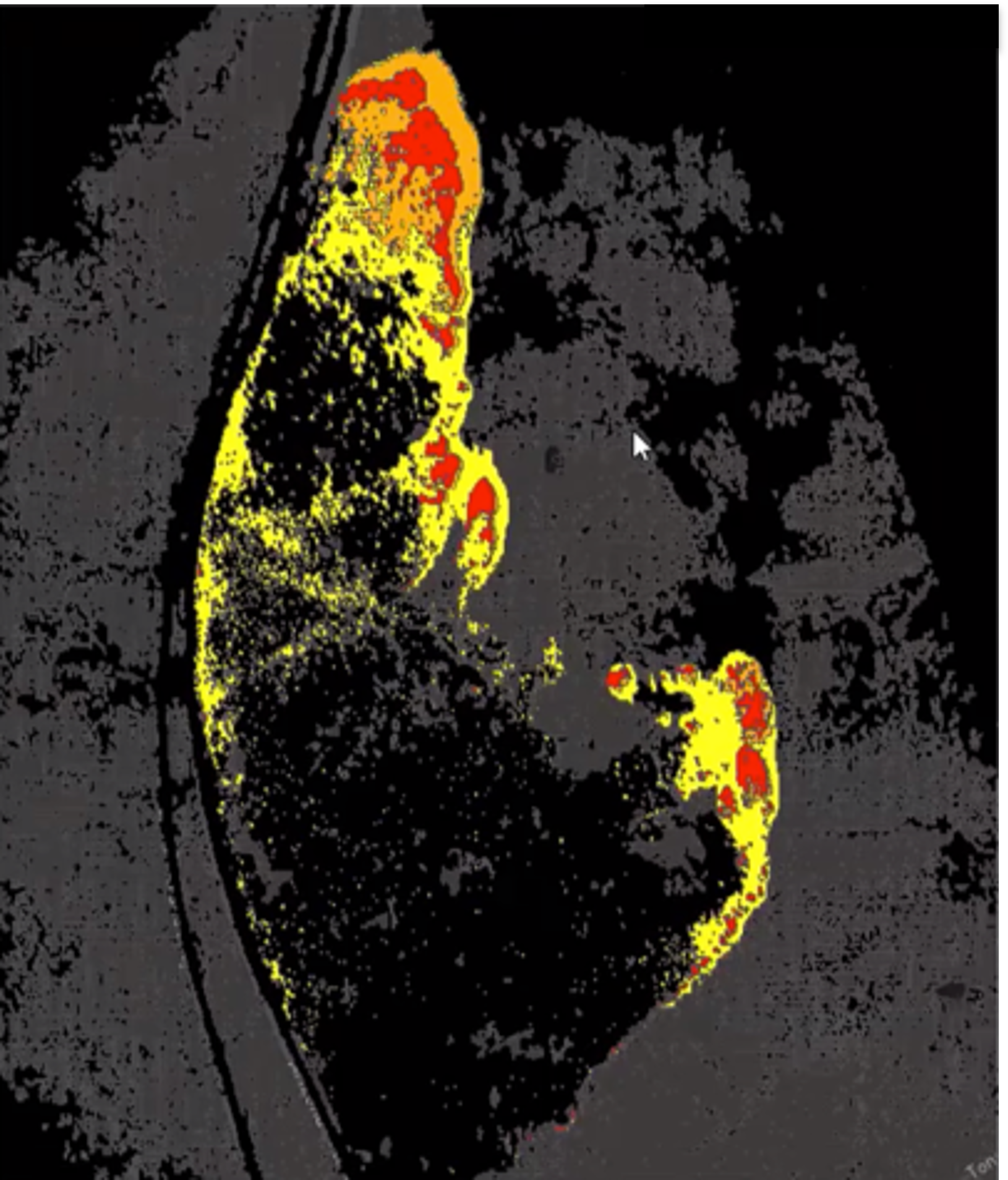
Classification Projects - Fire
Collected data from actively piloted aircraft - RGB, Short Wave Infrared, Mid Wave Infrared and weather data - from active wildfires. Created training sets by manual classification of imagery. Active burning areas are orange, intense heat is red, smoldering is yellow and burnt is black in the image below.
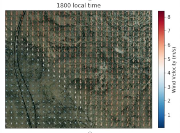
We use the Weather Research and Forecasting (WRF) model and specialize in high resolution (100 meter) forecasts. These may be used for terrain following wind simulation/forecast to couple with or overlay on fire classification.
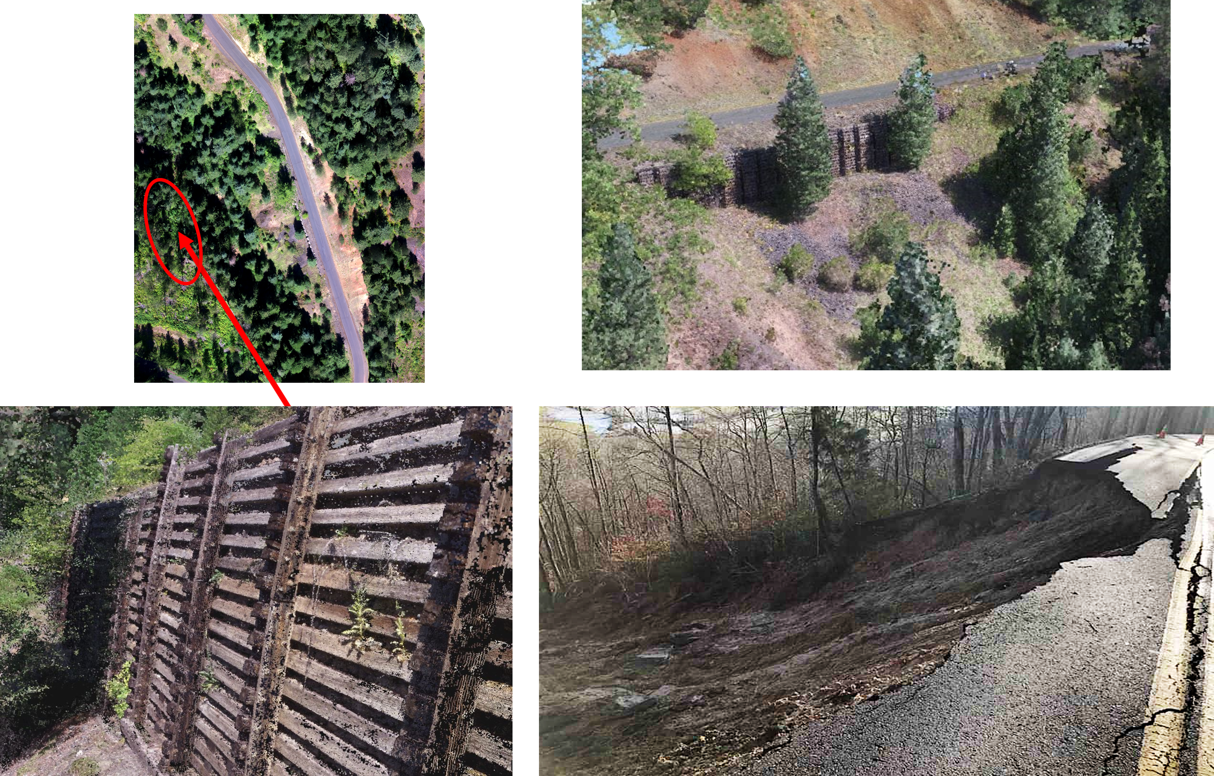
Landslide Monitoring
3D point cloud imagery generated to discover weaknesses in retaining walls of forest roads. This project led to over $1 million in funding for infrastructure repairs.
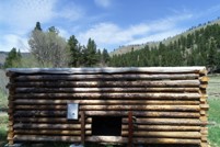
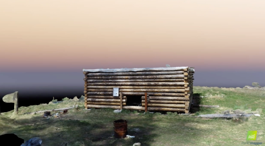
In a pilot project with the US Forest Service, we produced 3D models of historic structures using UAS imagery and Pix4D. These models help maintain and inventory of the structures and could possibly be used for for restoration work.
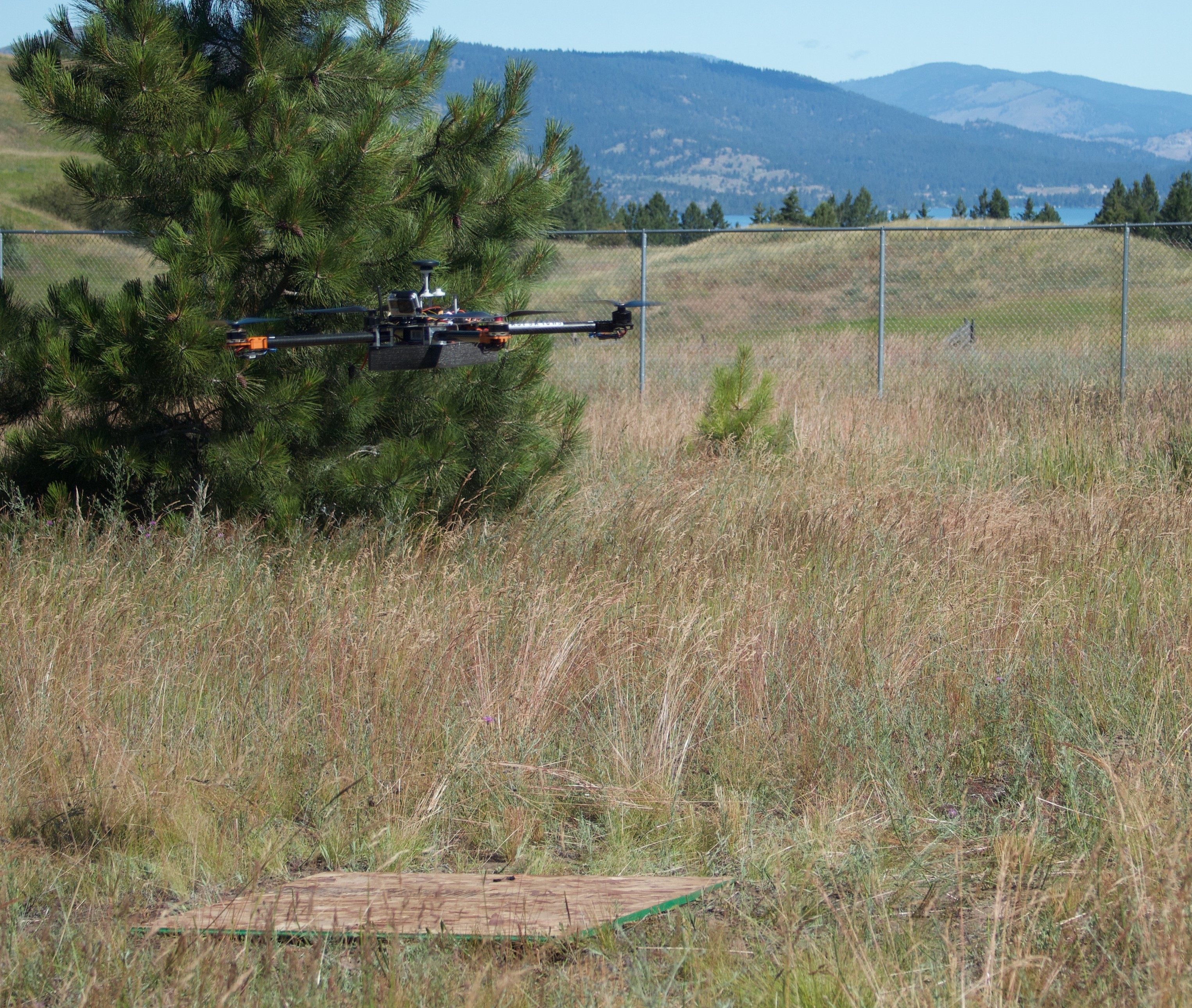
Autonomous Drone Surveillance
As sub-contractors to a private company on a DoD grant, we created Python code using the DroneKit API to autonomously fly our quadrocopter to a given latitude/longitude and circle. This location was specified based on suspicious activity. The code and DroneKit could easily be repurposed for a variety of projects.