SOUTHWEST MONTANA’S EAST PIONEER MOUNTAINS
 SOUTHWEST MONTANA’S EAST PIONEER MOUNTAINS
Mark Spero with Rick Graetz
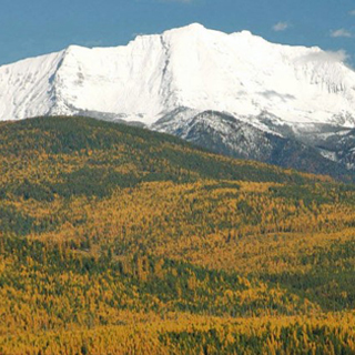
Montana’s West and East Pioneer Mountains rise in the state’s far southwest corner, and though many people link these two ranges together as the Pioneer Mountains, they are very different. Lower elevations and dense forests define the western range, and the eastern heights are known for sharp peaks and glacial lakes.
Like the West Pioneers, the surrounding lands were originally home to the Shoshone, Bannock, Salish, and Kootenai tribes. This area stands between the lands of various tribes, making it an important meeting ground for native peoples before the introduction of white settlers.
When miners and railroads entered southwest Montana, places in and around the East Pioneer Mountains were brimming with people seeking their fortunes through the discovery of precious metals. And prospectors knew where to find gold and silver.
Complex geology best describes the makeup of the range. It has all the required rocks to allow for minerals to form, that is, contact between sedimentary and igneous rocks.
It is mainly composed of granodiorite and intrusive igneous rock. This species is related to granite in many ways, but certain elements give it a darker hue than granite. They intruded into the thrust-faulted Belt sedimentary rocks, hence a contact zone.
From the 1870's to the early 20th century, perimeter towns like Coolidge, Glendale, and Farlin thrived. In the 1880's, Glendale had a charcoal smelter and a population of 2000. From 1905 through 1906, Farlin produced half a million pounds of copper. Coolidge was the site of Montana's most prominent and final major silver exploration. By 1922, the town had electricity, telephone service, and a school, but by the time the mine was fully operational, the economy had hit hard times, and Coolidge abandoned.
As mining receded, environmental protection grew. In 1908, the Beaverhead National Forest was established; over the years, it has grown, encompassing the East and West Pioneer Mountains. In 1996, this national forest expanded to 3.36 million acres, allowing the USFS to manage and protect critical wildlife habitat. The Beaverhead and Deerlodge forests were combined into one administrative unit that year.
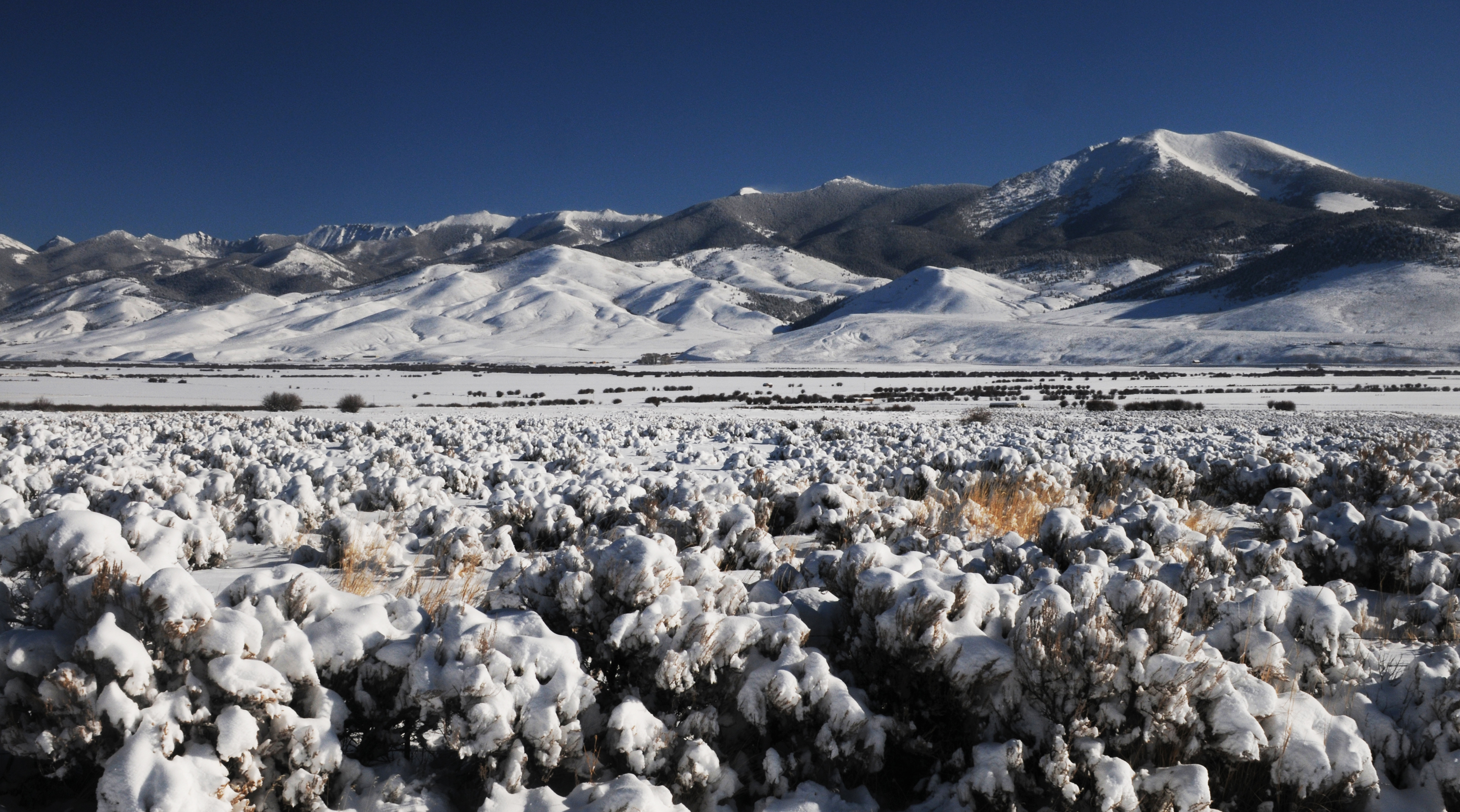
Glaciers left their imprint on much of Montana’s high alpine regions, and the East Pioneer Mountains illustrate the work of these natural bulldozers at its best – textbook ice-sculptured landscapes! Tweedy Mountain reaches 11,154 feet, and nearby Torrey Mountain, 11,147 feet, the two highest pinnacles show off the process. At least eleven other named summits reach well over 10,000 feet in elevation. The author of a book on the Pioneers estimates at least 50 pinnacles surpass 10,000 feet, and many are unnamed points on ridgelines. These and other glaciated peaks create the stark outline of the Eastern Pioneers. At the highest elevations, trees disappear, leaving the bare rock cut by moving ice thousands of years ago.
Hidden within the heights, and the 145,000 roadless acres of this range, are more than 30 glacial lakes containing rare freshwater species. Grayling Lake has some of the last Arctic Grayling, while Sawtooth and Hidden Lakes hold golden trout. Some were stocked with cutthroat and rainbow trout in the past, making the fishing bountiful for those who climb up to them.
Most of Montana's large animals, including goats, sheep, bears, elk, and moose, roam throughout the East Pioneers.
Both ranges are accessible from the Pioneer Mountain Scenic Byway, one of the only ways to get to some regions of these mountains. Closed from December to mid-May by deep snow, the Byway is the start of many climbing and hiking expeditions in summer and winter ski trips, both cross-country and downhill.
After the conclusion of significant mining operations, the towns of Coolidge, Glendale, and Farlin became ghost towns but still show remnants of their past for today's explorers to see. Near Glendale are the Canyon Creek dome-shaped charcoal kilns, of which 23 remain standing. They provided miners with much-needed fuel.
Coolidge Ghost Town and the Elkhorn Mine Complex are the most popular sites. Because the town expected to have a long, successful career before the national economic downturn, the mine complex boasts a huge mill, many decaying buildings, an elevated train track, and a now-closed-off mine entrance. Trapper Creek has at least five mines, though caution is necessary while investigating their entries. Crystal Park, accessed from the Byway, allows visitors to mine for quartz crystals.
With the mines closed and the towns abandoned, the East Pioneer Mountains show some of Montana’s history, both geologic and human. Glacial peaks, lakes, decaying mills, and houses all pepper this wilderness and forested lands. They may be off the beaten track and without many roads or paths, but that helps the Pioneers live up to their name.
Maps of this vast forest are available from the Deerlodge National Forest Supervisor’s office in Dillon, Montana. Call 406 983 – 3900 or 406 683 – 3913. Exploring Montana’s Pioneer Mountains by Leroy Frei and published by Sweetgrass Books is an excellent guide to this landscape and is detailed and a must if you wish to explore this range.
Mark Spero is a University of Montana graduate student and editor of UM’s This is Montana program. Rick Graetz is a member of UM’s Honors College faculty and a Senior Fellow in UM’s O’Connor Center for the Rocky Mountain West.