Swan Mountains a Gateway to Montana Adventure (Part 2 of 2)
South of Swan Peak, Lion Creek Pass offers another important route into the Bob Marshall Wilderness by way of Palisades and Little Salmon creeks. The route up the Swan-face side travels through beautiful stands of giant cedars. Farther down range, Smith Creek Pass is another course to the Swan summits and eventually into the South Fork country. The two trails join up with one coming over Lions Creek Pass to Little Salmon Creek.
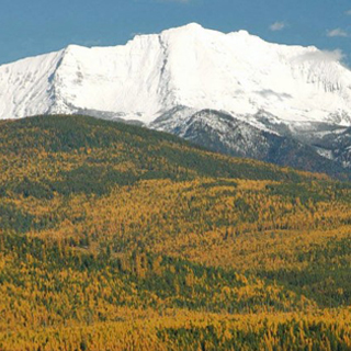
Just east of Condon, the second highest pinnacle in the Bob Marshall country, 9,356-foot Holland Peak, reaches to the clouds. Considered by many to be the most spectacular summit in the Swan Range, it sits amidst a jumble of other towering mountains and is characterized by two huge waterfalls emanating from the Upper and Lower Rumble Creek lakes just below its west face.
The east side of this massif features several active glaciers, but U.S. Forest Service maps depict more glaciers than actually exist. For instance, those shown in Albino Basin, just to the north of Holland Peak, are no more than persistent snowfields that even disappear some years.
Holland Peak, like many other points along the Swan Range, requires a good deal of physical effort to gain the top. The relief here ranges upwards of 5,500 feet, and much of it is darn vertical. Extending for many miles south of Holland Peak are beautiful basins holding high cirque lakes such as Terrace, Woodward, Lick, Pendant, Upper Holland, Koessler, Doctor, George and Necklace lakes, to name a few. To the people of the Swan Valley, this is Montana at its best.
The trails out of Holland Lake, favorites of horse packers, are steep and get one into the backcountry in a hurry. The two major ways are over Gordon Pass from Upper Holland Lake and down Gordon Creek into the South Fork of the Flathead, or via the Pendant or Necklace lakes to Big Salmon Creek and Big Salmon Lake. The distances from Holland Lake into the deep backcountry are great, and most people would rather use horses.
We have hiked across the Bob Marshall and prefer to take it from east to west, coming out at Holland Lake.
From the Seeley Lake area, Pyramid Pass offers access to the upper reaches of the South Fork of the Flathead drainage. Trails from here lead to Young’s Creek. Other less-used passes are in the vicinity of Monture Mountain. Young’s Pass is another popular trail and also leads to Young’s Creek. Hahn Creek Pass, out of the Monture Creek country on the southern end of the range in the Blackfoot Valley, is another well-used horse route into the upper stretches of the South Fork of the Flathead country.
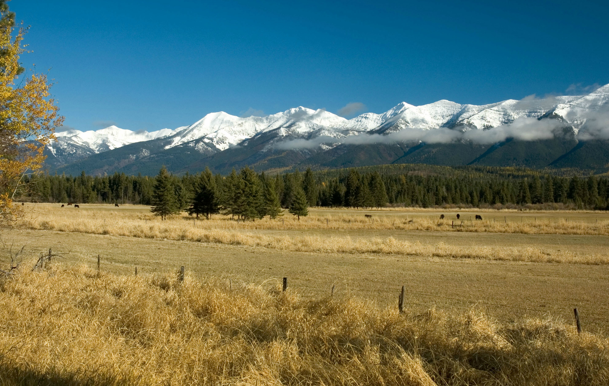
Because of the terrain, the eastern flank of the Bob Marshall offers more road access to the wilderness boundary than does the Swan side. However, there is ample access in the lower reaches of the Swan Valley to enable motorized vehicle enthusiasts to get a closer look at some of the steep slopes and high peaks of the Swan Range. There are loop-logging roads off of the Swan Highway that rise to elevated ridgelines and open to excellent views. The Swan Range, then, just like the Rocky Mountain Front on the other side of the Bob, offers something for everyone.
All of the Bob Marshall country – the contiguous 1.5 million acres of the Bob Marshall, Scapegoat and Great Bear Wilderness Areas plus about 1 million acres of de-facto wilderness – has been “sacred ground” to backcountry travelers since at least the first years of the 18th century. Trails were initially blazed by the great Native American nations as they crossed the Swan Range on their way to the prairie to hunt bison. Later, trappers, hunters and early day forest rangers followed these initial wilderness “highways” and created some of their own.
This gathering of mountains, creeks, rivers, lakes and valleys was so special to so many, that long before wilderness designation was on the public mind, the Forest Service set aside three primitive areas: the South Fork (Flathead) in 1931, the Pentagon in 1933 (the Big River – Middle Fork of the Flathead), and the Sun River in 1934. And in August 1940, in honor of Bob Marshall, who died in November 1939 and as a ranking Forest Service official worked hard to establish wilderness set asides, the agency linked them together, added some additional land and established the 950,000-acre Bob Marshall Wilderness.
The spirits of the first mountain travelers are felt in the cathedral hush of this now protected wild land. Entering it through the historic passages below the pinnacles of the Swan Range is an appropriate ritual. Before ascending into the forests sloping east give thanks to those who came before you and assured that this western flank of the country of the Bob you are about to trek would remain forever wild.
Rick and Susie Graetz | University of Montana | Department of Geography
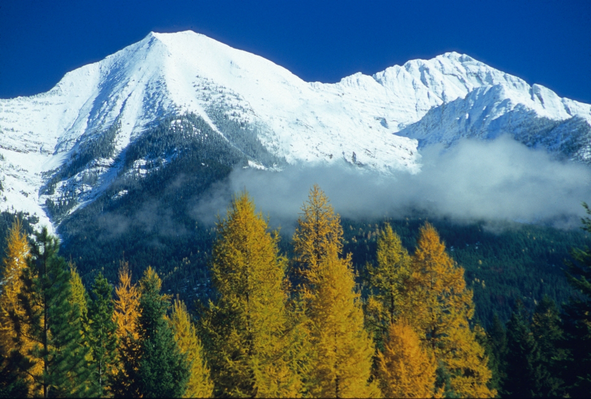
Larch trees turn color below the Swan Range’s Holland Peak, towering above the valley floor at 9,356 feet. (Rick & Suzie Graetz photo)