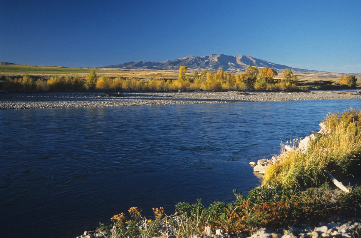
 Yellowstone River near Crazy Mountains: Montana’s iconic Crazy Mountains are seen in the background of this Yellowstone River scene. (Photo by Rick and Susie Graetz)
“It’s a good country. Where a man can sit in his saddle and see … all across to the west stretch the Crazies, and, swinging in the stirrups, a man has to throw back his head to follow their abrupt shoulders up to the white crests of the peaks. A pretty clean country where a man can see a long way and have something to see.”
– Spike Van Cleve’s words from “Forty Years’ Gatherin’s,” speaking of the view from his ranch
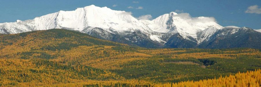
Considered an island range owing to their location separate of the main Northern Rockies, the Crazy Mountains of south central Montana are more akin to the Rockies than they are to the state’s other rounded and more forested isolated ranges. The valleys of the Yellowstone and Shields rivers set them well apart from the Absarokas to the south – and the Bridgers on the west. They are only about 30 miles by 15 miles in size, but serve as sentinels on the horizon from many points east.
Here, the transition from prairie to mountains is dramatic. In a 20-mile span from the river bottoms of the Yellowstone to the pinnacle of Crazy Peak, the terrain rises more than 7,000 feet.
These “Crazy Woman Mountains,” as the Native Americans sometimes called them, are crowned by 11,214-foot Crazy Peak. With 25 pinnacles soaring to more than 10,000 feet, they are the third highest range in the state. Ice, wind and water erosion sculptured them and created the more than 40 jewel-like lakes scattered amongst the sharp saw-toothed ridges and alpine basins. Today, only one ice-age remnant remains, Grasshopper Glacier, which clings to a north facing headwall between Cottonwood and Rock lakes on the west perimeter.
Nearly vertical slopes lead to the highest summits and windswept barren ridges. Mountain goats find this terrain to their liking and frequent the steepest areas.
The northern flanks of the Crazy Mountains are gentler, and the vegetation more lush, than the rocky and precipitous southern reaches. The historic Mussellshell River has its headwaters here in the north, and the Shields River begins its flow from the sheerer west ramparts. Sweet Grass Creek, heading toward the Yellowstone, rushes out of one of the deep eastern canyons.
There are several stories on how the mountains got their name. One was that a wagon train, coming through the Mussellshell Valley, was attacked by Indians. A woman’s family was killed, and it is said, she ran into the mountains to haunt the tribe. Another has it that a woman settler was separated from her wagontrain and wandered into these peaks. People thought that she couldn’t survive without going mad, so the range was dubbed the “Crazy Woman Mountains.” Others claimed it was because they popped up in the middle of nowhere or because of the convoluted geologic formations found there. Take your pick.
The Crazies are significant to Native American culture. In 1847, Chief Plenty Coup, a great chief of the Crow Nation, climbed Crazy Peak to seek a vision so he might properly lead and guide his people.
Although they do not enjoy the lasting protection wilderness status would give them, the extremely rough terrain and the attitude of local ranchers – and lately of the Forest Service – has kept this country pristine and relatively free of roads. Checkerboard ownership places a good portion of the landscape in private hands, including favorite climbing places such as Conical, Granite and Crazy peaks and Rock Lake. Some owners will give permission to enter, but most will not allow motorized use of this wild country ... foot and horse travel only! The same goes for much of the public land.
There isn’t an access shortage, as most of the footpaths traverse Gallatin National Forest ground. One of the most popular routes into the Crazies is reached from Highway 191 between Big Timber and Harlowton via Big Timber Canyon. Beginning at Half Moon Campground, the trail climbs to the high areas around Conical Peak and the Twin Lakes area and then crosses a pass before lowering to Sweetgrass Creek and another trailhead. Tracks also lead to the west side of the range from Wilsall and Clyde Park. There are about 66 miles of horse and walking byways within the Crazy Mountains.
Rick and Susie Graetz | University of Montana | Department of Geography