WHITEHALL
 WHITEHALL
By Mark Spero with Rick Graetz
Like many southwest Montana valleys, the Jefferson River served as a passage for native American tribes “going to buffalo” on the Montana prairie. Where the town of Whitehall now stands, was a crossroads for trails that would then follow the Jefferson to the Three Forks where many of the native peoples joined forces and traveled together. And over time no one tribe controlled the area rather
It was used for hunting and rest by the Bannock, Shoshone, Crow, Nez Perce, and Blackfeet amongst others. Indigenous tribes most likely entered southwest Montana in the 1600's and 1700's, this determined by archeologic records.
In late July 1805 as they moved up the Jefferson, the Corps of Discovery passed nearby. Once the Corps returned to St. Louis in late September 1806, word quickly spread about the great possibilities for the fur trade in what would become Montana. Even before reaching their journeys end Meriwether Lewis noted in his journal that they encountered 11 separate fur trade expeditions on the Missouri.
Eventually more and more fur traders and free trappers came to the Upper Missouri with some eventually making their way into southwest Montana following headwater streams and rivers, looking for beaver. They were in the Whitehall area around 1810 as the short-lived Fort Henry trading post was established at Three Forks about 50 miles downriver.
As the fur trade died out in the 1840's all of Montana remained quiet until on July 28, 1862. On that day the sound of eureka!! echoed across the nation heralding Montana’s first major gold strike on Grasshopper Creek in southwest Montana. Everything changed as thousands crossed the nation with many making their way to the many new gold camps of this part of the future state. Undoubtedly many passed through the lower reaches of the Jefferson River near where Whitehall would soon be.
Like many Montana communities the railroad, in this case the Northern Pacific & Montana gave birth to Whitehall when on September 25, 1889, a depot was established. There are a few stories of how the place got its name. The most credible is that Edward Brooke named the site for a town in Illinois.
However, Montana Place Names, a Montana Historical Society book, says that “Brooke named the town after the old Gilmer and Salisbury Stage Company station on Whitehall Creek, a mile or so from the current town. In 1867 the station consisted of a two-story white, wood framed house- the only structure painted white between Alder Gulch and Last Chance Gulch” - that is Virginia City and Helena.
Railroads continued to play an important role for the town, as the construction of the Milwaukee Railroad in about 1909, brought even more people to the valley.
Platted as a townsite in 1889 the Jefferson County Commissioners didn’t accept the name Whitehall until 1890.
An interesting tall stack, still standing, is a prominent feature of the settlement’s earlier years, what is a remanent of? This, from the book Roadside History of Montana by Don Spritzer;
“Dominating the “skyline” of Whitehall is a tall stark smokestack. The stack is all that remains of a speculative venture that failed. Around the turn of the 20th century, Billings had a thriving sugar beet industry. Some residents of Whitehall hoped to imitate this successful venture. After planting test plots, which proved that beets grew well here, the Amalgamated Sugar Company agreed to build a sugar factory. “
“Whitehall businessmen pushed everyone to buy stock in the enterprise and persuaded farmers to grow beets. In November 1917, Amalgamated began work on its factory. The following spring, the company built a 50-room hotel and numerous houses for future factory workers. A company agent brought in 100 families of Russian immigrants to work the beet fields. After dry summers in 1918 and 1919, beat harvests did not meet expectations. Wartime needs slowed work on the factory. Still, supporters did not give up. They formed a booster club and signed up more farmers and businessmen.” The local press extolled, “finish the yonder beet factory and soon Whitehall will be a city of 5000 people”.
“Amalgamated promised to stay in Whitehall only if 3000 acres were planted in beets in 1920. This quota one went unmet and Amalgamated began selling off bricks from the sugar plant. The local school district leased the hotel and uses for a dorm and the railroad removed its tracks leading to the factory site. Today only the 227- footstock remains.”
Railroads do not have the same importance to Whitehall as they once did, but the train whistle can still be heard as diesel engines pass through town preparing to climb westward and upwards to the Continental Divide about 15 miles away.
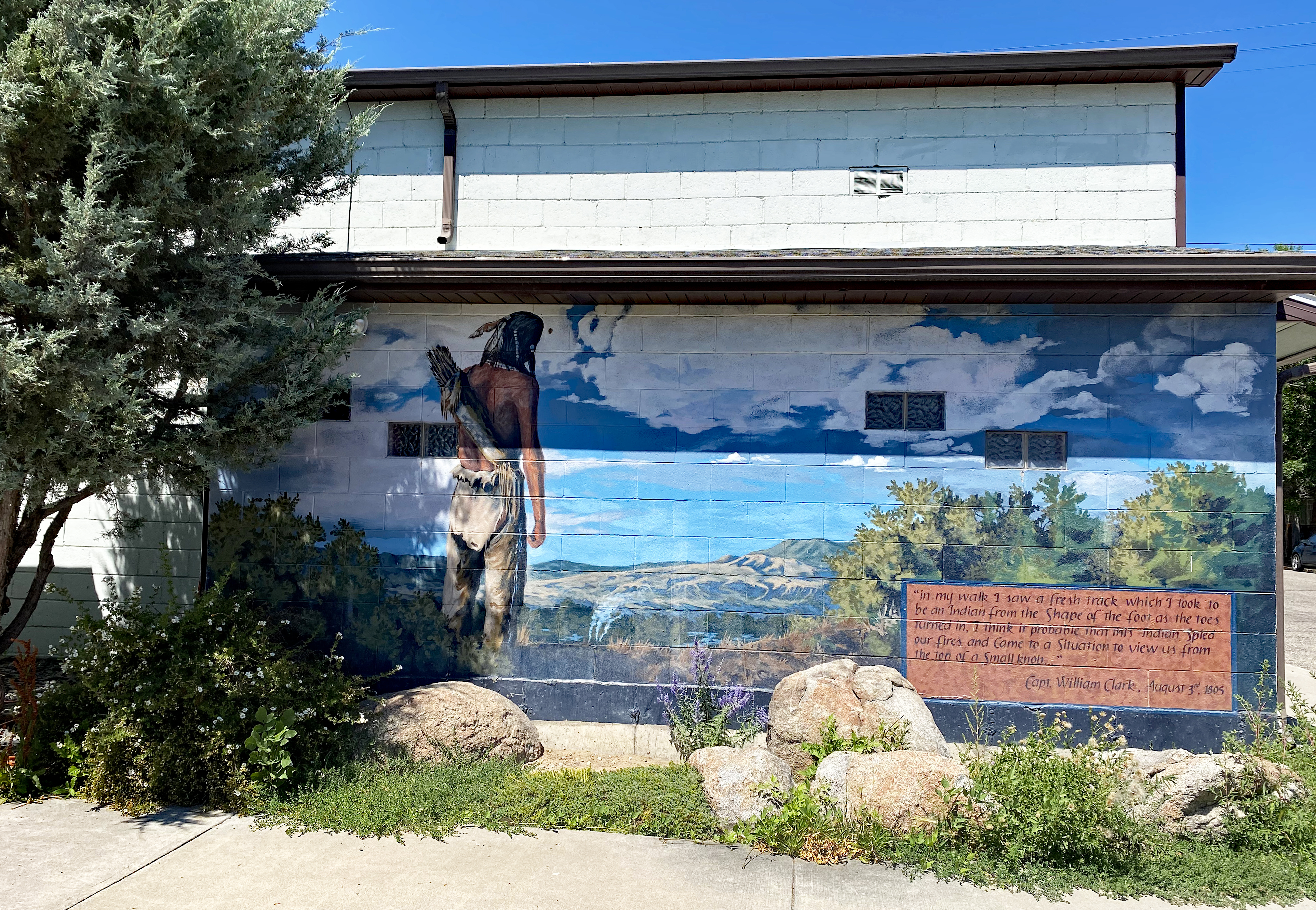
A prominent feature that draws visitors to this Jefferson Valley community are the twelve Lewis and Clark murals depicting the Corps of Discovery’s passage thru the landscape. In 1999, residents created the base for each mural, while Kit Mather and Michelle Tebay, who both live in the area, painted the details. Spread around Whitehall, these paintings link the town today to Montana’s important place in the exploration of the Louisiana Purchase and beyond.
Memories can be easily lost through the generations, but Whitehall strives to preserve the history of the Jefferson Valley and educate residents about the origins of place. Near downtown Whitehall sits a restored barn from 1914 that holds the Jefferson Valley Museum. Free to visitors, the museum depicts the history of the region from before settlement by Europeans to modern times. They also store genealogy catalogues and other research materials about the area. Volunteers manage the museum.
One of the biggest events of the year for Whitehall is Frontier Days. It spans the last weekend of July, and includes two nights of rodeos, street vendors, a parade, and dances. Each year has a theme, and residents from throughout the valley come to town to celebrate, watch various competitions, and learn more about their history. 2021 was the 37th anniversary of Frontier Days, and after the early days of the pandemic kept many people away from their community, the theme was Rediscover Whitehall, inviting everyone to partake and celebrate the town, as it is today and throughout the past couple centuries.
Earlier in summer, local folks organize a fund raiser named Black Tie Blue Jeans. The event raises money for local nonprofits, along with the funding for other Whitehall events including Frontier Days, Shakespeare in the Park, Fall Festival, and the Summer Reading Program.
Whitehall can boast of being only a 20-mile drive from Montana’s first state park: Lewis & Clark Caverns. It includes 3,000 acres of vistas, peaks, and opportunities for camping, but it is best known for its caverns, some of the largest known caves of their kind in the Northwest. These limestone caverns originally formed about 325 million years ago, were probably carved during ice ages with the help of acidic ground water.
Today, the Montana Department of Fish, Wildlife, and Parks offers guided tours of the caves. Lewis & Clark Caverns are also home to eight species of bats, including Townsend’s big eared species. These bats have only four known maternity rousts, one of which is in these caverns; park rangers monitor and protect them.
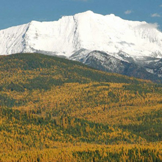
South of town the Tobacco Root Mountains rising to more than 6,400 feet above Main Street, are home to a wide variety of species, including some of the most endangered wildlife in Montana, such as the western toad, flammulated owl, and Canada lynx.
Though glaciers cut towering rock walls, hikers can find a wide variety of trails and camp sites. Hollowtop Mountain is the high point of the Tobacco Roots, reaching 10,604 feet. Named for the large cutout on one side of the mountain, climbers will find a variety of routs to the peak.
And in the southwest viewshed of Whitehall the less expansive but very impressive Highland Mountains crowd part of the horizon. The highest pinnacle, Table Mountain, 10,223 feet pinnacle is very visible.
Much of the area around Whitehall is included in the Beaverhead-Deer Lodge National Forest, the largest national forest in Montana, covering over 3.36 million acres. It is beloved by hikers, hunters, climbers, and all other outdoor enthusiasts. Within this realm, and close to Whitehall, are two well-known points of interest: Delmoe Lake and Ringing Rocks. Picturesque Delmoe Lake, surrounded by forests and cliffs, is a popular camping and fishing spot for locals.
Ringing Rocks looks like a large pile of boulders, but due to the composition of the rock and the erosion around them, a chime can be heard when the pile is hit with a hammer. When a piece is removed, it does not ring. This fascinating and unique geologic outcropping makes its beautiful music together, not separately.
And the Jefferson River is an asset to Whitehall. In many places it meanders through brushy, cottonwood bottoms, surrounded by numerous backwater sloughs that are vital waterfowl, upland birds, and other wildlife in the area. Bird hunting and fishing pastimes accessible to the community.
Whitehall’s location near Interstate Hwy 90 and within easy reach of air service in Helena, Butte and Bozeman has held a stable population of just over 1,000 over the past 30 years. Within sight of easily reached big mountains, the navigable Jefferson River, a scenic setting in ranch country, easy access to the mountains and a peaceful atmosphere has much to do with folks not leaving.
Montana is a big state, both in land and sky, and over the years Montanans have settled on various small towns as important place to meet, cross paths with distant neighbors, and generally form larger communities. One prime example of towns like this is Whitehall, which remains an exciting community that welcomes all travelers to explore an important and scenic part of Montana’s antiquity.