By Cary Shimek, UM News Service
MISSOULA – When the Cold War grew chillier around 1950, the U.S. military worried about a communist land invasion of the United States. So pilots were employed – many of them veterans of World War II – to photograph the entire country using aircraft.
This 70-year-old archive of overlapping photos was taken at different angles, providing topographic information for artillery in the event the Soviets rolled onto American soil. Such a “Red Dawn” never happened, but those pilots created an invaluable historical snapshot that predates useful satellite imagery by decades.
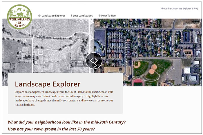
The collection was stored away and eventually digitized by the U.S. Geological Survey. Now the University of Montana and its partners have created a new tool, Landscape Explorer, which combines those 1950s photos with modern satellite imagery. It can be found online at https://www.landscapeexplorer.org/.
Visit the site and type in a city, location or your own address, and a slider can be pulled back and forth across the resulting image, allowing people to easily visualize the changes that have taken place during the past seven decades. At present the tool covers the American West, from the Pacific Ocean to North Dakota and down to Texas.
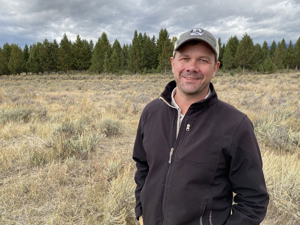
“Very rarely can you find a visualization tool that takes you back 70 years,” said Dr. Dave Naugle, a UM professor of large-scale wildlife ecology. “Satellite imagery doesn’t start getting really useful until the ’80s. We took something originally from the military, assembled it, made it really easy for anybody to use, and now it’s a great way to start a conversation about conservation.
“Thank goodness USGS archived all the car parts, but then our guys put it together and made a Ferrari out of it.”
Naugle is a researcher with UM’s Numerical Terradynamic Simulation Group, which has crafted software for NASA environmental satellites and regularly creates data products for scientists, land managers and others who use satellite imagery. NTSG is part of the University’s W.A. Franke College of Forestry and Conservation.
Other Landscape Explorer partners include Working Lands for Wildlife, a Natural Resources Conservation Service effort to improve agriculture and forest productivity while enhancing wildlife habitat on working landscapes; Montana NRCS; the Intermountain West Joint Venture, which works to conserve wetlands and sagebrush rangelands; and Nvidia, the graphic card producer that provided support through its Academic Hardware Grant Program.
Scott Morford, an NTSG research scientist and the project lead, said the original military imagery collection comprises millions of photographs from across the United States. Landscape Explorer incorporated roughly 170,000 of these images, using nearly 40 terabytes of data. The project scaled up from just western Montana to the entire state and eventually 17 western states.
Morford said the innovative part of what they accomplished was bringing all the historical digital images into a mapping platform and then automating most of the image processing.
“What we did is cracked the nut to figure out how to do this to scale,” Morford said. “People have done this with a couple hundred images, but taking all the historical imagery, automating how it was processed and bringing it all into an easy-to-use mapping interface, that’s a brand-new thing. And it’s been a wow-factor for a lot of folks who have seen it.”
While NTSG researchers automated most of the process to create Landscape Explorer, some work was still done manually. Enter Kristopher Mueller, a map-loving student from Iowa who arrived at UM to earn a GIS (Geographic Information Science) certificate from the forestry college. When GIS students were asked to work with imagery in the NTSG lab, he jumped at the opportunity. He’s now a UM graduate student in systems ecology.
“As I was stitching these images together and seeing all these cool areas, I became excited to get Landscape Explorer out into the world and have other people look at it,” Mueller said.
Naugle said, “If you can help young people like Kris earn their next degree while still getting experience working on our conservation team, that’s a win for conservation, UM and our employees.”
“We almost had Kris chained to the desk,” Morford said with a laugh. “He was pulling the imagery and georectifying it – stitching it together – so that it can all be one big visualization. It was a lot of work.”
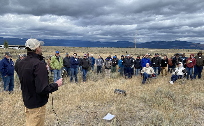
Both Naugle and Morford have worked to conserve sagebrush country and grasslands across the West to benefit wildlife, including species like sage grouse. This often means establishing conservation partnerships with ranchers and other private landowners. They said Landscape Explorer will help them illustrate their conservation project goals.
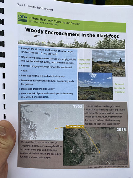
“Woody encroachment is one narrative this will help us communicate,” Morford said. “It’s powerful to show ranchers how much trees have invaded their grazing lands using the 1950s imagery.”
Other conservation groups are finding it useful as well.
“When we show Landscape Explorer to land trusts and others doing conservation work in the West, they are like, ‘Oh, my gosh! We pay companies for this. Now it’s going to be free!’” Naugle said.
And for the NTSG team, sharing this powerful tool is as important as building it.
“We just want to get this into the hands of as many people as possible to drive good decision-making,” Morford said.
###
Contact: Scott Morford, research scientist, UM Numerical Terradynamic Simulation Group, 406-461-4910, scott.morford@umonana.edu; Dave Naugle, wildlife professor of large-scale wildlife ecology, NTSG and UM College of Forestry & Conservation, 406-240-0113, david.naugle@umontana.edu.