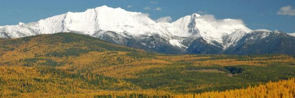
 The Bears Ears, seen from the west, loom in the distance. (Rick & Susie Graetz photo)
This week we make a departure from our columns that portray Montana. Bears Ears National Monument is constantly in the news, yet very few Montanans know much about it.
On Wednesday, Dec. 28, 2016, President Obama designated a new gem in the nation’s public owned lands system – the 1.35 million acre Bears Ears National Monument in southeast Utah.
One million acres of the new monument will be managed by the Bureau of Land Management, and 290,000 by the U.S. Forest Service. A joint planning process is now underway, and, much like before the monument was created, all stakeholders will be involved. The agencies consider public input as essential.
In a historic move, the Bears Ears National Monument will recognize Native American traditional and historical knowledge through means of a commission. The Bears Ears Commission will consist of one elected officer each from the Hopi Nation, Navajo Nation, Ute Mountain Ute Tribe, Ute Indian Tribe of the Uintah Ouray and Zuni Tribe. The expertise of the Bears Ears Commission will help further the proclamation’s directive to provide access to members of Indian tribes for traditional and cultural use of the land, including the collection of plants and firewood.
To allow for local guidance and input, the monument managers will establish an advisory committee that will include state and local governments, tribes, recreational users, local business owners and private landowners.
Obama’s proclamation recognizes the layered history of Bears Ears and future opportunities for archaeological and paleontological study. It also gives a nod to the many activities now enjoyed in the area like hiking, rock climbing, hunting, backpacking, canyoneering, whitewater rafting, mountain biking and horseback riding.
To manage motorized and non-motorized vehicles (mountain bikes) in the monument, managers will create a transportation plan to designate which roads and trails will be open to motorized and non-motorized use. This will allow off-highway-vehicle use on routes that are currently designated as open to motorized vehicles. New roads or trails for motorized vehicles only will be allowed for public safety or cultural resource protection.
Like all national monuments, federal lands in Bears Ears are withdrawn from new mining, energy development and grazing, and existing valid rights and leases will be honored.
Though they’re the monument’s namesake, the Bears Ears feature is only one part of this landscape. The pair of towering buttes stand in the center, with Dark Canyon Wilderness and Beef Basin to the west, Comb Ridge on the east, the Grand Gulch Plateau and Cedar Mesa to the south, and Indian Creek/Canyonlands National Park to the north.
The newly protected landscape within the national monument covers a broad expanse of red rock, juniper forests and high plateau. The cultural, historic and prehistoric legacy includes an abundance of early human and Native American historical artifacts left behind by early Clovis people, Ancestral Puebloans, Fremont culture and others.
Just as important to the Bears Ears designation are the modern-day connections that the Navajo Nation, Ute Mountain Ute Tribe, Hopi Nation and other tribes have to this land.
And what about the name Bears Ears? One of the more popular Navajo stories about the area is about Changing-Bear-Maiden, who was very beautiful and desired by many men. She would have nothing to do with them. However, Coyote the trickster persuaded Changing-Bear-Maiden to marry him in spite of her brothers’ warning that the union would bring evil.
Changing-Bear-Maiden began to change, and by winter’s end her transformation into a mischievous bear was complete. Realizing that the only way to save her was to change her into another form, her brothers killed her, cutting off her ears and throwing them away. They became the buttes seen today.
In the heart of southeast Utah’s magnificent desert country of canyons, “standing rocks” and Cedar Mesa, Bears Ears is easy to access from the towns of Moab, Monticello, Blanding and Bluff. These communities straddle U.S. Highway 191 and are south of Interstate 70. Highway 191 extends northward thru Montana to Canada.
Rick and Susie Graetz | University of Montana | Department of Geography
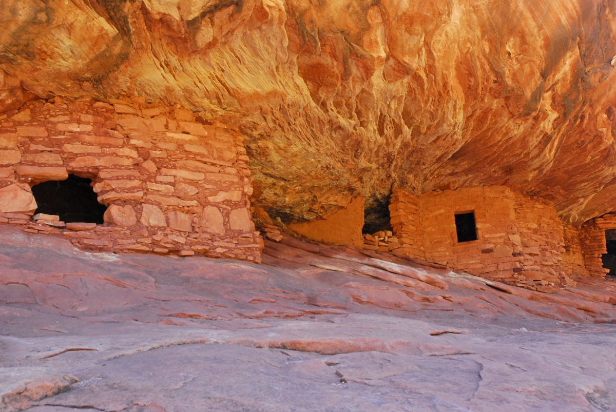
These Anasazi Ruins are found in Mule Canyon. (Rick & Susie Graetz)