A Journey with the Yellowstone in Missouri River Territory (Part 1 of 2)
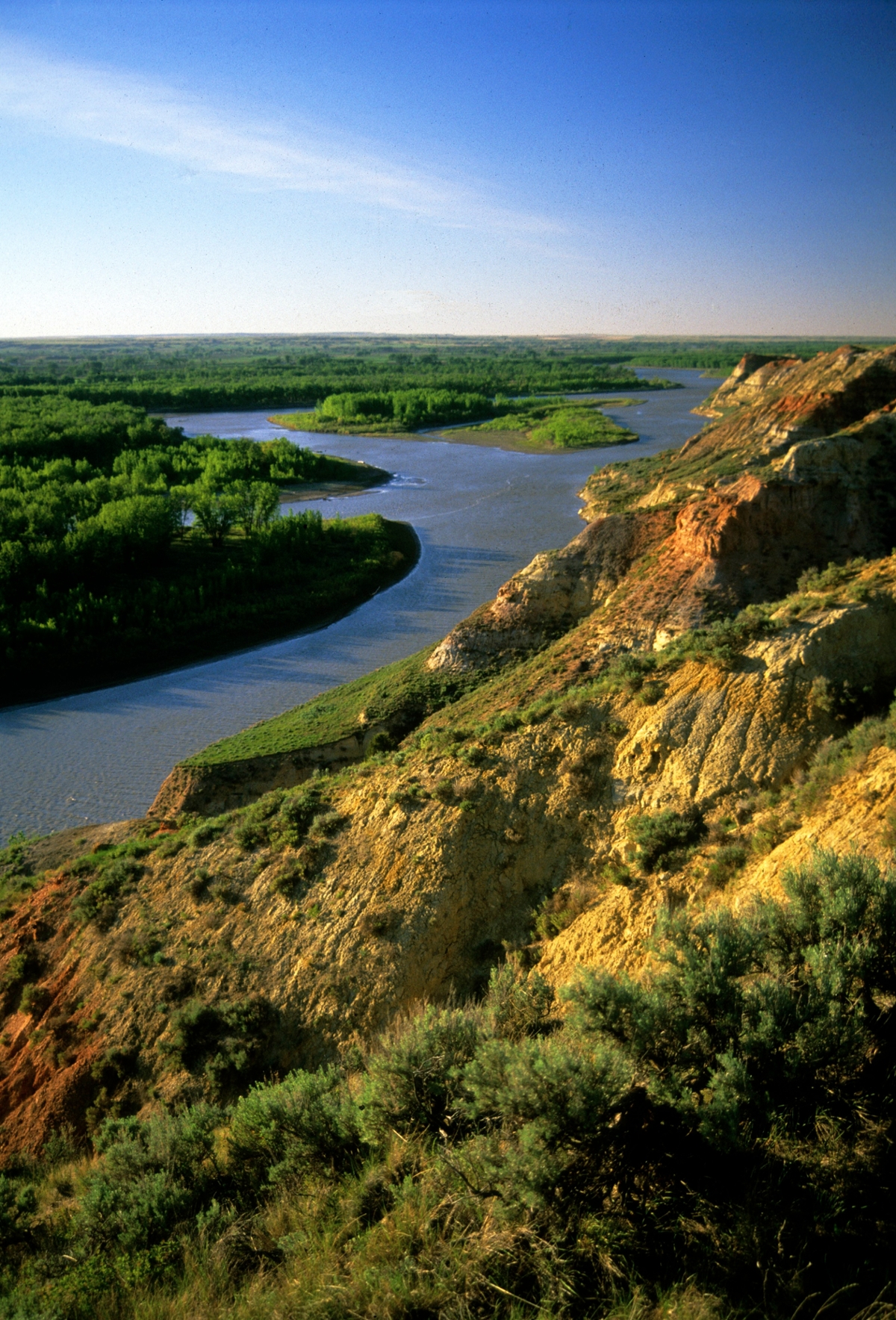
 The Yellowstone River near Sidney (Photo by the Rick and Susie Graetz)
Rolling along for nearly 335 miles in Montana’s Missouri River Country, the Missouri River takes top billing, but the Yellowstone River is far more than a bit player. The 670-mile long waterway’s claim to fame is that it remains the nation's longest undammed river. While it only logs 50 miles in Missouri River Country, it takes in some exquisite landscapes and carries a great deal of Montana history with it.
Gathering some of the finest mountain and prairie topography on the planet, Montana's Yellowstone drains a 70,000-square-mile piece of the West in grand fashion. Once serving as “a moving highway” into the wilderness, this unique river flowed through the passage of millions of bison, the travels of the Corps of Discovery, the creation of the nation's first national park and the foundations of a state.
Long stretches haven’t changed since the Yellowstone’s not-so-long-ago yesterdays, and much of the water continues to surge through clean space. Human presence has grown along the river, but for the most part it is unobtrusive.
The towns of Savage and Crane create small human outposts along a 15-mile stretch of the Yellowstone. Historical notes show Savage, which benefited from the irrigation project, was named for H.M. Savage, a railroad official. The town of Crane, close to Sidney, was titled after the owners of the Crane Ranch. Upstream from Savage, in 1909, a diversion dam was built for the Lower Yellowstone Irrigation Project. When the work was completed, there were nearly 400 miles of canals and ditches carrying Yellowstone River water to croplands, including widespread sugar beet fields.
From Savage to Sidney, the river provides a popular floating stretch amid the Elk Island and the Seven Sisters Wildlife Management areas and the state-owned Crittenden Island. Elk Island, actually three islands in high water and one in low flow, is near Savage, while Crane provides access to the seven small islands named Seven Sisters that legendary Yellowstone steamboat Captain Grant Marsh titled in honor of his siblings.
Floating from Elk Island to the Seven Sisters is a great way to see this special length of the Yellowstone, home to whitetail and mule deer, upland game birds, ducks and geese and other wild critters. It takes from five to seven hours to cover this 12-mile stretch of water. Experienced “river rats” recommend paddling hard once you put in at Elk Island in order to get into the more scenic right-hand side channel. And since the river moves slowly here, sightings of eagles, blue heron and all manners of birdlife are a strong possibility.
On August 2, 1806, Capt. William Clark wrote about this segment: “river wide and very much divided by islands and Sand and Mud bars...Saw emence numbers of Elk Buffalow and wolves to day...passed the enterance of Several brooks on each Side.” Clark was most likely describing Elk Island and the Seven Sisters.
The river from Savage downstream, with its wide bottoms crowded with islands and sandbars and cottonwoods growing in profusion, still looks very much as Clark depicted it. From the town of Intake forward, the terrain on the river’s east side becomes rugged. Badlands and river breaks intermix and ascend well above the floodplain. Juniper, small ponderosa pine and green ash give a warm color to a harsh soil.
Rick and Susie Graetz | Department of Geography | University of Montana
