The Montana Groundwater Academy is a 3-day, place and research-based science program combining classroom and field investigations. MGA engages students in firsthand investigations aligned with the Next Generation Science Standards, and led by scientists and educators. Student understanding is assessed before and after the MGA experience to evaluate program effectiveness.
Day 1
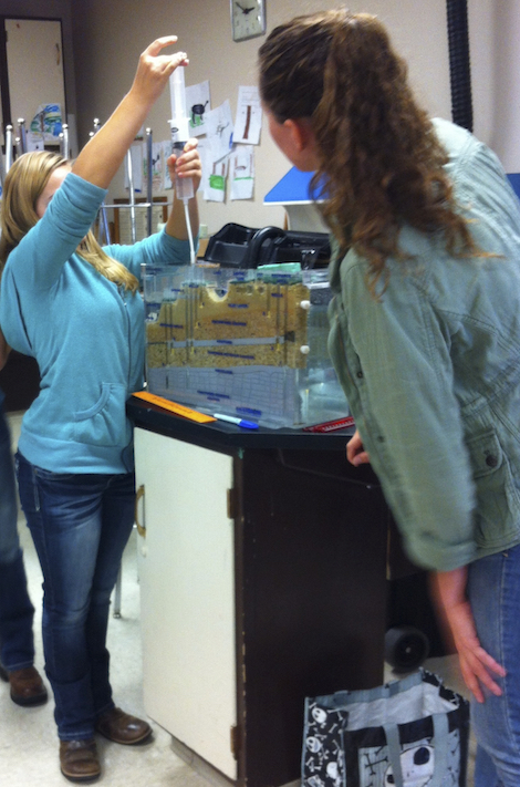
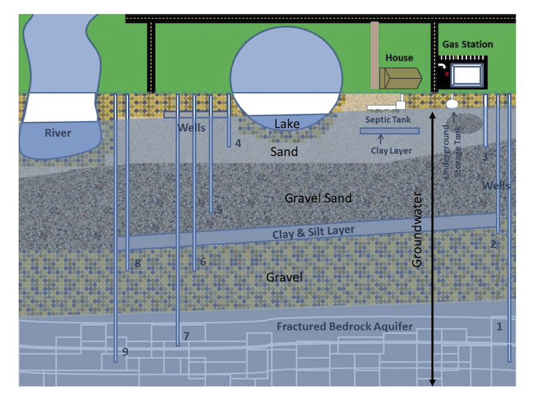
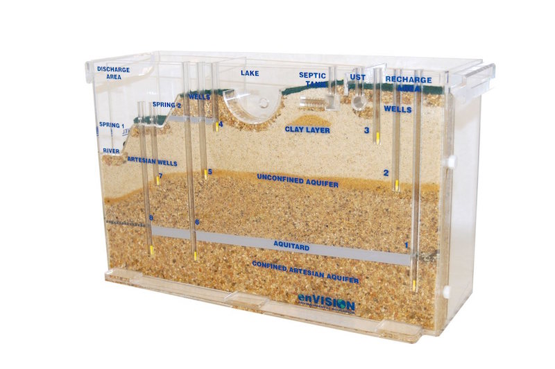
Students use groundwater flow models to develop initial understandings of groundwater system structure and function. A driving question, “Which well would you choose to use for your house?” is posed, and the class undertakes experiments with the flow models to investigate and develop deeper understanding needed to make an informed choice.
Learning Goals
Students will develop the capacity to...
- Explain where groundwater is located.
- Explain why groundwater moves in different directions and with differing levels of ease, depending on site conditions.
- Explain how groundwater and surface water are connected to and affect each other.
- Explain how groundwater becomes contaminated, and how contamination could be prevented or remediated.
Day 2
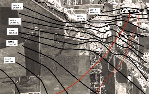
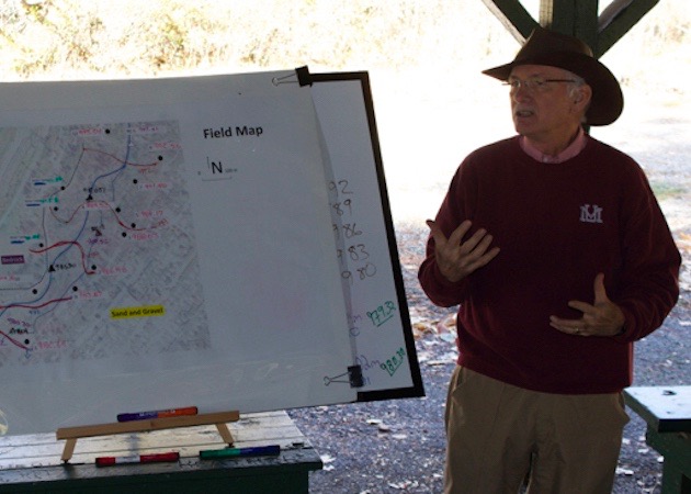
Students use data they collect at the Greenough Park field site to investigate how groundwater flows through landscapes and implications for managing groundwater resources. The day begins with an exploration of the field site and learning how to take water table elevation measurements. Students explore the 3D water table surface using a scale model before dispersing through Greenough Park with MGA facilitators to take measurements from monitoring wells and stage gauges. Students share, compile and evaluate the accuracy of their data. They then use their data to impute a contour map of the water table around Rattlesnake Creek and infer direction of groundwater flow in the area.
Driving questions
- Where do you think groundwater is at the field site? Where is it coming from? Where is it going to?
- What clues does the area provide about where groundwater might be?
- What can we learn about groundwater flow from ground and surface water elevation measurements?


Day 3
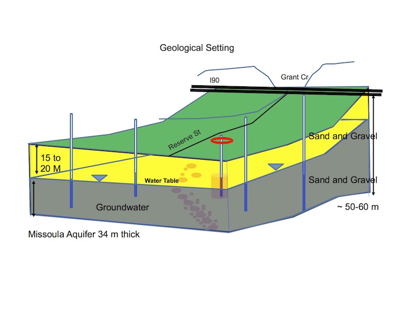
During this classroom lesson, students apply their understanding of hydrologic systems to solve a real-world case of groundwater contamination in the Missoula Valley. Students use data including drinking water quality standards, geological and groundwater elevation maps, information about the possible sources of the contamination and water quality test results to solve the contamination mystery and answer these questions...
- Where did the contaminant come from?
- Where is the contaminant going and who could be exposed?
- What should be done and why?