Satellite Studies
Wildfires are a serious threat in Montana, impacting not only homes and safety, but also air quality and public health. Smoke from wildfires contains tiny particles that can cause health problems, from breathing difficulties to more serious conditions like heart and lung disease.
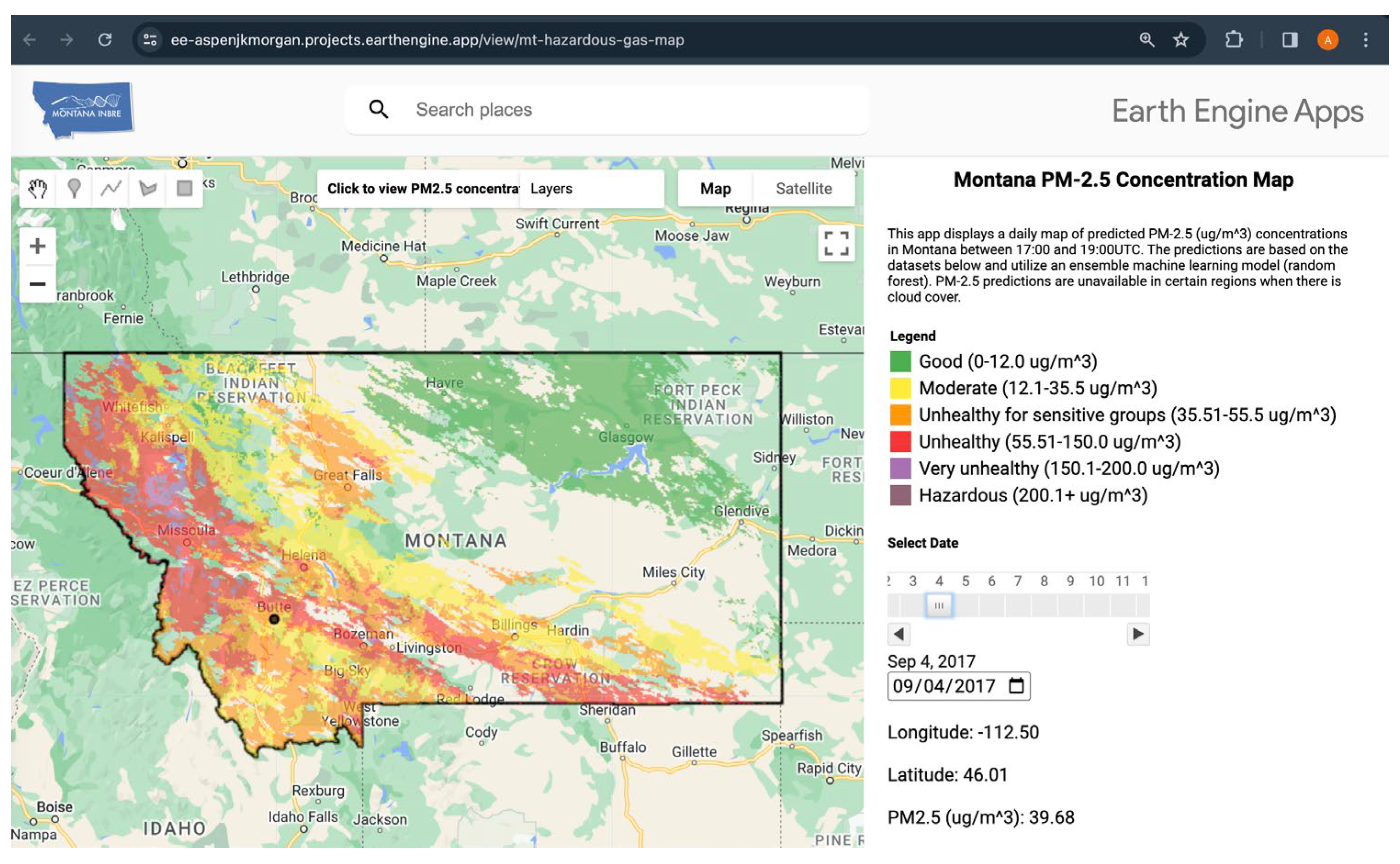
Currently, Montana has 20 ground-based sensors to measure air quality, but they aren’t enough to give a complete picture across the state’s large and varied landscape.
To address this, we developed a new way to estimate air quality using satellite data and advanced computer modeling. By combining information about wildfire smoke (detected by satellites) with weather data like temperature, humidity, and wind, we created maps showing PM2.5 concentrations – a key measure of air pollution – across Montana from 2012 to 2023.
These maps, available through an online application, help communities understand where air quality is poor and take steps to protect themselves during wildfire season. This improved understanding can lead to better health outcomes for all Montanans.
Read the research article published in the Air journal