Faculty
Kevin McManigal
Faculty Affiliate
Contact
- Office
- CHCB 437
- kevin.mcmanigal@mso.umt.edu
- Website
- https://www.opcarto.com/
- Curriculum Vitae
- View/Download CV
Personal Summary
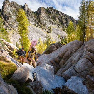
Kevin McManigal has intimate knowledge of the modern GIS and cartographic workflow. Employed as a professional cartographer, he is a recognized innovator among his peers at the North America Cartographic Information Society. He teaches cartography as an art form, utilizing GIS and graphics software to produce maps that inform and inspire. He also has extensive travel experience, including mountaineering expeditions to Alaska, Europe, and South America. His field research includes trips to the Sierra Nevada of California, the Himalaya of Nepal and Bhutan, and the Altai of Mongolia, where he studies the dynamics of glacial change.
Education
- M.S., The University of Montana, 2011
- Geography with Emphasis in Cartography, Repeat Photography, and Glaciology
- Thesis: Retracing the 1910 Carruthers Royal Geographical Society Expedition to the Turgen Mountains of Mongolia – Reconstruction of a Century of Glacial Change (Dr. Ulrich Kamp, advisor)
- B.A., Humboldt State University, 2006
- Geography (major) with Emphasis in Cartography
- German (minor)
- Graduate Certificate in GIS & Remote Sensing, Humboldt State University, 2006
- Emphasis in Glacial Remote Sensing
Field of Study
Cartography, GIS, Remote Sensing, Mountain Geography, Glaciology
Selected Publications
Articles
- Kamp, U., B.S. Krumwiede, K.G. McManigal, C.G. Pan, M. Walther & A. Dashtseren (2013): The Glaciers of Mongolia. Institute of Arctic and Alpine Research (INSTAAR) Occasional Papers, 61, 48 pp.
- Kamp, U., K.G. McManigal, A. Dashtseren & M. Walther (2013): Documenting glacial changes between 1910, 1970, 1992 and 2010 in the Turgen Mountains, Mongolian Altai, using repeated photographs, topographic maps and satellite imagery. The Geographical Journal, 179, 248-263.
- Kamp, U., B.S. Krumwiede, K. McManigal, M. Walther & A. Dashtseren (2013): Glaciers of Mongolia – Summary. In: Williams, R.S., Jr. & J.G. Ferrigno (eds.), Satellite Image Atlas of Glaciers of the World: State of the Earth’s Cryosphere at the Beginning of the 21st Century. U.S. Geological Survey Professional Paper 1386–A, A75 and A128.
Maps
- 2013: Adventure Cyclist Magazine: "Ride Greater Yellowstone, Map," "Touring Central Montana, Map."
- 2013: Map for book chapter written by Professor Mizuki Miyashita. “Map of the Blackfoot Reservations”
Outreach
- McManigal, K., U. Kamp [co-authors] (2013): Glacier Retreat in Mongolia. Flyer about glacier monitoring and research expeditions to the Turgen Mountains of Mongolia. Produced by the Royal Geographic Society and distributed to 650 High Schools in the U.K. as part of science education curriculum.
Publications
Articles
- McManigal, K.G., S.J. Halvorson, N. Wangdi, U. Kamp & T. Wangchuk (2012): An investigation of glacial retreat and impacts on water security in Lunana Valley, Bhutan. Himalaya, 31, 52-54.
- McManigal, K. (2012): Practical Cartographer's Corner, Graphic Styles and the Appearance Pallet in Illustrator CS5. Cartographic Perspectives, Number 69-Spring.
- 2006: Proceedings of the Western Snow Conference Annual Symposium, “Correlation of Temperature and Snow Water Equivalency in the Sierra Nevada.”
- 2006: The California Geographer, “Applying Remote Sensing and GIS Techniques to Measuring Mass Loss in the Palisade Glacier, Sierra Nevada, California”
- 2005: The California Geographer, “The Economic Geography of Switzerland's Special Relationship with the European Union.”
Maps
- 2012: Adventure Cyclist Magazine: “Mongolia by Bike, Map,” “In the Land of the Long White Cloud -NZ, Map,” “The Canadian Flathead, Map.”
- 2011: Adventure Cyclist Magazine: “Swiss Alpine Bike Route #1, Map.”
- 2010: Adventure Cyclist Magazine: “Billy The Kid Trail, Map,” “St. Albans Raiders, Map,” “Two Africas, Map.”
- 2009: Cartography Design Annual: “Map of Glacial Lake Missoula.”
- 2009: Adventure Cyclist Magazine: “Riding the Roof of the World, Tibet Map,” “Norway in Granny Gear, Map,” “September in the San Juans, Map.”
- 2008: Adventure Cyclist Magazine: “Enrique’s Colombia, Map.”
Affiliations
- Adventure Cycling Association
- American Center for Mongolian Studies
- American Alpine Club
- Association of American Geographers
- California Geographic Society
- Gamma Theta Upsilon
- Humboldt State University Geography Club
- International Commission on Mountain Cartography
- North American Cartographic Information Society
- Phi Kappa Phi Honor Society
- Phi Theta Kappa Honor Society
- Society for Conservation GIS
- The University of Montana Geography Club
Specialized Skills
Cartography, GIS, Remote Sensing, Mountain Geography, Glaciology
Professional Experience
- 2008-2011: GIS Specialist and Cartographer, Adventure Cycling Association.
- 2006-2008: Freelance Cartographer and Web Developer, Orange Peel Cartographic.
- 2005-2006: GIS Manager and Cartographer, North California Wintu Tribe.
- 2006: Lead Cartographer, North Coast Open Studios.
- 2005: Cartographer, Institute of Cartographic Design.
- 2001-2006: Sales Associate, Northern Mountain Supply.
- 2002-2006: Rock Climbing and Sea Kayaking Guide, Center Activities HSU.
- 1997-2006: Adventure Ropes Course Facilitator and Builder, Lodestone Adventures Inc.
- 1998-2001: Director of Climbing Program, The Boojum Institute for Experiential Education.
- 1995-1998: Summer Camp Director, YMCA Camp Bluff Lake.
Honors / Awards
Grants and Scholarships
- 2009-2011: Teaching Assistant Scholarship, The University of Montana.
- 2010: Bertha Morton Scholarship, The University of Montana.
- 2010: Research Scholarship, American Center for Mongolian Studies.
- 2010: Research Grant, Ugyen Wangchuck Institute for Conservation and Environment, Bhutan.
- 2010: Nikwax Mountain Award, American Alpine Club.
- 2010: Arthur K. Gilkey Memorial Research Grant, American Alpine Club.
- 2005: NSF-NASA Field Science Grant, Juneau Icefield Research Program.
- 2005: John L. Harper Scholarship, Humboldt State University.
- 2004: William L. Squire Scholarship, Humboldt State University.
- 2001-2003: CR Memorial Scholarship, CR Foundation League Scholarship, Ingebritson Humboldt Area Foundation Scholarship, College of the Redwoods.
Awards and Honors
- 2011: Association of American Geographers, Mauna Kea Student Presentation Award.
- 2011: Association of American Geographers, Photography Competition, 3rd Place.
- 2010: Gamma Theta Upsilon, International Geographical Honor Society,
- 2010: Golden Key International Honor Society, The University of Montana.
- 2009: Phi Kappa Phi Honor Society, The University of Montana.
- 2006: Student of the Year, Humboldt State University.
- 2006: Phi Kappa Phi Honor Society, Humboldt State University.
- 2006: Christopherson Geosystems Paper Award, Joe Beaton Professional Poster Award, Professional Computer Displayed Map Award, California Geographic Society Conference.
- 2005: Christopherson Geosystems Paper Award, Joe Beaton Professional Poster Award, McKnight Professional Paper Award, California Geographic Society Conference.
- 2005: Outstanding Delegate, West Coast Model Arab League
- 2003: Phi Theta Kappa Honor Society, College of the Redwoods.

