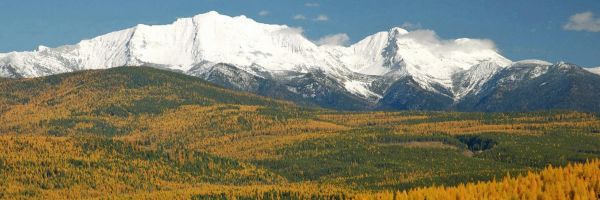
 The Big Snowy Mountains (Photo by Rick and Susie Graetz)
Colors filled the entire sky and painted the many distant mountains in all manners of red, orange and purple. Arriving at the summit of Greathouse Peak in time to experience a prolonged and glorious sunset, Dave Byerly, then publisher of the Lewistown News Argus, Mike Hedrick, then manager of the Charles M. Russell National Wildlife Refuge, and I received benediction and a just reward for an arduous day’s hike. For this writer and backcountry wanderer, it was one of the best.
The Big Snowy Mountains ascend in an elongated mass from the ocean of prairie lands of central Montana – a distinct range with a perch that looks out on the farthest-reaching views in Big Sky Country. This unique mountain complex is located 15 miles south of Lewistown, the geographic center of the state. Instead of a rugged summit line, an eight-mile long tundra-like meadow, over 8,200 feet high, makes up a large portion of the top. One lengthy stretch, a narrow smooth spine, is appropriately called Knife Blade Ridge. From the Snowy Mountains’ highest point, 8,681-foot Greathouse Peak, on a day when the air is clear, a hiker can survey a 300-mile span from the Sweetgrass Hills, near Shelby in the northwest, to the Beartooth and Pryor Mountains below the Yellowstone River Country to the south and southeast.
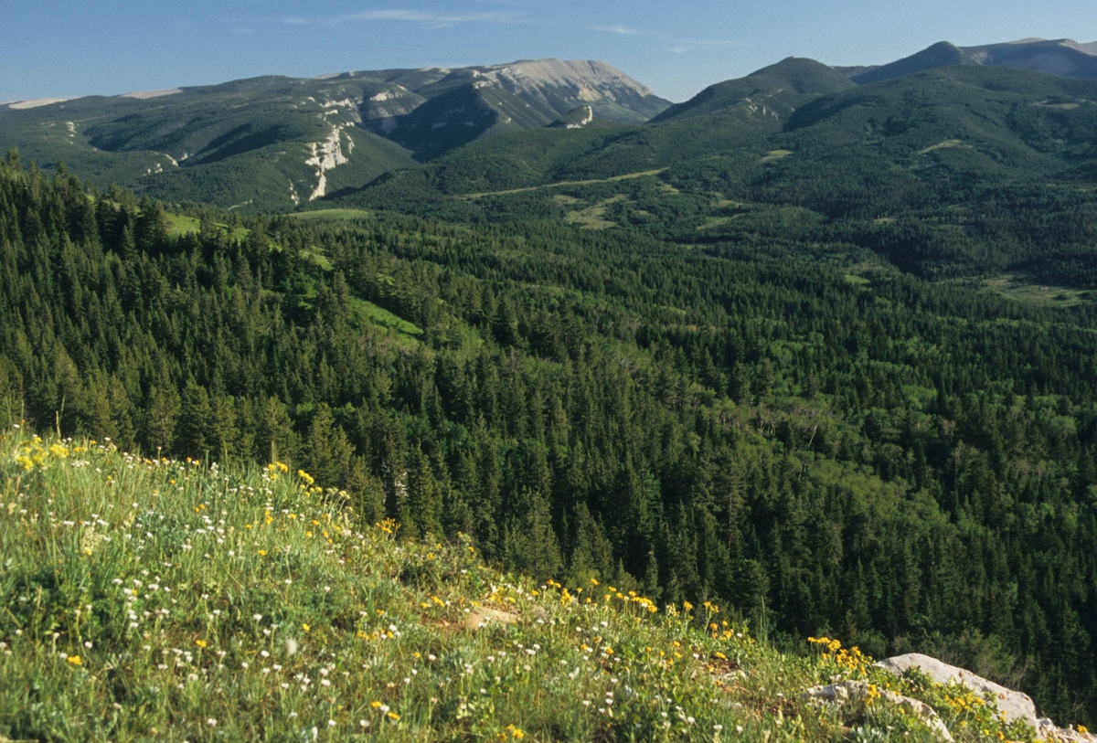
These east-west aligned mountains are made of a porous limestone that allows rain and snowmelt to seep down through them into an aquifer that pores out in several springs. These include Big Springs, which supplies Lewistown with water that is reportedly the purest in the nation. Deep, bowl-like canyons and sparse tree cover characterizes the dry south side of the Snowies. North face canyons are longer, have a somewhat gentler rise and are heavily forested.
In the western end of the Big Snowies, caves have been etched out of the limestone. Many smaller ones are still unexplored. The largest of the known caverns, Big Ice Cave, just below the top ridge, is a treat on hot summer days. The temperature inside is 40 degrees cooler than outside. From a 5-by-10-foot entry, the cave slopes downward to a room about 100 feet long and 75 feet wide. Refrigeration comes from a heavily compacted icy snowdrift that lasts the year round. This underground wonder is accessed from Neil Creek on the southern perimeter.
Popular Crystal Lake, on the north, is reached by Rock Creek Road, off of Montana 200 west of Lewistown. From here, a trail leads to another prominent cave, Devil’s Chute. A footpath off this route also heads to the nearby Big Ice Cave. Sharp eyes will spot marine fossils in the vicinity of the caves. Just below the lake, take a 3.5-mile trek up the East Fork of Rock Creek to the stunning Crystal Cascades, a 100-foot stair-step waterfall.
Further east, Half Moon Creek Trail approaches the Snowy Mountains’ divide from the north, and the Swimming Woman Canyon Trail reaches it via the southern flank. Both byways meet near Greathouse Peak and just west of 8,678-foot Old Baldy, the second highest summit. The north side Cottonwood Creek Trail, which follows the East Fork of Cottonwood Creek to Greathouse Peak and a ridge route from the east slopes of the range to Old Baldy, are two other worthwhile walks. Once winter’s snowbanks melt, the terrain up high is dry, so backpackers planning on overnight stays along the crest need to carry all their water with them.
With the exception of the Crystal Lake area and caves, the Snowies receive low use. Their outstanding wilderness characteristics have allowed for a 104,000 acre core area to be set aside as a wilderness study area by the U.S. Congress. Hawks, golden and bald eagles, moose, deer, elk, goats and bears thrive in the pristine and quiet environment of the high country of these mountains.
A factor in keeping these central Montana mountains wild has been the lack of commercial gold deposits or extensive areas of harvestable timber. The folks in Lewistown take pride in this place.
For a good overview map of the area, use the Lewis and Clark National Forest Jefferson Division Visitors Map. An index for USGS topo maps for the range is available at your local outdoor shop. The Lewis and Clark National Forest ranger stations at Harlowton (406-632-4391) and Stanford (406-566-2292) manage the public land in the Big Snowy Mountains.
Rick and Susie Graetz | Department of Geography | University of Montana| Historical notes courtesy of the UMRBNM and the BLM