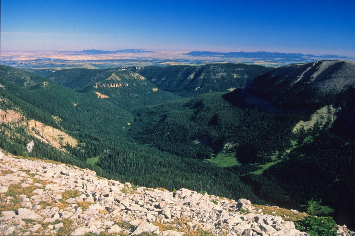
 Looking north from the crest of the Big Snowy Mountains offers stunning views of Lewistown and the Judith and North and South Mockisin mountains. (Photo by Rick and Susie Graetz)
The center of Big Sky Country defines its northern flank with the Missouri River Breaks, then points south to the Yellowstone/Missouri Divide only a short distance north of the Yellowstone River. On the west, the Castle, Belts and Highwoods are the boundary. From there, stretching toward the sunrise, its eastern perimeter follows the Musselshell River after it makes its turn at the “Big Bend” near Melstone to the Missouri River.
Central Montana has experienced virtually every stage of Montana's history, from the times of the nomadic Plains Indians through the Corps of Discovery, which opened the area to fur traders, prospectors, cattlemen, outlaws, vigilantes, railroads and homesteaders. Today, it epitomizes much of what the “real Montana” it is famous for – small population, open space, intact ranches and farms and a dominant rural way of life.
The largest community – Lewistown with the 6,000 folks who choose to live there – is Montana's geographic center and brags of having one of the nation's purest water supplies. The liquid, clarified as it flows through the limestone rock of the Big Snowy Mountains, gushes out of the ground just south of town at Big Springs.
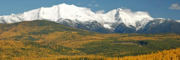
This Montana province is also the gathering place of prairie island ranges: the Big and Little Snowy, Highwood, Judith, North and South Moccasin, Bull, Little Belt and Castle mountains. In addition, the northern peaks of the Crazy Mountains are part of central Montana. All are weather producers for the Central Territory, hatching some of the state's heaviest spring snowfalls and severe summer thunderstorms. Showers are frequent over them, and the grass, as the proverb states, seems to be greener on their side of the fence than in other parts of the state.
Outside Lewistown’s south door sit the Big Snowy Mountains – the pride of this part of the state. Ascending in an elongated mass from the ocean of prairie lands of central Montana, a perch on their crest, 8,681-foot Great House Peak, looks out on the farthest-reaching views in Big Sky Country. On a day when the air is clear, a hiker can survey a 300-mile span from the Sweetgrass Hills near Shelby in the northwest, to the Beartooth and Pryor mountains below the Yellowstone River to the south and southeast.
Mining and the search for gold played a major role in bringing people to the Judith, Little Belts, Moccasins and other high terrain. In 1880, gold was discovered in the northern segment of the Judith Mountains, establishing the current-day semi-ghost town of Maiden, which at one time had a population of 6,000. Now silent, Gilt Edge on the southeast side, was another of the boisterous Judith gold camps. When the ore played out, as it did elsewhere in the state, remnants of these and other gold camps such as Kendall in the North Moccasin Mountains, attest to the once flourishing human presence in these parts.
Rick and Susie Graetz | University of Montana | Department of Geography