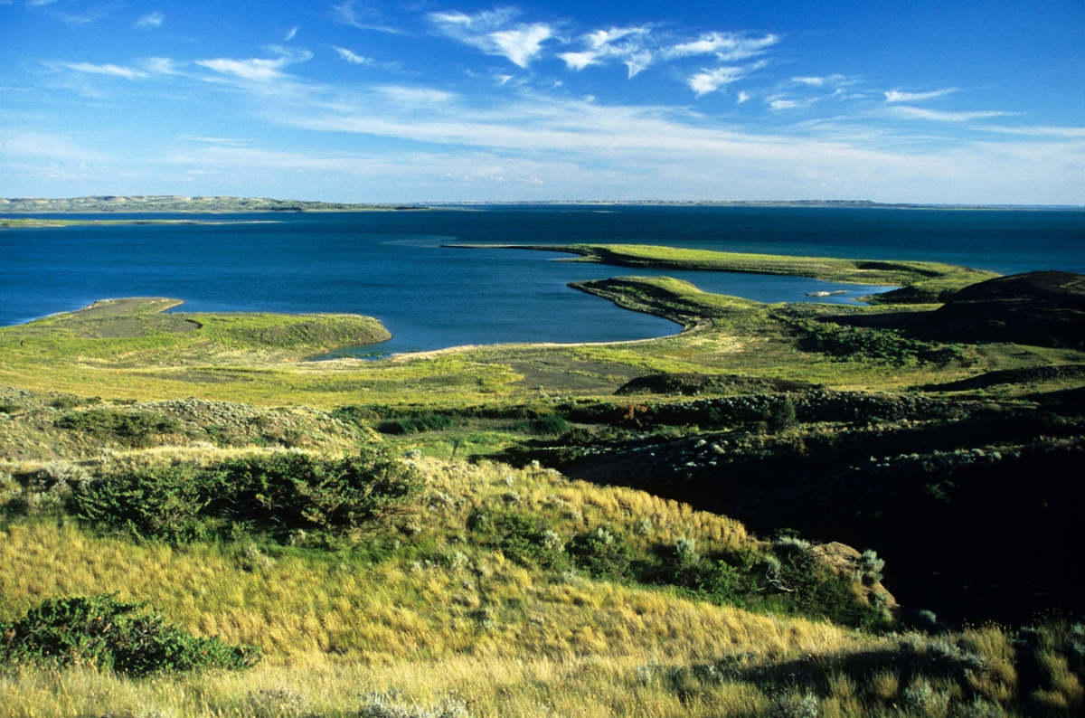
 A view of the Charles M. Russell National Wildlife Refuge from the south shore of Fort Peck Lake (Photo by the Rick and Susie Graetz)
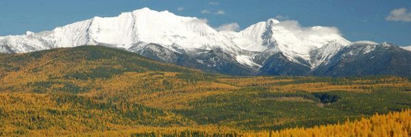
It is an uncommon landscape – at once stark, beautiful, imposing and inviting – this Charles M. Russell National Wildlife Refuge. Time has left most of it with the same appearance as when the Crow, Blackfeet, Nez Perce and Sioux hunted and did battle here. And while some of the wildlife species have disappeared, notably bison and grizzly bears, others, including elk and bighorn sheep, thrive.
The CMR, as it is commonly called, occupies a large swath of Montana’s northeast quadrant and is in the center of some of the least inhabited country in the United States. This 1.1 million-acre refuge straddles part of the free flowing Missouri River and takes in 250,000-acre Fort Peck Lake with its 1,600 miles of shoreline, the rugged Missouri Breaks and wild prairie grasslands. From the western boundary 10 miles upstream of the Fred Robinson Bridge near Grand Island, moving in a straight line, a plane or boat will cover 145 miles by the time it reaches the spillway of Fort Peck Dam and the eastern perimeter of the refuge.
The mix of landforms of the CMR is impressive. Tabletop uplands give way to rugged coulees, wide and precipitous canyons (some 1,000 feet deep) and spectacular badlands. This much-dissected expanse of ground has been carved by flows of water such as Seven Blackfeet Creek, Devils Creek, Snow Creek, Hell Creek and the Musselshell River. Hence the term river breaks.
Elevations and relief are low by Montana standards, but when looking up at some of the high points from the bottom of a gulch, the slopes appear as tough to climb as any mountain. The lowest elevation on the refuge, when Fort Peck Lake is at full pool, is 2,246 feet. One of the loftiest spots is 3,241 feet, in the area above Seven Blackfeet Creek.
Enormous expanses of mostly public land (more than 2 million acres) managed by the Bureau of Land Management surround the Charles M. Russell Refuge. Primitive roads cross this BLM land and lead to the CMR.
The best access to the western edge of the refuge is from Fred Robinson Bridge south of Zortman and Malta. The James Kipp Recreation Area allows for camping and a self-guided wildlife/scenic road goes into the refuge north of the bridge.
The most popular byways into the central and eastern units of the CMR include the Crooked Creek Road near Winnett and the route to Hell Creek out of Jordan. These roads are useable in all but the wettest circumstances (two or three days of rain). Travel is slow, and sixty miles might take more than two hours of drive time.
On the eastern margin of the CMR, off of Highway 24, several routes (dry weather roads) wind to the many recreation areas and boat launches on the Dry Arm. One of the more scenic is the McGuire Creek Road. The best access to the northeast part of the Charles M. Russell is out of Fort Peck, just south of Glasgow.
If you plan to hike in this wild country, realize there are few trails, no palatable drinking water and you will need to be aware of rattlesnakes and prickly pear cactus. The experience of seeing the CMR makes these somewhat rough conditions worthwhile. Camping is allowed anywhere on the CMR, but follow the regulations provided with the Refuge map.
The U.S. Fish and Wildlife Service manages this place, Charlie Russell’s namesake wildlife refuge, first and foremost for the benefit of wildlife, and it is in good hands. As a result, critters of all sizes thrive here.
You’ll visit this grand landscape as a guest of the animals, so be respectful. In turn, you will see one of the crown jewels of the National Wildlife Refuge system and a unique piece of America.
Maps and more information for the refuge can be obtained by writing to: CMR, Box 110, Lewistown, MT 59475 or by calling 406-538-8706.
Rick and Susie Graetz | Department of Geography | University of Montana