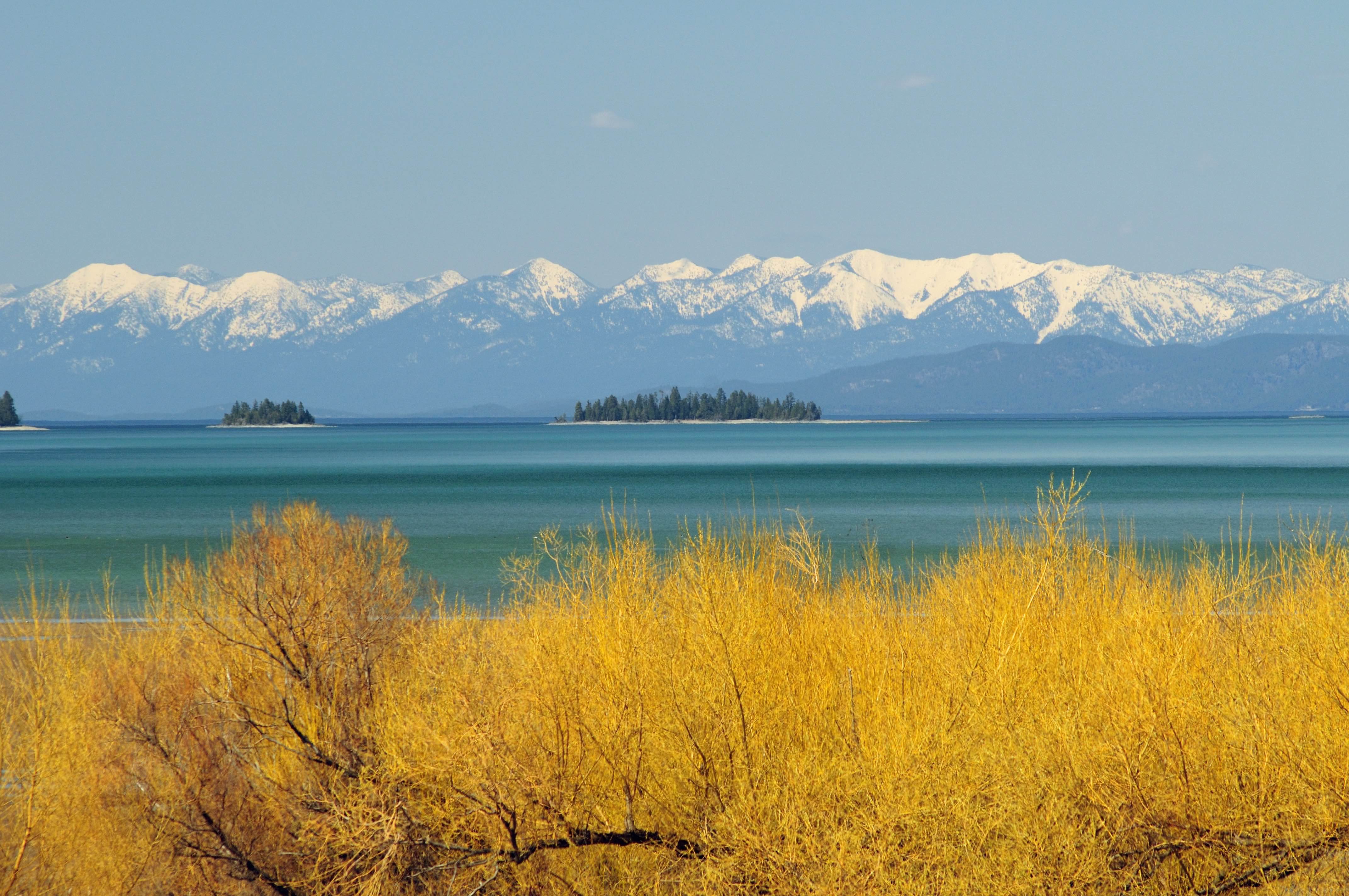
 Spring comes to Flathead Lake while the Swan Range is still cloaked in winter.
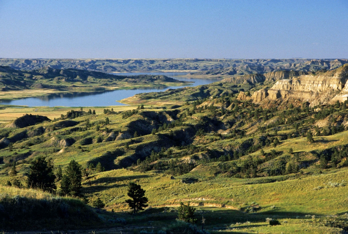
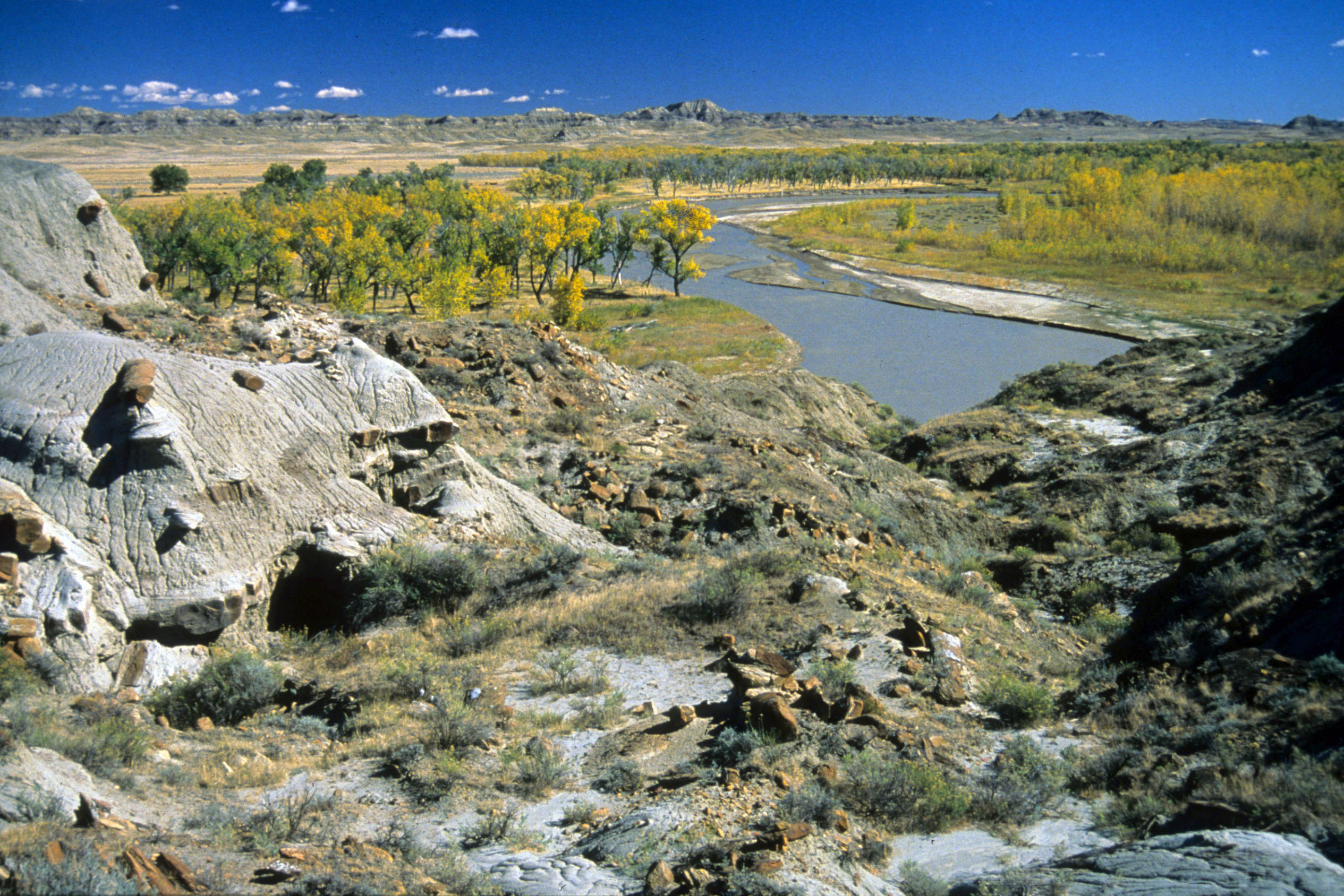
Snow Creek north of Jordan shows off the Missouri River breaks in their spring dress.
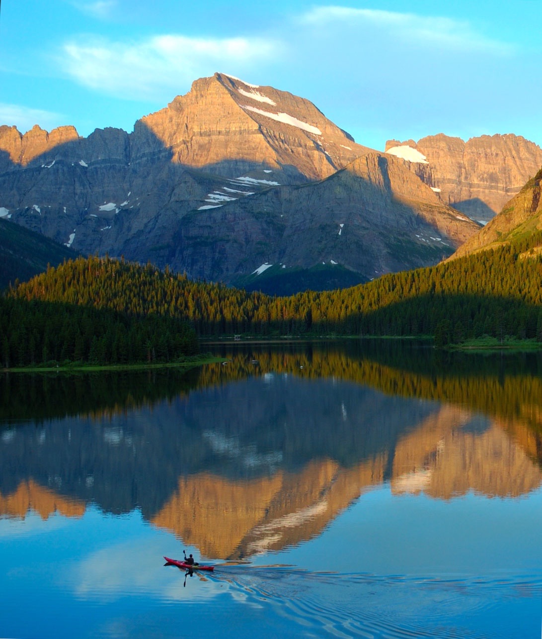
Swiftcurrent Lake in Glacier National Park mirrors Mount Gould and the Continental Divide
"A mile wide, too thin to plow, too thick too drink” – the Powder River south of Broadus
The height of Montana summer – early August – a serene Flathead Lake framed by cedar, ponderosa and spruce confronts me. It is 6 p.m., the sun is still high in its arc but low enough on the western horizon to fade and blend the low-slung ridges and tops of the Salish Mountains, rising from the lake’s western shore 13 miles or more in the distance.
The dark, seemingly featureless massifs become progressively lighter the farther west they extend. A smoke haze from forest fires adds to the silhouetting created by the sun and distance.
Silence has taken over. The water is still. The mechanized watercrafts have been put to bed. Nothing is left to disturb the peace and vision. The human intrusion is vanquished by the expanse of water stretching to the sunset side.
A setting is in place to picture the lake’s and northwest Montana's yesterday.
Looking south toward the foot of the lake, my imagination takes me back to March 1812, when explorer and fur trader David Thompson crested a hill to become the first known white man to stand in awe before the sparkling Flathead Lake.
Turning toward the mountains on the west, I envision lonely trappers seeking the elusive beaver and other fur-bearing animals along the streams threading the forested uplifts. A bit more conjecture, and it is possible to hear the crack and thud of an ax taking a bite out of a pine tree as logging operations took hold in these same woods at a later date.
The smoke-veiled sky made it easy to imagine monster-sized steamboats, with antennae-like stacks belching black sooty clouds that hang in the air, and dripping paddle wheels churning a frothy wake as they plied the 27-mile-long lake from about 1885 to 1930.
The thought of all the history and change that has passed through this incredible valley in the relatively short period of its recorded time is exciting and makes me yearn to know more.
But whether it is on Flathead Lake, the banks of the Missouri River or from a Beartooth summit, the surroundings’ stories ask to be remembered, beg to be relived, lest all that happened lose its importance. It’s not difficult to look back on Montana’s formulative years; it was such a short time ago. And that is part of what makes this state a grand package of space and time.
Every state boasts of great beauty and a history worth remembering. Montana though, combines geography and an unquiet record of the past into an enviable mix. Our topography is diverse and stunning. The Northern Rockies within Montana’s borders equal or surpass mountains found elsewhere, and the prairie lands flowing east of the high country are the most unique and beautiful in the nation. Nowhere on the North American continent do river breaks, island ranges, buttes and badlands come together like they do in Montana's piece of the Great Plains.
Couple this grandeur with great sweeps of landscape unaltered through time and chronicles extending back less than two centuries, and one of the most fascinating and enviable places in America unfolds.
A complete study of a region requires affiliation of place and history. It is especially essential when viewing Montana. Much of what we see here today is intrinsically linked to the past and understanding the past is required to interpret our province of today.
The late K. Ross Toole, an eminent historian and distinguished University of Montana professor, summed up segments of our history and lends us his perspective on its abrupt changes.
"For many years, while immigrants rushed to the West Coast, the facts of geography sealed off the great northern pocket. When at last it was probed, civilization came all at once. It came too fast. There was no ebb to the flow. The plains had sustained millions of buffalo. The sea of grass was endless. To the cattlemen who poured from the south and the west onto this great area in the early 1880's, it was inconceivable that the plains could not sustain their great herds forever. Tough and resourceful as they were, their days on the open range were tragically numbered. In less than a decade their empire had crumbled and the grass was gone.
“Then it was the ‘honyocker,’ who like the cattlemen moved onto the land with quick profit as a basic motive. There were a few good years, but then nature struck again. The mass exodus of people left whole communities empty. Eleven thousand farms were abandoned in eastern Montana in the late teens and early twenties. The boom had been great, so was the bust. The promoters and the ebullient honyockers did not know land. And they left behind them mute towns with tumbleweeds banked high on windward sides of leaning buildings. They also left behind a sorely wounded country.
“In 1880, Nate Leavengood’s meadow, where Anaconda now stands, was a lush and quiet place. As far as the eye could see in all directions there was nothing but the valley, the swelling foothills and mountain ramparts.
“Four years later, the meadow was gone, blighted by arsenic fumes from the largest copper smelter in the world. There had been no gradual encroachment of civilization, no creeping in of small farms and little stores. There was no village. First there was nothing, and then all of a sudden there was the world’s largest smelter and around it a raw new city.”
While Montana’s history may be young, it certainly is deep, and much of its evidence is written on the land.
Knowing that an old trail – the Mullan Wagon Road – followed the Clark Fork River, explains scars along a bench or hillside and the disappearing pieces of a cribbage that supported a bridge. Awareness that Indian tribes traversed the Rock Creek country of northeast Montana explains the circles of stones in succession on a ridgeline – tepee rings.
Recognizing and appreciating Lewis and Clark and the Corps of Discovery’s time in Montana is essential. When Lewis penned his journals on the night of April 27, 1805, in essence he was recording the first written history of Montana. Big Sky Country was uncharted and cloaked in ambiguity. These explorers mapped the land and noted all they witnessed, thereby hoisting the veil. Their account was one of not only biological wonders and magnificent country, but also of wealth. Again K. Ross Toole explains, "Although they left only the ashes of their campfires behind, Montana would never be the same again.”
After studying the words of Meriwether Lewis and William Clark, it is essential to learn of the fur trade. The trappers or "mountain men" as they were often referred to, took over where Clark, the topographer, left off. Their wanderings to almost every quarter of Montana provided more detailed mapping – small compensation for what they took in return. Their mark on our terrain was one of exploitation, setting a pattern that continues to this day. In addition, they had a profound and disastrous effect on the Indians.
The ensuing steamboat era lasted from 1859 through 1888. It started when high waters of the early summer of 1860 brought the steamboat Chippewa to Fort Benton, providing accessibility to the soon-to-be Montana Territory. And the chronology of our underpinnings marches on – the mining, the railroad, the so-called Indian Wars and the homestead era, to name a few. To know these happenings is to better appreciate the terrain of the present.
It’s a big chunk of ground, this Montana. Drive from Troy on the Idaho line in the northwestern corner of the state to Alzada in the far southeast and your iron chariot will up its odometer 800 miles. Cruise across the Hi-Line from Troy to the North Dakota border and it’s an easy 658 miles.
No doubt, pockets of our state's geography have changed dramatically and lost much of their openness and old Montana flavor. Yet, nearly everywhere in this state, even on the fringe of areas thick with development, it is still possible to find, within a short distance, the simple grandeur of the prairie, a quiet meadow, a rippling stream or a trail leading to a mountaintop where we can drink in the simple freshness that replenishes our souls and picture the not-so-long-ago Montana.
It’s a vivid portrait for all who will seek it ... This Is Montana!
Rick Graetz | Department of Geography | University of Montana