 Winter 2020 melted into a stir-crazy spring. Homebound and remotely engaged at best, I had never been more eager for warm weather and long bike rides. The forecast of a balmy June weekend in the Sapphire Mountains was a grounding reminder of how fortunate I am to be in Montana.
After a long evening shift at work, I drove east from Missoula for a much-needed solo bike/camping trip along Rock Creek in Granite County. I planned to ride 55 miles from south to north and reach the confluence with the Clark Fork River, spending the night at one of many National Forest campgrounds along the way.
I pitched my tent at the Pintler Peaks RV park near downtown Phillipsburg. Awakening to a bright blue morning, I quickly broke camp and rode to a coffee shop, where I met my caffeine quota before loading my bike, locking the car and hitting the road.
Pedaling north on Pintler Veteran's Memorial Scenic Highway, I turned left on Route 348 and crossed Flint Creek. Winding my way through sun-soaked pastures, I gained about 1,000 feet in elevation along the southern edge of the John Long Mountains. After eight mellow miles, a panorama appeared that demanded my dismounted attention. 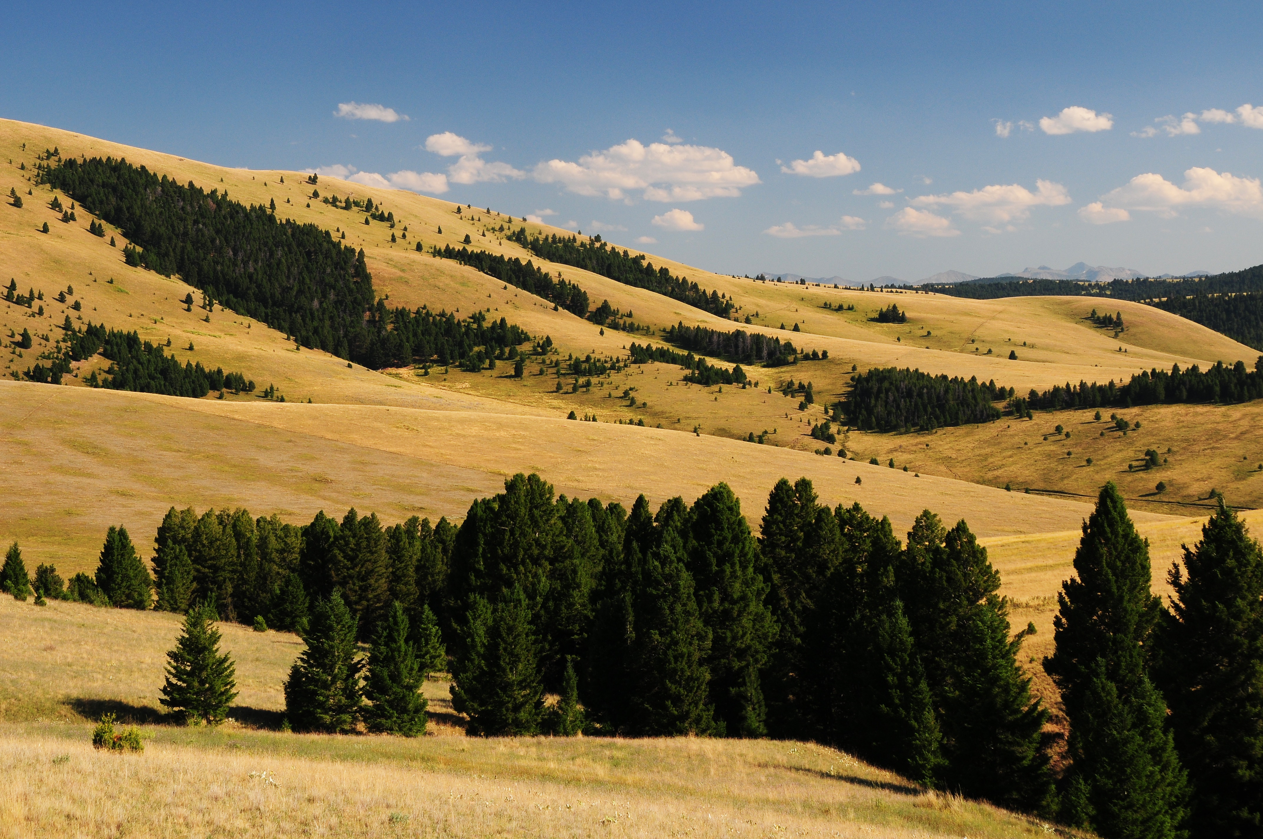
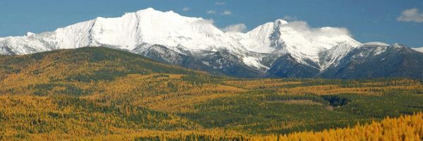
The Anaconda Range was strung out like a banner across the cloudless southeast sky, and to the west, the Sapphire Mountains seemed a stone's throw away. The hills between the ranges were alive with rustling grasses and speckled with tufts of conifer green and angus black. I sat and watched a bluebird emerge timidly from a wooden box on a fencepost before taking flight and disappearing, perfectly camouflaged against the azure ceiling.
Eager to descend toward Rock Creek, I once again “saddled up.” The prospect of covering six miles with hardly a turn of the pedals is indescribably delightful to the flatlander I am. Fifteen blissful minutes brought me to the junction of Granite County Route 348 and Lolo National Forest Road 102.
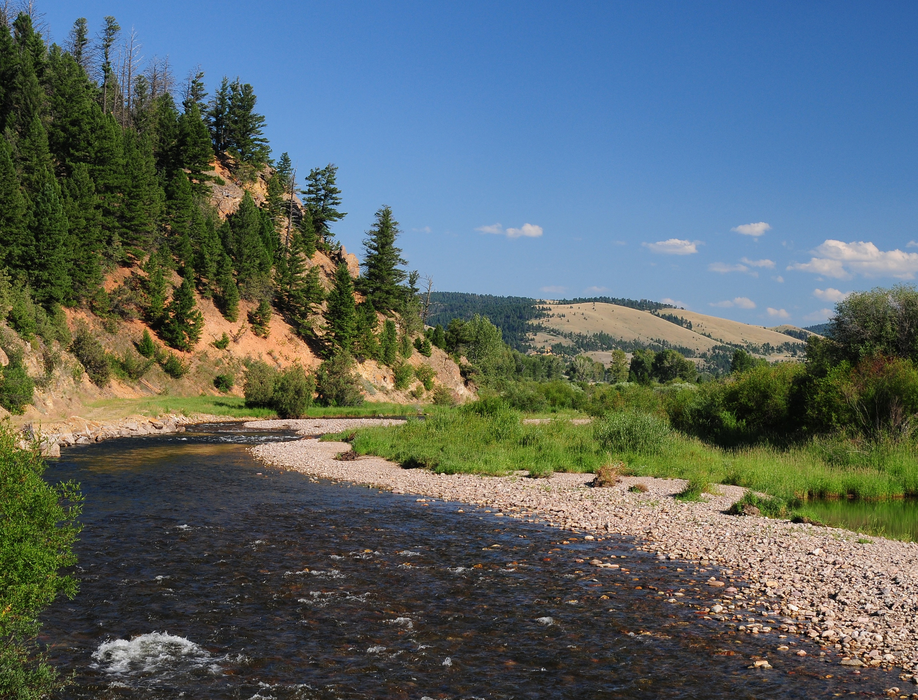
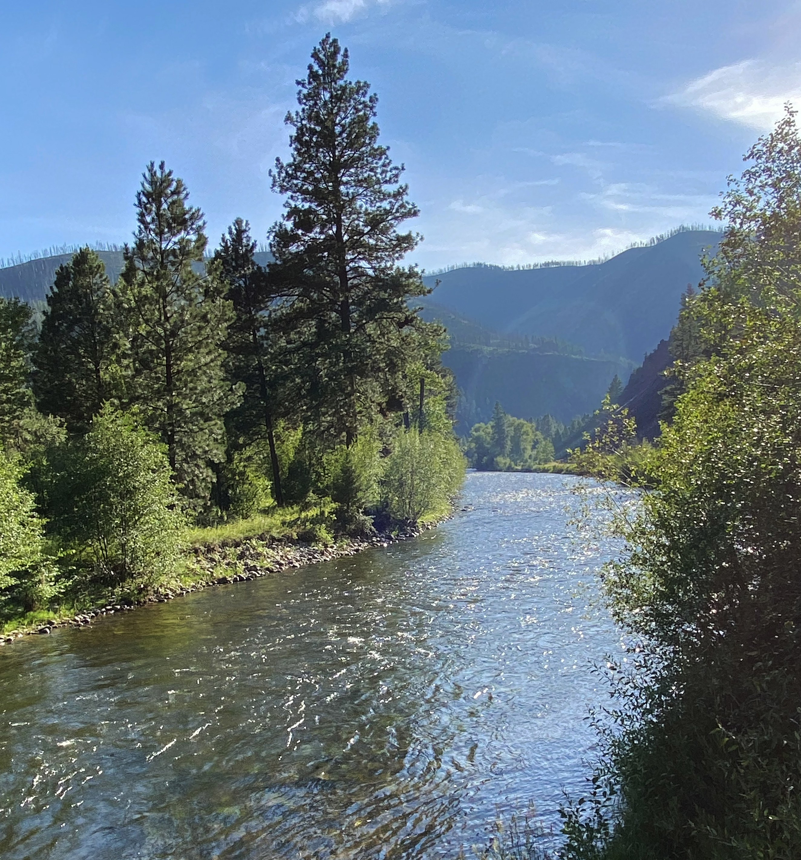
After crossing Rock Creek, the road turned to dirt, but the first few miles were unexpectedly smooth. Private grazing land along the creek transitioned abruptly to pine forest where a sheer wall of bedrock stood tall on either side of the road, like a gateway into the Sapphires.
From this point on, nearly everyone I saw was knee-deep in this blue-ribbon trout stream. The backdrop to the scene was spectacular. Huge outcrops of fine-grained sedimentary rock towered over the creek, grey in color with streaks of dead-pine-needle orange. Groves of dark green ponderosa pines clung precariously to the steep hillside, and in between, stone-strewn landslides crumbled their way to the water below.
This tributary of the Clark Fork River has long been visited by the Salish and Pend d'Oreille tribes, whose name for Rock Creek translates to “logs in the water.” The Hellgate Treaty of 1855 protects their right to hunt, fish, and gather throughout their ceded territory to this day. For thousands of years, well-worn trails were used by tribes throughout the greater region. These trails led from the Bitterroot Valley across the Sapphires, the Blackfoot Valley to the north, and from beyond the Continental Divide to the east, following the Clark Fork to the mouth of Rock Creek.
By the late 19th century, talk of gold deposits rippling through the region brought droves of treasure seekers from the east. President Grover Cleveland and other prominent investors threw 1.5 million dollars into developing the area. Despite their efforts, it all turned out to be little more than a rumor, and the promised railroad never arrived.
Miners weren’t the only early American settlers in the region; 11 miles after turning onto Road 102, I arrived at the Morgan-Case Homestead. Agnes “Annie" Morgan was born in Baltimore in 1833 when over 100,000 African-Americans in Maryland lived in slavery. It is unclear whether Morgan was a slave herself. Still, it could explain her eventual relocation (or perhaps flight) to Granite County, Montana.
Annie had a knack for healing and caretaking. A renowned cook, her local claim to fame was having prepared meals for General George Armstrong Custer. Arriving at the now-restored cabin in the early 1890's, she was given the task of caring for the severely alcoholic uncle of David Durfey, a Philipsburg Attorney. After being nurtured back to health and sobriety, the elderly uncle departed the cabin while Annie remained, and eventually filed a homestead claim.
The "Case" in the cabin's name comes from Joseph "Fisher Jack" Case. On a hike in the nearby rugged backcountry, Annie found Jack barely conscious and deathly ill with Typhoid fever. She helped him to her place, where over the next several weeks, she again proved her therapeutic abilities. Once he felt better, Case built a fence around Annie's property as thanks and payment for her care. According to local lore, Case and Morgan took a shine to one another and lived in the cabin until Annie died in 1914.
Immediately downstream, the road veered away from the creek and made a short, steep climb. The gravel became increasingly loose and picking a line through the potholes required my undivided attention. This was easier said than done, as I was often distracted by the views beyond the road before being brought back to front and center by a series of bone-jarring ruts. On the coasting side of the hill, I found the Hogback Homestead, where Charles F. Gernhard, in 1913, built an extensive wood flume irrigation system to sustain his crop fields. The Hogback and Morgan-Case Homesteads are available to rent through the US Forest Service—a thought to keep in mind for making this trip with friends.
A few more miles downstream, I came across the Rock Creek Microburst site, which proved the early namesake "logs in the water," to be fitting. Here, an entire forest seemed to have grown in the wrong direction, as long barren trunks stretched down toward the creek bed. On June 15, 1989, a severe thunderstorm created a violent downdraft with wind speeds of 150 mph. It is difficult to imagine a steep-sloped forest thrown to the ground in one fell swoop. The phenomenon is explained and drawn out in detail on an informational roadside sign.
The next stretch of the road followed the creek's eastern bank so intimately that it felt like I was riding on top of the water; so close, I could have reached out and high-fived the paddlers to my left. The steady hum of my tires mingled with the stream's gurgle created a meditative white noise that rendered all estimations of time and distance moot. The ride was so pleasant, I wanted to delay its end. When a hiking trailhead and a swinging bridge came into sight, I accepted the chance to take a break.
I crossed the bridge and entered the Welcome Creek Wilderness, a 28,135-acre landscape full of steep, rocky ridges. There are no roads, no homes, and practically no flat surfaces to speak of. I scrambled to the top of the first ridge, weaving between boulders until I found a spot to sit and enjoy the quiet.
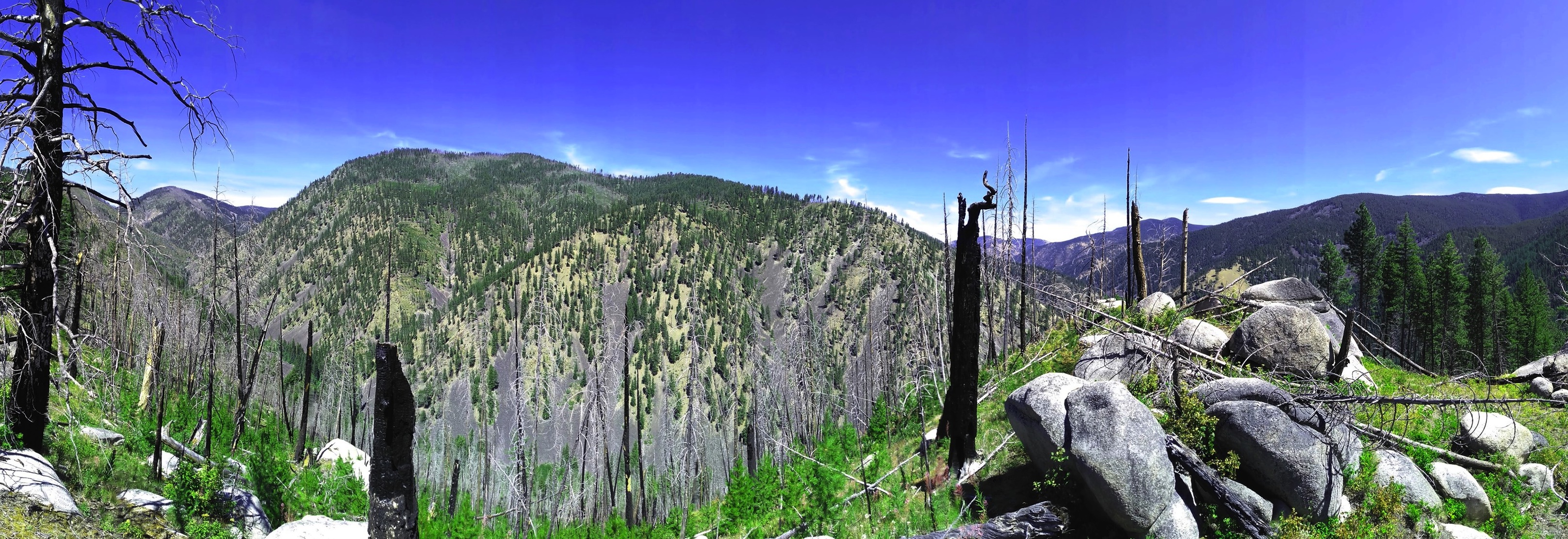
Below to my right, I could still see Rock Creek tumbling through the woods, and to my left, I spied the shape of its tributary, Welcome Creek. Viewing both made me curious to see where they met, so off I went to find it. My tired legs shook as I clambered through the unexpectedly treacherous and steep terrain; despite its beauty and peace, “welcoming” is not exactly how I would describe this place. I stood at the confluence for a while and watched the stark change as one current fed into the other. This reminded me of where I was headed— Rock Creek's terminus at the Clark Fork River. With that in mind, I turned back to the trailhead.
Back on my bike, I rounded a corner to find a herd of bighorn sheep picking their way down a severe pitch to my right. They traversed their narrow trail with such confidence and certainty that my maneuvering through ruts and rocks seemed like child's play in comparison.
When I passed Norton Campground, where I had planned to stay, it was only five pm and the creek was still luring me around each bend. The road had just turned to pavement, too, which was an absolute joy to ride since my pothole troubles had increased exponentially. I kept on pedaling.
The next landmark was the town of Quigley, a place that has changed considerably since the mining days. In 1896, J.C. McLeod of Philipsburg told a reporter with the Daily Missoulian that Quigley was a town “running over with life and prosperity." One hundred and twenty-three years later, it took me 30 seconds to ride through town, and there was no bustle to speak of. Today, Quigley is no more than a bait shop and a couple of houses. Still, its location near a wide swath of wilderness, a blue-ribbon trout stream, and copious campsites makes it an ideal destination for outdoor enthusiasts.
Each turn in the road revealed yet another picturesque view of the creek glistening in the hot afternoon sun. Before I realized it, I was in Clinton, the end of the line for me. I pulled off at the Fisherman's Mercantile, where an inviting porch made for a perfect place to rest. As the welcoming committee of local dogs greeted me, I chatted with employees and customers who confirmed my suspicion that Norton was the closest place to camp.
I usually avoid backtracking, but I didn't mind giving this captivating corridor a second look. Back into the national forest, back through Quigley, back along the murmuring waters to the Norton campsite, this put my total mileage for the day up to 65. By the time my tent was pitched, I was pretty much asleep already.
In the morning, the forecasted rain was splendidly absent. I biked into Clinton, where a friend would pick me up and return me to my car in exchange for a pint at the Philipsburg Brewery and a taco from the cart outside.
All along my Rock Creek trek, I found places I knew I could—and would—return to. The Sapphire Mountains have so much to offer and lie just a few hills away from Missoula. This route is one of many getaways in Southwestern Montana, and in my admittedly biased opinion, a bicycle's seat offers the ideal vantage point for taking it all in.
Patrick Shea is a University of Montana Journalism graduate student for UM’s This is Montana Community Vitality Project.
Photo Captions:
Rock Creek at the Junction of the Rock Creek Road and Hwy 348 – Rick & Susie Graetz (header)
The southeastern foothills of the John Long Mountains – Rick & Susie Graetz
Welcome Creek Wilderness - Jun Saito
Rock Creek from Rock Creek Road - – Rick & Susie Graetz