 SILVER STAR - “Worldwide service from the middle of nowhere!”
By Zach King - University of Montana- Davidson Honors College
“The valley though which our rout of this (day) lay and through which the river winds it's meandering course is a beatifull level plain with but little timber and that on the verge of the river. The land is tolerably fertile, consisting of a black or dark yellow loam, and covered with grass from 9 Inches to 2 feet high. The plain ascends gradually on either side of the river to the bases of two ranges of mountains which ly parrallel to the river and which terminate (it's) the width of the vally. The tops of these mountains were yet partially covered with snow while we in the valley. Were suffocated nearly with the intense heat of the midday sun. The nights are so could that two blankets are not more than sufficient covering.”
Meriwether Lewis – Journal entry August 2, 1805 – passing through the Jefferson Valley between the Highlands on the west and the Tobacco Root Mountains to the east and near the current site of Silver Star
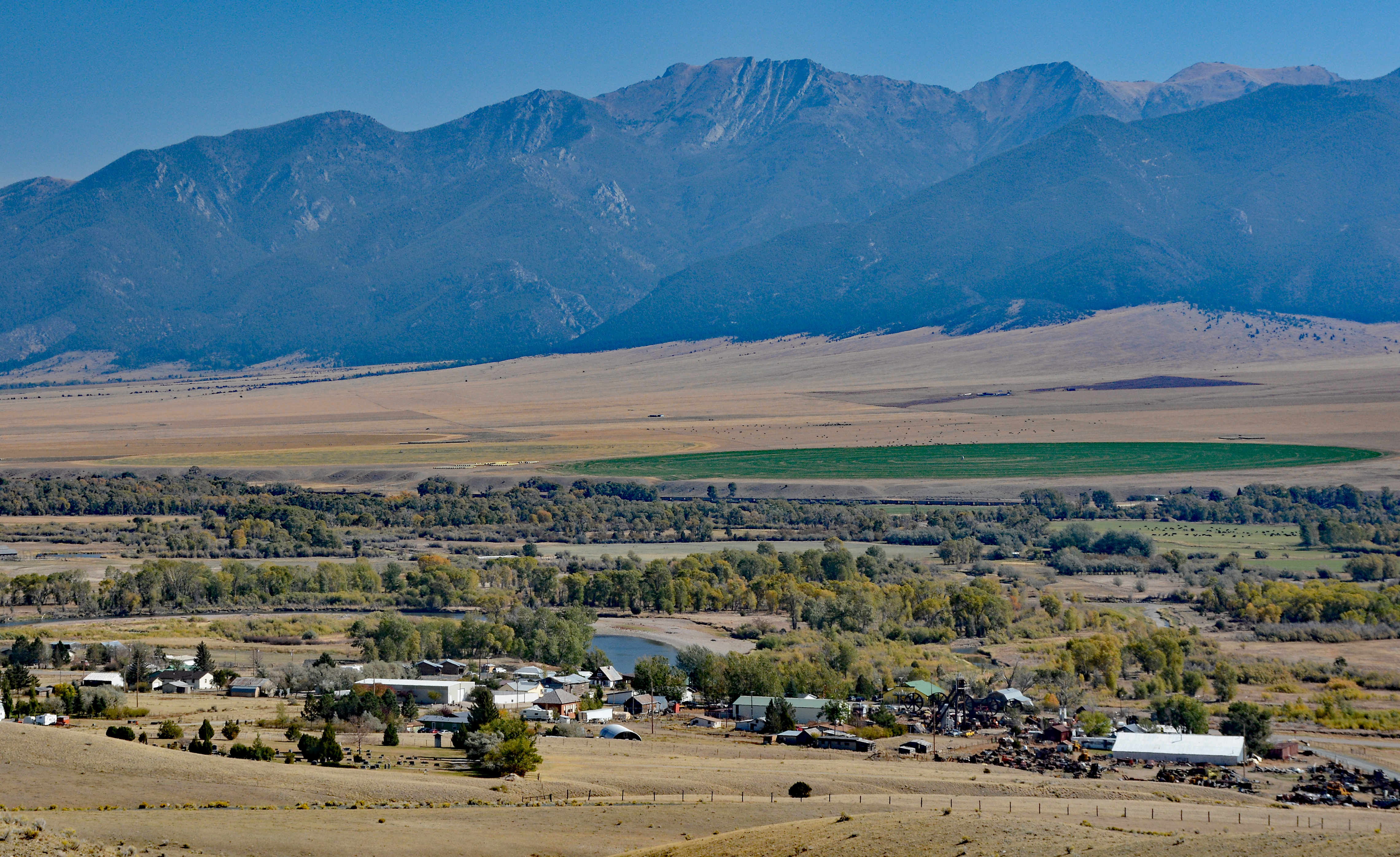
Montana’s third oldest town, Silver Star first came to life in 1866. The state’s first gold rush that occurred in summer 1862, brought on a rush of prospectors and with their arrival gold camps sprang up throughout southwest Montana. This community edging the Jefferson River and in the heart of the river valley, was born from the discovery of the precious metal. Minerals were found in the Tobacco Root Mountains that rise sharply east of town as well as in the more gradually ascending Highlands on the west side of the Jefferson River Valley.
In July 1866. Greene Campbell struck gold 1.5 miles west of where Silver Star now is and formed a claim there in his own name. It was the first patented mining claim in Montana. Many discoveries preceded Campbell’s, but they weren’t registered.
And where gold was in those days is where people moved. One of these families the Barkells, relocated to the area after grasshoppers destroyed their farm in the Beaverhead valley. They were the first to build a home here.
To serve the miners and prospectors many businesses flourished including a butcher shop, seven saloons, various stores, and a blacksmith shop. And a Masonic Lodge, a staple of many of the larger camps, was established on the second floor of the drug store. The Silver Star Hotel, just across from Granny’s Store of today, was opened in about 1867.
What became Silver Star quickly developed after that, gaining a post office in June 1869. An estimated 2,000 people lived in the area as local mining camps expanded.
“Silver Star” came from a mining claim named The Silver Star, run by two brothers, George, and Bill Boyer. The brothers, along with many other prospectors and miners in the region, would spend their Saturday evenings together at a general store that was built between two of the larger camps in the area. There were some arguments as to what these two camps should be named, to which one of the Boyers stated “We’ll call this one ‘Silver Star’ and the other one ‘Rag Town.’” Rag Town was the name of the now current Iron Rod, Montana for a long time.
As the gold and other metals “played out” people left the area, but the moniker Silver Star stayed on to become the community of 40 people today. Much quieter times now.
To be small does not mean to be a place without character. Granny’s Country Store, a distinctive bright yellow structure exhibits that personality. The owners define the place proudly by the tagline “Worldwide service from the middle of nowhere!” and indeed Silver Star is somewhat isolated. The building, including the post office, was purchased in 2003 and the owners combined the bookstore and the post office in order to make the process of shipping ordered books to other towns more efficient. And Granny’s also provides basic groceries.
There’s an emphasis on education in regard to the natural world in this business, with many
books regarding wildlife, sustainable living, Native American life, and all sorts of possibilities
one can sink their teeth into. Want to find out how to use dandelions and ways to apply them to recipes? That information is readily available. And included with some the book pages and descriptions for products are colorful facts about the owner’s families and personal lives.
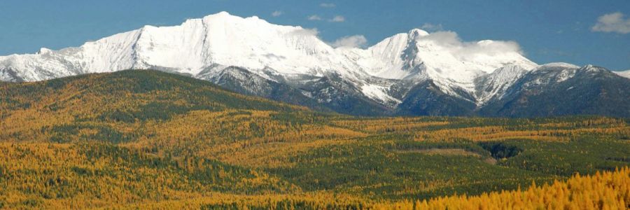
Mountains are a prominent feature of Silver Star’s settings offering numerous recreation possibilities. Towering walls of the Tobacco Root Range soar quickly on the east to summit ridges more than a mile above the townsite’s 4,750 feet of elevation. Looking west the Highlands make their “gentler” ascent to elevation.
First coined “South Bowlder Range” in 1873 then followed up by “Jefferson Range” in the early 1990s, the name Tobacco Root would eventually be reached as locals would ground up dried roots and plants to make tobacco. Another possibility is it derives from bitterroot, which the Shoshone would cook and claim it smelled similar to tobacco.
A mass of igneous rock termed the Tobacco Root Batholith makes up the core of the uplift. Granite, an igneous rock, and gneiss a metamorphic, are clearly visible in the high, steep walls that edge the nearby Madison, Ruby, and Jefferson Rivers. Peaks were carved by alpine glaciation. Numerous glacial features such as cirques ad horns are everywhere. And forty-two pinnacles exceed 10,000 feet. Hollowtop at 10, 604 feet is the loftiest.
High country lakes are filled with fish such as lake trout, cutthroat trout, arctic grayling, rainbow trout, and bull trout. The land itself is home to 244 terrestrial vertebrate species such as black bears, elk, and lynx. And beyond wildlife, the land is also used for livestock grazing.
Lands that were once a mining mecca are now mountains to hike and bike within.
Access from the east is limited by topography and private lands. The best approach roads to trailheads are on the southern end of the range from the Sheridan area. The Mill Creek Road is considered a primary passage.
Immediately across from Granny’s, Cemetery Road points into the Highlands. However here again after a few miles private land restricts access. South of town and just prior to the Jefferson River crossing a public road heads deep into this small grouping of mountains. Hells Canyon Road ascends to the Hells Canyon backcountry ranger station, a USFS rental cabin, and trailheads.
Table Mountain at 10,223 feet is the highest point in the range. A trailhead a near the Hells Creek Cabin leads to the flat upper reaches of the mountain. Several other summits reach beyond 10,000 feet and carry the Continental Divide.
There’s a saying or phrase that gets passed around about how there’s beauty in the small things. Well Silver Star is indeed small, but it has its own unique beauty – that is the town its past and the surrounding mountains.
Zach King is a freshman in UM’s Davidson Honors College majoring in Economics and minoring in Communication Studies