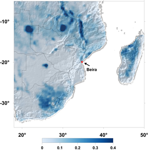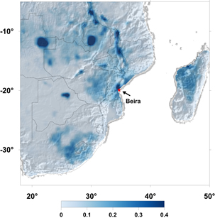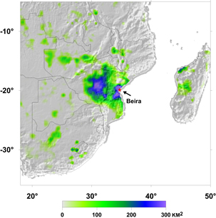
Flooding from Tropical Cyclone Idai observed from the NASA SMAP mission
Flooding over southeast Africa from Cyclone Idai, which made landfall near Beira, Mozambique on March 15th, 2019. The images show the surface 1fractional water (fw) cover change observed from the NASA Soil Moisture Active Passive (SMAP) satellite. The images depict surface water cover during March 11-13, 2019 indicating relatively wet conditions from rainfall prior to Cyclone Idai landfall on March 15th. The middle image shows the fw extent during peak flood conditions for March 17-19, 2019, while the image at right depicts the dramatic flooded area increase around the major city of Beira and the surrounding region stemming from the intense tropical cyclone. The NASA SMAP satellite has a low frequency (L-band) microwave radiometer with enhanced capabilities for detecting surface water changes in nearly all weather conditions and under low to moderate vegetation cover.