
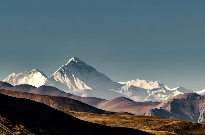
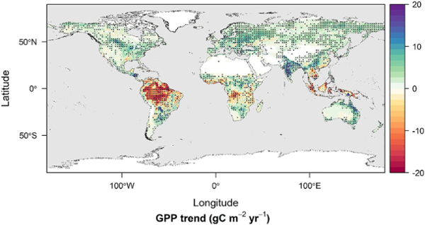
2025 Nature Communications - Seasonal stabilization effects slowed the greening of the Northern Hemisphere over the last two decades
A reanalysis of Northern Hemisphere vegetation greening trends observed from long-term satellite data reveals that moisture and heat related stress in the late growing season, along with other resource constraints, are increasingly offsetting positive growth effects from warmer temperatures in spring and rising atmosphere CO2 levels. Current state-of-the-art terrestrial biosphere models do not accurately represent these amplifying and stabilizing seasonal factors, which may impair model forecasts of future climate
2025 Vision Article: Aiding Africa
 Arthur Endsley, a researcher with UM's NTSG, leads a project designed to use NASA satellite data to help scientists in Northern Africa and elsewhere make use of data on climate change’s impacts on agriculture.
Read the Vision Magazine Article
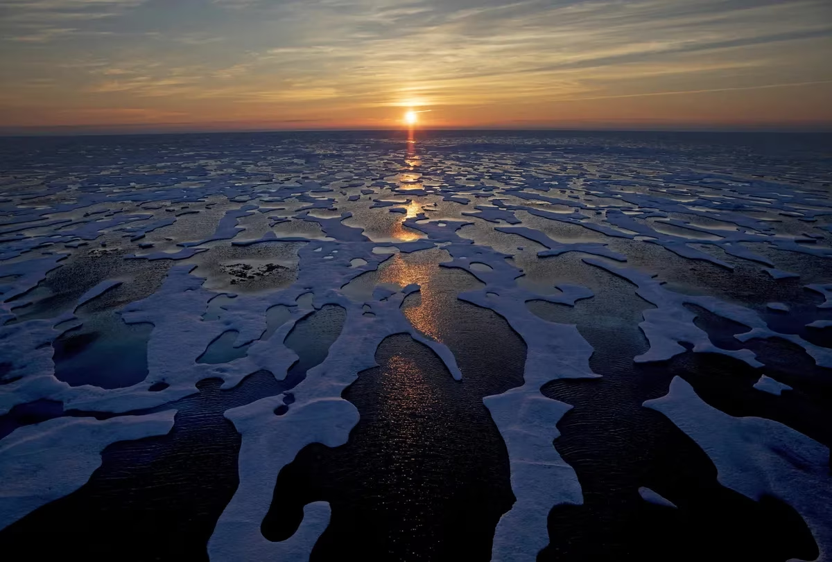
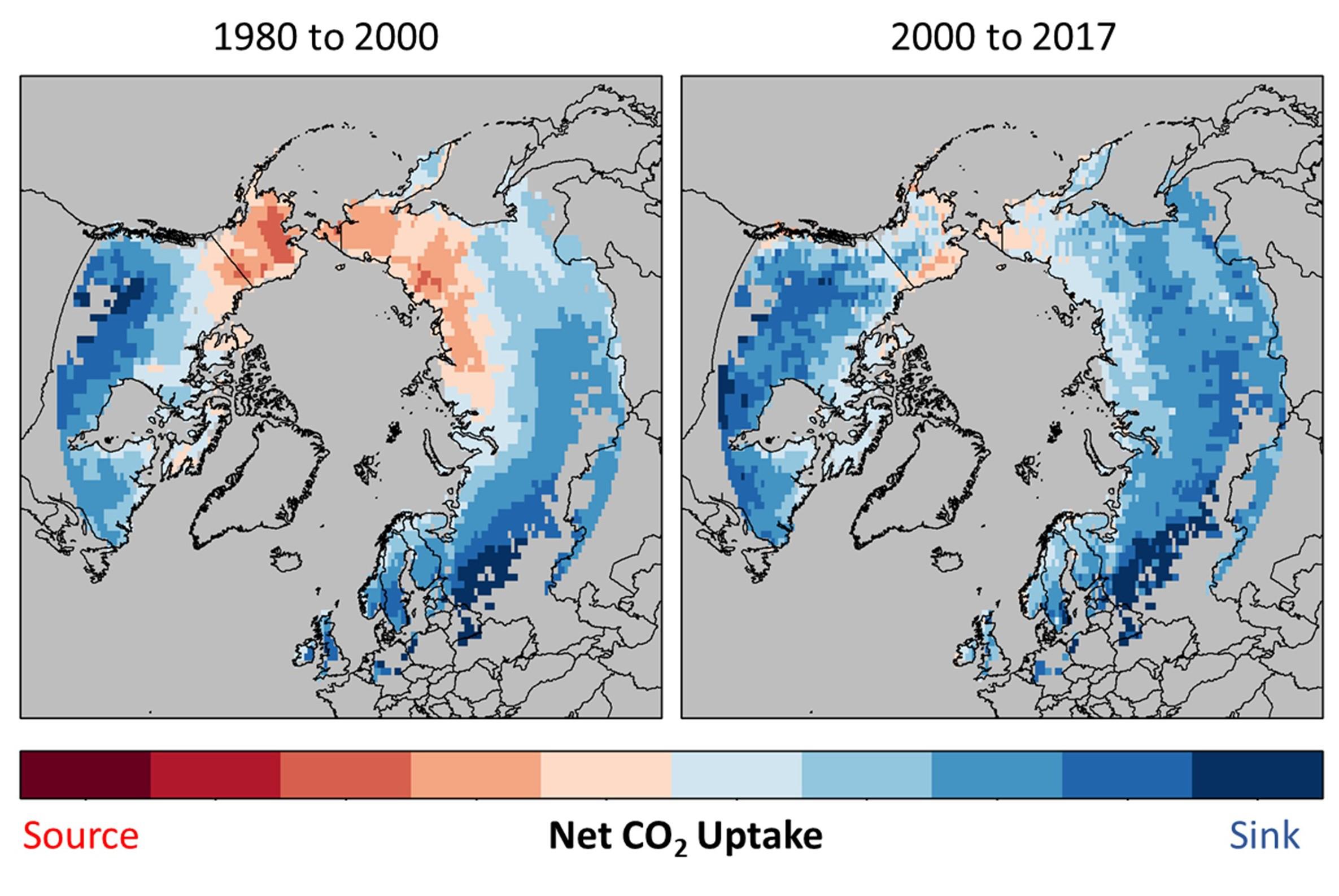
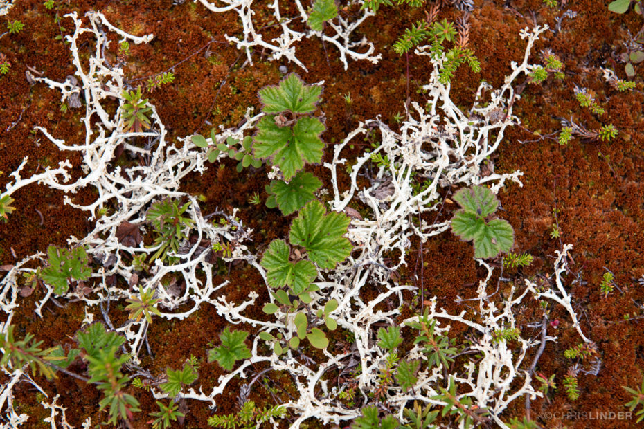
Satellites reveal alarming hotspots of Arctic change

Ecological warning lights have flashed across the Arctic for decades. New research on climate warming reveals that some of the most extreme shifts are happening in Siberia, Canada’s Northwest Territories, and Alaska.
The study, published in Geophysical Research Letters, offers a detailed look at how Arctic and boreal ecosystems are experiencing rapid and alarming transformations.
Flood irrigated wetlands increasingly important to western wildlife
 Western Confluence published a story about emerging research that suggests flood irrigation can benefit soils by saturating them and feeding groundwater supplies. The science also indicates benefits for habitats supporting multiple wildlife communities.
UM Research Reveals Earth ‘Taking Deeper Breaths’ as Climate Warms
 A new study led by University of Montana NTSG researcher Zhihua Liu has found that global warming is making the yearly rise and fall of carbon dioxide levels in the atmosphere more extreme, particularly in northern high latitudes.
Open science training using NASA earth observations to empower climate science and agriculture in Africa
Developed in collaboration with the Numerical Terradynamic Simulation Group of the University of Montana and the Department of Geographical Sciences at the University of Maryland, the Open Climate Science curriculum provides openly accessible and comprehensive resources for researchers, professionals and learners. The initiative received funding from NASA through the Transform to Open Science Program (TOPS), underscoring the importance of advancing open climate science practices.
Arthur Endsley heads NASA Open Science Project at University of Montana
 NTSG research scientist Dr. Arthur K. Endsley is the Principal Investigator of a new NASA-funded computational climate-science curriculum.
NASA recently awarded $6.5 million to educational institutions in the United States to facilitate open science education and training. Open Science aims to make NASA's research and data more collaborative, accessible, inclusive, and transparent—benefiting not only scientists and students—but farmers, city managers, and citizens.
Under the Open-Source Science Initiative (OSSI), NASA aims to make scientific knowledge more accessible. NASA pledged a 5-year investment in the Transform to Open Science (TOPS) project, designed to help researchers implement Open Science principles into their work. TOPS projects employ scientists and researchers of all levels of experience, from undergraduate students to program managers. ScienceCore, one of the TOPS curriculums, cultivates skills and knowledge in specific disciplines.
NTSG's Dr. Steve Running is Ranked Second Among All Scholars Worldwide in Forestry Publications
 ScholarGPS has ranked NTSG's Dr. Steve Running second among all scholarly publications in the field of Forestry.
UM Forms Partnership With Naval Undersea Warfare Center
The University of Montana has forged a new cooperative research agreement with the Naval Undersea Warfare Center based in Keyport, Washington. The agreement will make possible U.S. Department of Defense funding opportunities ranging from $500,000 to $10 million.
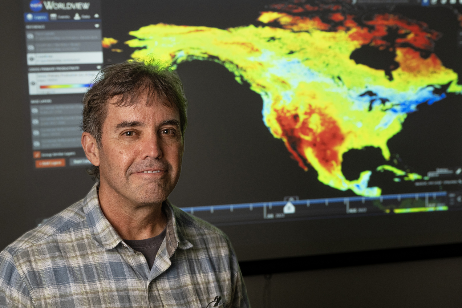
NTSG professors Steve Running and John Kimball ranked among top Environmental Scientists globally in 2023 by Research.com
 Dr. John Kimball, director of the NTSG, and Dr. Steve Running, former director of the NTSG, were ranked among the most influential environmental scientists of 2023 by Research.com.
Click the link to see Dr. Steve Running's Ranking
Click the link to see Dr. John Kimball's Ranking
Click the link to see the full ranking of Best Environmental Sciences Scientists
Warming temperatures are turning permafrost regions into carbon sinks, research suggests
 NTSG Director Kimball was interviewed for an article discussing a recent publication that suggests that carbon sinks are forming in permafrost regions due to warming temperatures. The article written by Nathan Vanderklippe appeared on The Globe and Mail website on April 13, 2023.
NTSG Research Scientist Arthur Endsley received NASA funding for TOPS Training Program
 A proposal from NTSG Research Scientist Arthur Endsley was selected for funding by NASA under its Transform to Open Science (TOPS) Training program. 2023 is NASA's Year of Open Science, and the TOPS Training program aims to make NASA's science more "collaborative, accessible, inclusive, and transparent for everyone." Dr. Endsley's proposal is to develop a computational climate-science curriculum, teaching reproducible scientific computing skills to professional researchers who are interested in using NASA's gridded climate datasets to understand how climate change is affecting agriculture, healthy soils, and water resources. The 2-year award will culminate in multiple workshops taught at the École Nationale Supérieure Agronomique (ENSA) in Algeria, along with other virtual workshop opportunities.
Shrinking Lake Abert
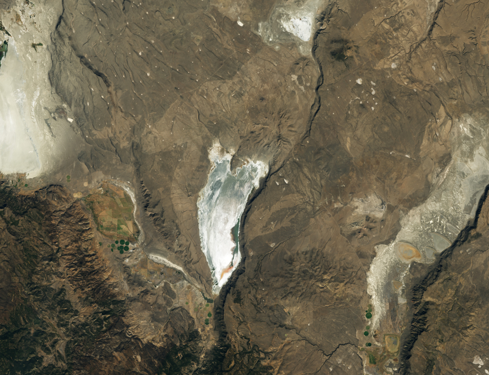 A story released by NASA January 27, 2023, uses NTSG Landsat 7 and 8 data to compare the loss of water in Lake Abert over the last 20 years. This lake is a key stop-over for tens of thousands of migratory birds in southern Oregon.
America's Billion-Dollar Tree Problem
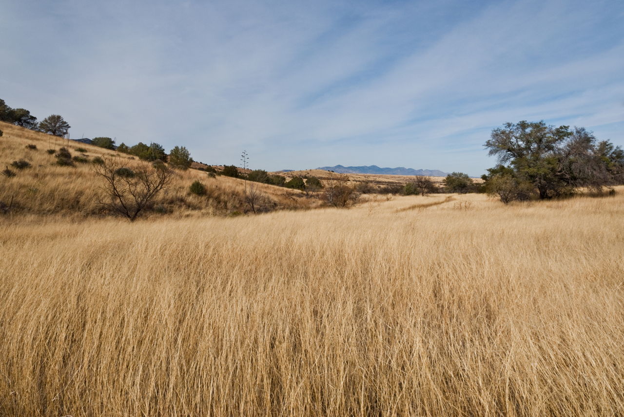 A Wired article released November 23, 2022, describes how drought-resistant invaders overrun grasslands that wreck animal habitats, suck up water supplies, and cost landowners a fortune. This article is based on the recent paper from NTSG Research Professor Scott Morford titled, "Herbaceous production lost to tree encroachment in United States rangelands," published in the Journal of Applied Ecology in October 2022.
Permafrost thaw and climate change on the Himalayan Plateau
 A Newsweek article reports that permafrost thawing on the Himalayan Qinghai-Tibet Plateau has occurred at twice the global average rate in recent decades. This thawing seriously threatens the stability of local infrastructure. NTSG's Director, John Kimball, was interviewed for this article.
UM Study Finds Plant Growth Offsets Carbon Release of Thawing Permafrost
 Permafrost is a layer of soil in polar and forested boreal regions that remains frozen all year. A new study from the University of Montana challenges the notion that high-latitude permafrost regions are becoming a net source of carbon dioxide that greatly contributes to climate warming.
The study was led by researchers in UM’s Numerical Terradynamic Simulation Group, a leader in satellite remote sensing and Earth-system science. Their findings were published in Nature Communications.
Former NTSG Professor Brady Allred's RAP project featured in UM's Vision Magazine
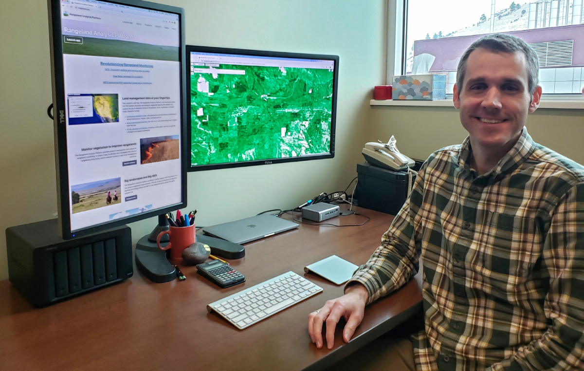 Former NTSG Professor Brady Allred's Rangeland Analysis Platform (RAP) was recently featured in the University of Montana's research magazine, Vision. A link to the PDF article is available below.
Former NTSG Director Steve Running ranked #12 among top environmental scientists globally in 2022
Dr. Steve Running, former director of the NTSG, was just ranked as the 12 most influential environmental scientist of 2022 by Research.com.
Earlier snowmelt causing knock-on effects for Arctic carbon
 An article published by the University of Sheffield identifies Arctic warming is causing earlier snowmelt and longer growing seasons in the Arctic tundra. It was previously believed that this would cause an increase in carbon sequestration in these regions. New research shows that the earlier snowmelt is actually causing a loss in net carbon sequestration later in the year.
Read more on the University of Sheffield website
Associated Paper: Earlier snowmelt may lead to late season declines in plant productivity and carbon sequestration in Arctic tundra ecosystems.
Carbon dioxide loss outpaces uptake in many regions of Alaska and Northwest Canada
 A new paper from Woodwell scientists and 24 collaborating organizations confirms that soil respiration is overpowering carbon uptake in many permafrost landscapes, especially in tundra and recently burned forests. The study, recently published in Environmental Research Letters, adds new year-round data on carbon dioxide (CO2) fluxes from soil respiration in Alaska and Northwest Canada to a growing body of work suggesting that the Arctic-boreal zone may be reaching a critical tipping point.
Read more on the Woodwell Climate Research Center website
Associated ERL Paper: Soil respiration is strongly reducing the Arctic-boreal carbon sink for atmospheric CO2
New EPA Climate Indicators track freeze-thaw environmental trends
 The EPA has updated their Climate Indicator using the NTSG Freeze-Thaw data from their microwave satellite record (FT-ESDR).
LP DAAC Releases MODIS Version 6.1 Net Evapotranspiration, GPP, and NPP Data Products
The Land Processes Distributed Active Archive Center (LP DAAC) is pleased to announce the availability of the Terra and Aqua Moderate Resolution Imaging Spectroradiometer (MODIS) Version 6.1 Net Evapotranspiration, Gross Primary Productivity (GPP), and Net Primary Production (NPP) products. These collections will continue to grow as data are produced chronologically. Details on product improvements for Version 6.1 are provided on the Digital Object Identifier (DOI) landing pages. Version 6 Net Evapotranspiration, GPP, and NPP data products will remain available and will continue with forward processing during this transition.
Eos, Research Spotlight: A Global Look at Surface Soil Organic Carbon
 Soil organic carbon is an important element of ecosystem and climate health. Remote sensing can now give scientists a global look at this important piece of the carbon puzzle.
Article by David Shultz in Eos
Water Limitations in the Tropics Offset Carbon Uptake from Arctic Greening
 More plants and longer growing seasons in the northern latitudes have converted parts of Alaska, Canada and Siberia to deeper shades of green. Some studies translate this Arctic greening to a greater global carbon uptake. But new research shows that as Earth’s climate is changing, increased carbon absorption by plants in the Arctic is being offset by a corresponding decline in the tropics.
Continue reading on the NASA website
Madani, N., N.C. Parazoo, J.S. Kimball, A.P. Ballantyne, R.H. Reichle, M. Maneta, S. Saatchi, P.I. Palmer, Z. Liu, and T. Tagesson, 2020. Recent amplified global gross primary productivity due to temperature increase is offset by reduced productivity due to water constraints. AGU Advances 1, 4, https://doi.org/10.1029/2020AV000180.
Arctic Shifts to a Carbon Source due to Winter Soil Emissions
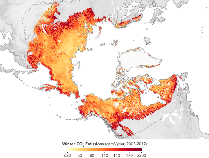 A NASA-funded study suggests winter carbon emissions in the Arctic may be adding more carbon into the atmosphere each year than is taken up by Arctic vegetation, marking a stark reversal for a region that has captured and stored carbon for tens of thousands of years.
Brady Allred & Matt Jones Discuss the Rangeland Analysis Platform (RAP) on The Art of Range Podcast
Brady Allred and Matt Jones discuss their Rangeland Analysis Platfom (RAP) on the Art of Range Podcast hosted by Tip Hudson. Listen to the show on soundcloud.
SMAP Tropical Depression Imelda Sept. 19 - 21, 2019
SMAP captures intensive rainfall flooding over southeast Texas from Tropical Depression Imelda.
Read more about SMAP and Tropical Depression Imelda in our article
SMAP Tropical Cyclone Idai Flooding Mar. 11 - 19, 2019
NTSG contributes to African Flood assessment from Cyclone Idai.
SMAP US Midwest Flooding Feb. 25 - Mar. 16, 2019
SMAP captures intense rain-on-snow driven flooding over the US Midwest. Flooding over the upper Midwest observed from the NASA SMAP satellite, which provides enhanced microwave (L-band) sensitivity to surface water (fw) within a course (~36-km) sensor footprint.
John Kimball discusses opportunities for Big Data to address climate challenges
Climate change, deforestation, ocean acidification, pollution — the scale of human-induced environmental impacts on the Earth is now so profound that scientists have declared a new geological epoch, the Anthropocene.
Big Data has emerged as a game-changer for addressing and mitigating these impacts, thanks to the vast amounts of environmental data being collected and processed every day from a multitude of sources — from satellites and sensors to aircraft and weather station networks. Climate sciences are particularly leading this Big Data revolution, as recognized by the Data-Driven Climate Sciences section of Frontiers in Big Data.
We asked Professor John Kimball — the section’s Chief Editor and Professor in the Department of Ecosystem and Conservation Sciences at the University of Montana, USA — for his insights on what Big Data means for the environment and sustainability.
Understanding High-Latitude Methane in a Warming Climate
Beneath vast plains of Arctic tundra and swampy taiga forests lies permanently frozen ground or permafrost. As northern polar regions continue to warm at a rate twice the global average, this permafrost begins to thaw. Unfrozen, waterlogged soils are like witches’ cauldrons for methane, a greenhouse gas 25 times more potent than carbon dioxide.
In these environments, organic material from plants and other sources slowly decays with the help of microorganisms called Archaea, releasing methane (CH4) into the atmosphere [Schuur et al., 2015]. Scientists know that this process is occurring, but the precise amount of Arctic carbon released as CH4 remains uncertain. Also, atmospheric measurements of the amounts of methane released by permafrost (a top-down approach) are far less than estimates of these amounts made using point-based field assessments and ecosystem modeling (bottom-up approaches). Thus, how a changing climate has affected and will affect future CH4 emissions remains a topic of debate among scientists.
New NTSG Research reveals link between plant traits and global ecosystem productivity
MISSOULA – A team of scientists at the University of Montana has discovered that climate change will significantly impact plant traits and distributions in the coming decades, affecting global ecosystem productivity.
Nima Madani, who graduated from UM in December with a doctorate in systems ecology, led the study. Scientific Reports recently published the team’s results.
UM Professors Listed Among ‘World’s Most Influential Scientific Minds’
Two University of Montana Regents Professors recently were recognized as Highly Cited Researchers on the 2017 list of The Worlds Most Influential Scientific Minds.
The publication, released in December by Clarivate Analytics, lists UM Regents Professor of Ecology Ragan Callaway and recently retired UM Regents Professor of Ecology Steve Running under its Environment/Ecology section.
Callaway and Running ranked in the top 1 percent of scientists by citations for field and publication year in Web of Science.
New FT-ESDR polar fine grid product release at NSIDC
This data set consists of a Northern Hemisphere daily landscape Freeze/Thaw status at 6 km resolution for the years 2002 to 2016 derived from observations acquired by the Advanced Microwave Scanning Radiometer-Earth Observing System (AMSR-E) and the Advanced Microwave Scanning Radiometer 2 (AMSR2).
"Is terrestrial net primary production a planetary boundary for the carbon cycle?"
In the last few years, an interesting framing of global planetary boundaries has been developed, yet without a carbon cycle variable. In this seminar, I will suggest that NPP might be a relevant planetary boundary, and with a multi-decade of measurement that already exists, I will evaluate how stable global terrestrial NPP is and whether we can define a realistic boundary. Finally, I will discuss the policy relevance of such a boundary.
NTSG wins University of Montana Website award 2017
MISSOULA – The votes are tallied and the winners selected in the University of Montana’s annual Pinecone Awards contest, which invites web users to select the University’s best websites.
- Best User Experience: School of Art.
- Most Innovative: University Center.
- Most Improved Site: Numerical Terradynamic Simulation Group.
- People’s Choice: W.A. Franke College of Forestry and Conservation.
- Best Visual Design: Avian Science Center.
- The Pulaski: John Venters, University Center.
- Best Study Page: School of Theatre & Dance.
Congratulations NTSG Alumni Ramakrishna Nemani for receiving the 2017 Distinguished Alumni Award
A pioneer in satellite-driven ecological forecasting technology, Nemani, who earned a doctorate in forestry from UM, is the director of NASA's Ecological Forecasting Laboratory. His work, which he started at UM, is the basis NASA Earth Observing System's weekly monitor of global plant production, a unique global dataset used by scientists worldwide. Nemani, whose rank of a senior research scientist is attained by only one in 1,000 NASA employees, developed and leads a modeling framework called the Terrestrial Observation and Prediction System. TOPS produces ecological nowcasts and forecasts using satellite and climate data and is a crucial tool used in global carbon monitoring, helping address issues related to water, natural hazards, carbon emissions and sequestration, agricultural productivity, public health, and urban planning.
Tracking Changing Soil Temperature, Moisture, and Carbon in the Arctic
To improve our understanding of how large stores of soil carbon and Arctic vegetation are responding to climate change, a team of scientists participating in the NASA Arctic-Boreal Vulnerability Experiment (ABoVE) recently gathered in Alaska to take part in a remote field campaign. Team members were Jennifer Watts (University of Montana; Woods Hole Research Center), Kyle Arndt and Andrea Fenner (San Diego State University), and Stephen Shirley (University of Montana).
Using SMAP to monitor surface flooding from Hurricane Harvey Aug. 2017
A new series of images generated with data from NASA's Soil Moisture Active Passive (SMAP) satellite illustrates the surface flooding caused by Hurricane Harvey from before its initial landfall through August 27, 2017. The SMAP observations detect the proportion of the ground covered by surface water within the satellite's field of view. The sequence of images depicts successive satellite orbital swath observations showing the surface water conditions on August 22, before Harvey's landfall (left), and then on Aug. 27, two days after landfall (middle).
Giovanni: The Bridge Between Data and Science
Using satellite remote sensing data sets can be a daunting task. Giovanni, a Web-based tool, facilitates access, visualization, and exploration for many of NASA’s Earth science data sets.
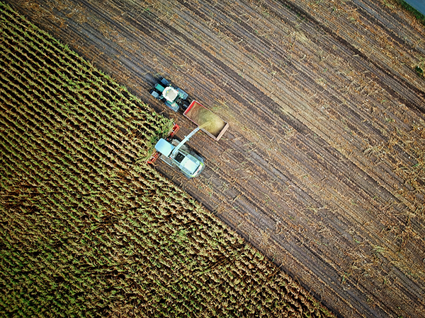
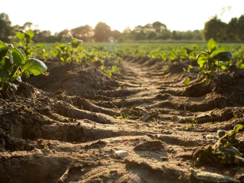
Harnessing rich satellite data to estimate crop yield
URBANA, Ill. - Without advanced sensing technology, humans see only a small portion of the entire electromagnetic spectrum. Satellites see the full range--from high-energy gamma rays, to visible, infrared, and low-energy microwaves. The images and data they collect can be used to solve complex problems. For example, satellite data is being harnessed by researchers at the University of Illinois for a more complete picture of cropland and to estimate crop yield in the U.S. Corn Belt.
UM wins NASA grant to study ag impacts on water resources
Researchers in the geosciences department at the University of Montana announced Wednesday they have received a $750,000 NASA grant to develop and apply remote sensing technologies to study hydrology on the state’s agricultural lands.
Senator Tester Applauds Partnership
(U.S. Senate) - U.S. Senator Jon Tester is applauding three research teams from Montana State University and the University of Montana that have been selected to receive funding and develop their research with NASA.
SMAP Data products updated
The Level-4 SMAP soil moisture and carbon data products, listed below, have been updated to Version 3 and are now available at the NASA National Snow and Ice Data Center Distributed Active Archive Center (NSIDC DAAC).
- SMAP L4 9 km EASE-Grid Surface and Root Zone Soil Moisture Geophysical Data (SPL4SMGP; DOI: http://dx.doi.org/10.5067/B59DT1D5UMB4)
- SMAP L4 9 km EASE-Grid Surface and Root Zone Soil Moisture Analysis Update (SPL4SMAU; DOI: http://dx.doi.org/10.5067/20ULJH6EZKFJ)
- SMAP L4 9 km EASE-Grid Surface and Root Zone Soil Moisture Land Model Constants (SPL4SMLM; DOI: http://dx.doi.org/10.5067/4IYTBSUKM57Q)
- SMAP L4 Global Daily 9 km Carbon Net Ecosystem Exchange (SPL4CMDL; DOI: http://dx.doi.org/10.5067/O4HAQJEWWUU8)
For the Level-4 soil moisture data, the primary changes implemented in this version include:
- SMAP observations are now assimilated in Eastern Europe, the Middle East, and East Asia due to expanded coverage of brightness temperature scaling parameters. The latter is based on 2 years of SMAP Version 3 brightness temperature observations where the SMOS climatology is unavailable because of RFI.
- An improved version of the model-only Nature Run (NRv4.1) simulation is used to derive brightness temperature scaling parameters, model soil moisture initial conditions, and soil moisture climatology.
For the Level-4 carbon data, the primary changes implemented in this version include:
- The model now uses dynamic 8-day fPAR inputs obtained from the latest (Collection 6) MODIS fPAR record at 500 m resolution.
- Updated and recalibrated ancillary Biome Properties Look-Up Table (BPLUT) and re-initialized model initial global soil organic carbon (SOC) pools to reflect new MODIS Collection 6 fPAR inputs.
For more information on changes implemented in this version, please see the SMAP Data Versions page at the NSIDC DAAC.
To access data, documentation, and tools, please see the SMAP Web site at the NSIDC DAAC.
Data Acknowledgements:
Data center: NSIDC DAAC
Sponsor: NASA EOSDIS
If you have questions, please contact the User Services Office at nsidc@nsidc.org.
Best regards,
NSIDC DAAC
User Services
How a Melting Arctic Changes Everything
Eight countries control land in the Arctic Circle. Five have coastlines to defend. The temperature is rising. The ice is melting. The race for newly accessible resources is beginning. And Russia is gaining ground.
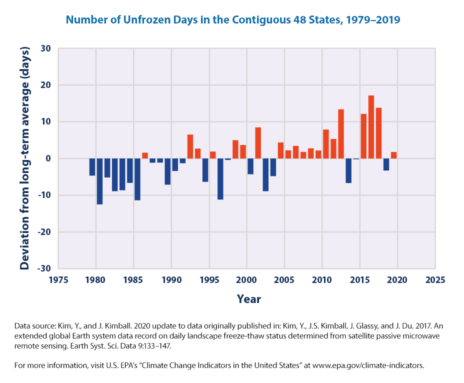
Fewer Freezing Days
Key Points: 1. Observed changes in the length of the frost-free season, defined as the number of frost-free days in a year, reflect the overall warming trend in the climate system. The bars on the graph show the difference between the number of frost-free days each year and the average number of frost-free days from 1979 to 2014.
Plant Productivity in a Warming World
The past decade is the warmest on record since instrumental measurements began in the 1880s. Previous research suggested that in the '80s and '90s, warmer global temperatures and higher levels of precipitation -- factors associated with climate change - were generally good for plant productivity. An updated analysis published this week in Science indicates that as temperatures have continued to rise, the benefits to plants are now overwhelmed by longer and more frequent droughts. High-resolution data from the Moderate Resolution Imaging Spectroradiometer, or MODIS, indicate a net decrease in NPP from 2000-2009, as compared to the previous two decades.
Montana: Trout and Drought
The flow of water in Montana's rivers is the lifeblood for its economy, both through tourism and agriculture. Montana's trout and the $300 million recreational fishing industry depend on cool waters flowing from melting snow high in the mountains throughout the summer. Irrigated crops play a prominent role in Montana's $2.4 billion agricultural industry, and these crops rely on the same strong river flows during the summer when soils are driest and plants thirstiest. But a broad trend is changing the way streams and rivers flow in Montana.
The pattern over the past fifty or so years is unmistakable. Across Montana, temperatures in March have been rising. An analysis by Climate Central shows that average March temperatures have risen over 7°F since the 1950s. This rise matches general expectations from other research on effects of human-caused global warming in the US West; and the climb is projected to continue (see animated map), although its steepness will depend on how many more greenhouse gases go into the atmosphere.
Warmer March temperatures mean that snow in the mountains begins melting sooner. Earlier snowmelt means less snow remains during the summer months — especially late in the summer — which translates to less water flowing down Montana's rivers. This means less water for irrigation, and slower flows in streams. Slow-moving water heats up more easily when the weather is hot, so slower summer flows mean more opportunities for water to get above the lethal 78°F threshold for trout.
Beyond this, Montanans also have to cope with increased wildfire activity and more outbreaks of tree-killing insects. Both trends, which have been linked to human-caused warming, cost the economy dearly.
Montanans are not sitting idly in the face of these challenges. They have already begun to tap their massive potential to produce climate-friendly wind energy. In fact, it is estimated that Montana's winds could generate as much electricity as nineteen western states consume today; currently, Montana is tapping about 4% of this potential. Making energy from wind produces essentially no greenhouse gases.
Montana also sits on about a quarter of the nation's coal reserves. Governor Brian Schweitzer wants to build coal to liquid (CTL) plants, which use coal to make liquid fuels that can replace gasoline or diesel fuel. However, CTL plants are water-intensive, and the production and use of CTL fuels generate twice the greenhouse gases that regular petroleum products do. Recognizing the carbon challenge from coal, Montana is aiming to be a leader in a new technology that would harvest coal's energy while capturing and burying deep in the ground carbon dioxide that would otherwise be released in liquid fuel production. Even with this step, however, using CTL fuels would still release about the same amount of greenhouse gases overall as burning gasoline or other crude oil products.
Footage credits: Environmental Defense Fund, Government of Canada, Invenergy & the Andy Nebel Company, Getty Images, University of Montana, Broadcast Media Center, American Museum of Fly Fishing, Western Governors' Association, Phil Takatsuno/ Yellowstone Media, Casey A. Cass/ University of Colorado
Human Consumption of NPP
On Dec. 14, 2010 NASA Goddard researchers will conduct a press briefing at the American Geophysical Union Fall 2010 meeting, entitled, "Satellite Supported Estimates of Human Rate of NPP carbon Use on Land: Challenges Ahead." In the first measurement of this trend, the research showed humans are using an increasing amount of Earth's annual production of photosynthetic land plants and that consumption rose from 20 to 25 percent from 1995 to 2005.
Watch the video from NASA on Youtube