Adding Attributes for Landscape Position, Landform, Water Flow Path, and Waterbody Type
Project lead: Linda Vance
Analysts: Joe Fortier and Claudine Tobalske
Since the early 2000s, the US Fish and Wildlife Service has been enhancing wetland data in its Wetlands Geodatabase, also referred to as the National Wetlands Inventory (NWI), by adding LLWW descriptors. These LLWW descriptors enhance the information in the existing wetland classification standard by providing information on potential wetland function.
LLWW descriptors describe the landscape position (relation of a wetland to an adjacent waterbody); landform (the physical shape of the wetland); water flow path (the direction water flows into and out of the wetland); and waterbody type (lake, river, stream, or pond). These enhanced wetland data can then be used to conduct landscape analyses of wetland function, assist in the development of conservation strategies, and increase public awareness of wetland functions.
We developed an automated procedure to assign LLWW descriptors to existing digital wetland data through a combination of crosswalks between Cowardin and LLWW wetland classification schemes, and by deriving spatial context of each unique wetland complex from a variety of ancillary, geomorphic and hydrologic data sources. The process was built into a series of geospatial tools that significantly reduce the time and cost of assigning LLWW across large geographic areas, and applied to the more than 2 million polygons in Montana’s wetland and riparian mapping geodatabase.
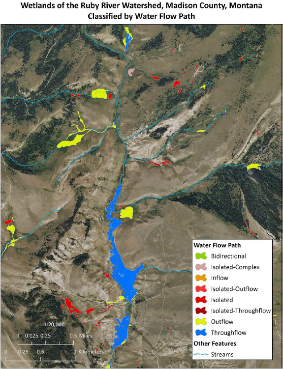
Example of water flow path classification for wetlands in the Ruby River drainage.