Fine Scale Land Use-Land Cover Mapping
Project lead: Linda Vance
Analyst: Claudine Tobalske
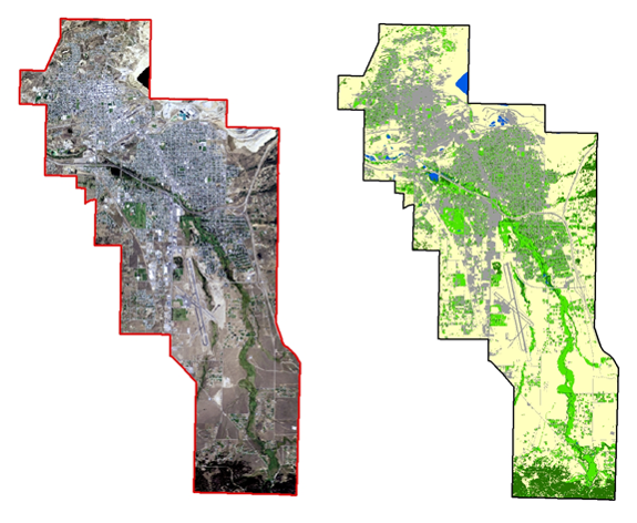
In this contract for Missoula’s Geodata Services, we segmented and classified 2009 NAIP imagery using eCognition, an object-based image analysis software that classifies whole “objects” instead of individual pixels, making it possible to use textural and contextual information in addition to spectral information.
Using 1m NAIP imagery and multi-resolution segmentation and classification within eCognition, we were able to map five land cover classes (Barren, Impervious, Grass, Tree and Shrubland, and Water) with an accuracy >92%.