Assigning Headwater Status to Montana's Wetlands
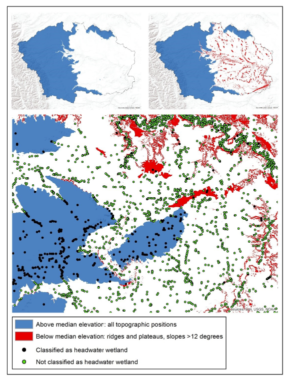
Example of headwater identification in the Marias 6-digit HUC watershed.
Project lead: Linda Vance
Analyst: Claudine Tobalske
Headwater wetlands provide critical functions for the maintenance of aquatic systems, including water storage, maintenance of surface/groundwater connections and biochemical processes, support for hydrodynamic balance, and habitat for diverse assemblages of native species. Yet modern (since 2007) wetlands mapping by MTNHP in Montana did not include explicit identification of headwater wetlands. To remedy this gap, we devised a method for the Missouri River Headwater Basin, then applied it to the entire state.
By combining topographic position with median elevation at the 6-digit HUC watershed level, we generated a binary layer that was used to assign headwater status to those mapped wetlands whose centroid fell on headwater pixels.
Read the full report on the MTNHP website.