
The Marmot Madness project is on hold, but you can still help build this dataset by submitting all marmot sightings to iNaturalist where they will be incorporated into the full publicly available dataset Thanks to everyone who participated in this project already!
Join the Philip L. Wright Zoological Museum this summer in our surveys for an iconic mountain mammal.
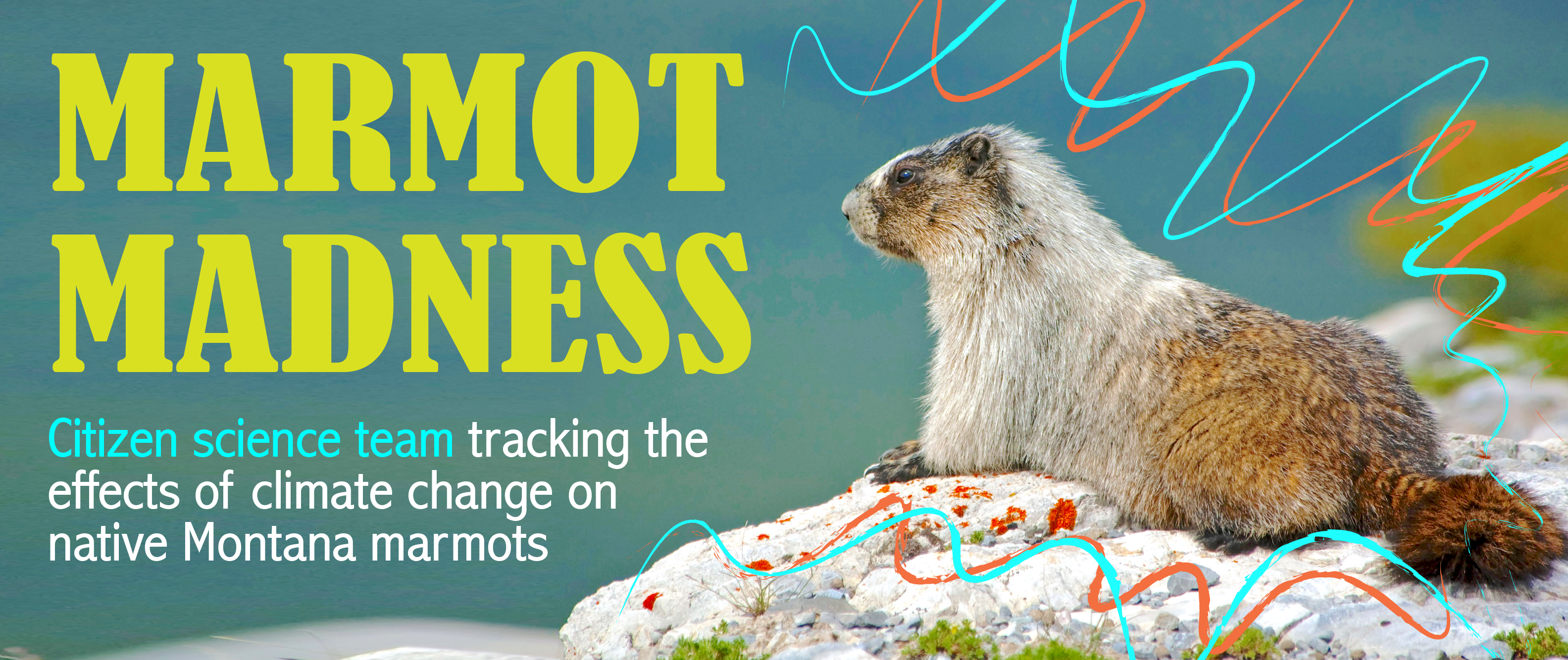
How do species react when climate changes? One of the main ways we expect species to react to climate change is by shifting their range—disappearing from some areas, and potentially appearing in new ones. In the northern hemisphere, southern range boundaries are of particular interest because they are the first place we expect to see species disappear due to the effects of warming climate. And the stakes are higher for cold-adapted montane species like the hoary marmot (Marmota caligata), which are isolated on mountaintop "sky islands." Enough climate warming could cause a localized population collapse (extirpation)—a trend almost impossible to reverse because of how difficult it would be for marmots to repopulate from another, isolated peak.
How can we track these extirpations and range shifts? By hitting the field for surveys, and comparing where we see a species today vs. where we saw it in the past. Our best resource for knowing where we have seen a species in the past is museum collections, just like the ones held at the Philip L. Wright Zoological Museum. Each specimen not only has a date and location where it was collected, but it also allows us to verify the identification to make sure we're comparing apples to apples (or, marmots to marmots!).
The Phil Wright Museum is pairing our historical hoary marmot records with modern resurveys to investigate the dynamics of this species in western Montana, at the southern edge of its range in the Rocky Mountains. The key question is whether hoary marmots are still found at the locations where they were historically collected between 1895-1980, or whether they have become extirpated in a pattern that suggests an effect of stress due to environmental change.
Marmot Madness is generously supported by the Wright family, building on Dr. Phil Wright's work, legacy, and love of biodiversity.
If you're a citizen scientist interested in helping by collecting data in some beautiful places in Montana, read on!
Basic Information
WHO: You! Participation is open to anyone who can comfortably hike in mountainous terrain and is interested in helping us collect data on the status of marmots in this region.
WHAT: Drive and hike to historical hoary marmot collection sites, and survey for marmots by sight (no animals will be handled). Surveys are on your own schedule—once we give you the information for a site, you can visit it whenever you like in the survey window. We will provide training, directions, and detailed instructions for each site. Transportation, camping/lodging, and all other costs are the responsibility of the volunteer(s).
WHERE: Sites across western Montana and northern Idaho, all within 6 hrs drive from Missoula. Many are closer and would make good day-trips. The more distant points are in some beautiful corners of our state, and would make wonderful excuses for a night or two of camping.
WHEN: Surveys may be done any time from June 15 through August 31, 2022.
HOW (TO SIGN UP): See our sign-up page.
FAQ
One of the sites I already surveyed is available again—why is that? We're only calling a site complete if one of our surveyors is able to visually confirm that hoary marmots are present. If that hasn't happened yet, we'll continue to visit the site for the time being. However, a survey where no marmots were seen is still very useful! There are many reasons why you might not see a marmot even if they're present, and absence data helps us understand how detectable the species is under our protocol, different weather conditions, and times.
Can I do multiple survey sites? Absolutely! However, we ask that you only sign up for a couple of sites at a time, and only reserve more once the first ones are complete.
What gear do I need? Aside from your usual hiking and outdoor safety gear, you'll just need the survey information (we will provide), your phone and/or GPS device, and binoculars.
How hard is the data collection? Searching for marmots will take at least one hour once you reach the site. Data collection is quite simple, and will take less than 15 minutes once you spot marmots.
Why do we recommend some sites be done in the same trip? Because they are very close to each other, in some cases close enough that you may be able to cover them in the same day. The sets are just a recommendation for efficiency; you are not required to do all the sites in a set.
How rough are the roads to get to the trailhead? It varies, though most are Forest Service roads maintained for passenger vehicles. When you reserve a site, we'll let you know what to expect to the best of our ability.
How strenuous are the hikes? There's huge variation in the hikes, from less than a mile to a 30-mile roundtrip wilderness expedition along the CDT! Most are in the middle, around 4-12 miles roundtrip through moderate to mountainous terrain. Routes are mostly or entirely on existing trails. When you reserve a site, we'll let you know what to expect to the best of our ability.
Is this a good activity to involve kids in? We'll leave that judgement up to you. Some sites will be kid-appropriate in our estimation, and we think kids would certainly enjoy trying to spot marmots!
What happens if I can't complete a site I signed up for? Let us know ASAP, and we'll open that site up to other volunteers.
I surveyed a site but I'm not confident that I did it well, now what? Send us the data you collected, and let us know what difficulties you had. We'll decide whether to send another surveyor to double-check.
I'm interested in helping, but I don't think I can make it to any of the available points. Is there another way to be involved? Aside from the points we're trying to re-survey, we're very interested in determining other locations where hoary marmots are found today! You can always add points (for marmots, or any other species you see) to iNaturalist, and they will automatically show up in our project Marmot Madness - Montana. We are especially interested in knowing whether hoary marmots are currently in the following areas: southern Bitterroots (south of Trapper Peak), Pioneer Mountains, Boulder Mountains (E of Deer Lodge), and Beaverhead Mountains.
I have more questions! Email us at montanamarmots@gmail.com
Sites
All drive times are estimated one way from Missoula, MT.
All hike distances are estimated roundtrip.
| STATUS | SITE NAME | NUMBER | COUNTY | LAT | LONG | EST DRIVE | HIKE NOTES |
| complete: hoaries present! | Little Stony Lake | 16 | Granite | 46.285176 | -113.776399 | 1.5 hr | 10 mi |
| reserved | Cutaway Pass | 17 | Granite | 46.017926 | -113.339389 | 2 hr | 16 mi (long trail hike with elevation and exposure) |
| available | Goat Mountain Lake | 18 | Granite | 46.382668 | -113.041297 | 2 hr | 4-16 mi (depending on road conditions) |
| available | McDonald Peak South | 19 | Lake | 47.377512 | -113.919618 | 1 hr | 17 mi (much off-trail and very challenging), must be done before July 15, requires CKST permit) |
| available | McDonald Peak North | 20 | Lake | 47.397193 | -113.919255 | 1 hr | 6 mi (much off-trail, must be done before July 15, requires CKST permit) |
| reserved | Dick Creek | 29 | Missoula | 46.675979 | -114.358248 | 1.5 hr | 2-3 mi (most/all off-trail) |
| available | Carlton Lake | 30 | Missoula | 46.685432 | -114.228532 | 1 hr | 12 mi |
| available | Rattlesnake Creek | 31 | Missoula | 47.083246 | -113.887843 | 15 min | 40+ miles (most may be done on mountain bike) |
| available | Pyramid Lake | 32 | Powell | 47.259645 | -113.382353 | 1.5 hr | 8 mi |
| available | Brushy Fork | 2 | Idaho | 46.5802 | -114.5364 | 1 hr | 6 mi |
| complete: hoaries present! | *Oregon Lakes | 27 | Mineral | 47.05308 | -115.094499 | 2 hr | 4 mi |
| reserved | *Trail Lake | 28 | Mineral | 47.005018 | -115.042664 | 1.5 hr | 10 mi |
| available | Stuart Peak | 34 | Missoula | 47.006153 | -113.916341 | 15 min | 22 mi (quick drive, big hike!) |
| reserved | Tenmile Creek | 35 | Deer Lodge | 46.050324 | -113.139661 | 2.5 hr | 14 mi (campground at alpine lakes) |
| available | Indian Creek | 36 | Lewis and Clark | 47.58033 | -113.12061 | 3 hr | 30 mi (same trailhead as site 40) |
| available | Dearborn River | 37 | Lewis and Clark | 47.311187 | -112.814907 | 2.75 hr | 30 mi (nearly to top of Scapegoat Mountain) |
| available | Sugarloaf Mountain | 40 | Lewis and Clark | 47.408548 | -112.935741 | 3 hr | 36 mi (same trailhead as site 36; some exposed ridgeline) |
*consider one trip for sites 27-28
| STATUS | SITE NAME | NUMBER | COUNTY | LAT | LONG | EST DRIVE | HIKE NOTES |
| available | Upper Miner Lakes | 3 | Beaverhead | 45.265511 | -113.678877 | 3 hr | 8-12 mi (depending on road conditions) |
| STATUS | SITE NAME | NUMBER | COUNTY | LAT | LONG | EST DRIVE | HIKE NOTES |
| reserved | Elk Summit | 1 | Idaho | 46.32381 | -114.649827 | 2.5 hr | 5 mi |
| available | Stanley Butte | 39 | Idaho | 46.247694 | -115.210124 | 2 hr | 21 mi (passes by Stanley Hot Springs) |
| STATUS | SITE NAME | NUMBER | COUNTY | LAT | LONG | EST DRIVE | HIKE NOTES |
| reserved | $Lake Mountain | 5 | Flathead | 48.777746 | -114.590982 | 4 hr | 5 mi |
| available | $Red Meadow Mountain | 6 | Flathead | 48.75185 | -114.559408 | 4 hr | 3-4 mi (most/all off-trail) |
| available | $Nasukoin Mountain | 7 | Flathead | 48.792574 | -114.557059 | 4 hr | 4-10 mi (depends on road conditions) |
| complete: hoaries present! | ^Werner Peak | 8 | Flathead | 48.601303 | -114.448121 | 3.5 hr | 4 mi |
| available | ^Hallowat Creek | 9 | Flathead | 48.625703 | -114.443439 | 4.5 hr | 6 mi |
| not available | &Mount Oberlin | 10 | Flathead | 48.697898 | -113.733146 | 3.5 hr | 4 mi (Glacier NP) |
| not available | &Weeping Wall | 11 | Flathead | 48.728505 | -113.729822 | 3.5 hr | 6-8 mi (Glacier NP) |
| not available | &Logan Pass | 12 | Flathead | 48.696188 | -113.739113 | 3.5 hr | 2-4 mi (Glacier NP) |
| not available | &Piegan Mountain | 13 | Glacier | 48.707783 | -113.686201 | 3.5 hr | 3-8 mi, potential scrambling (Glacier NP) |
| not available | &St. Mary Lake | 14 | Glacier | 48.6905 | -113.5065 | 4 hr | 0-4 mi (Glacier NP) |
| not available | &Avalanche Creek | 38 | Flathead | 48.709635 | -113.786456 | 3 hr | 0-2 mi (Glacier NP) |
| available | Elkcalf Mountain | 15 | Flathead | 48.284899 | -113.298406 | 3 hr | 2-3 mi (most/all off-trail) |
$consider one trip for sites 5-7
^consider one trip for sites 8-9
&consider one trip for sites 10-14 + 38
| STATUS | SITE NAME | NUMBER | COUNTY | LAT | LONG | EST DRIVE | HIKE NOTES |
| available | Rock Lake | 33 | Sanders | 48.06933 | -115.642278 | 3 hr | 8-12 mi (depending on road conditions) |
| available | %Davis Mountain | 21 | Lincoln | 48.938286 | -115.967972 | 5 hr | 8 mi (some exposed ridgeline) |
| available | %Northwest Peak | 22 | Lincoln | 48.968403 | -115.96018 | 5 hr | 2-3 mi (most/all off-trail) |
| available | %Rock Candy Mountain | 23 | Lincoln | 48.897451 | -115.950748 | 4 hr | 9 mi |
| available | West Fork Yaak River | 24 | Lincoln | 48.947042 | -115.739086 | 4.5 hr | 4-8 mi (most/all off-trail) |
| available | Pipe Creek | 25 | Lincoln | 48.66282 | -115.651441 | 4 hr | 6 mi |
| available | Robinson Mountain | 26 | Lincoln | 48.960083 | -115.44268 | 4.5 hr | 10 mi |
%consider one trip for sites 21-23