3D Modelling
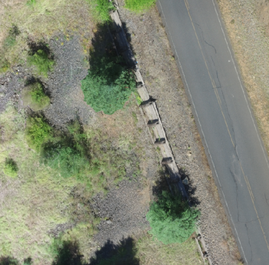
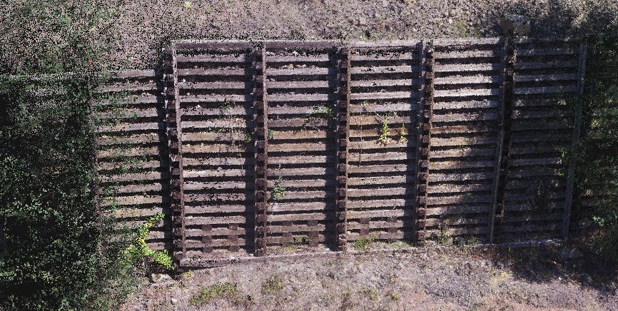
We used 3D point cloud imagery to identify weaknesses in retaining walls of forest roads. This work resulted in over $1 million in funding for infrastructure repairs. The image on the left shows drone-captured imagery of the timber wall holding up the adjacent forest road. On the right is a 3D point cloud of the retaining wall generated from the same drone imagery.
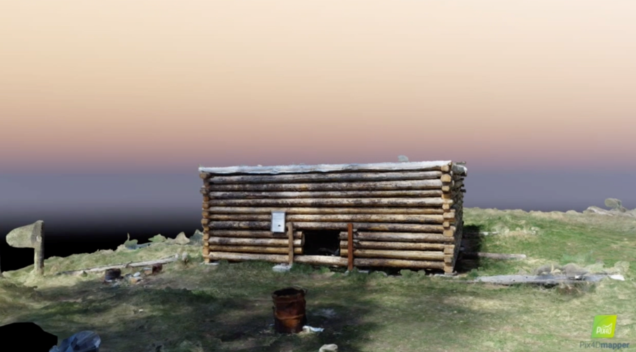
In another project with the US Forest Service, we produced 3D models of historic structures using UAS imagery and Pix4D photogrammetry software. These models help maintain an inventory of the structures and could possibly be used for restoration work.