
Landsat Gap-Filled Reflectances
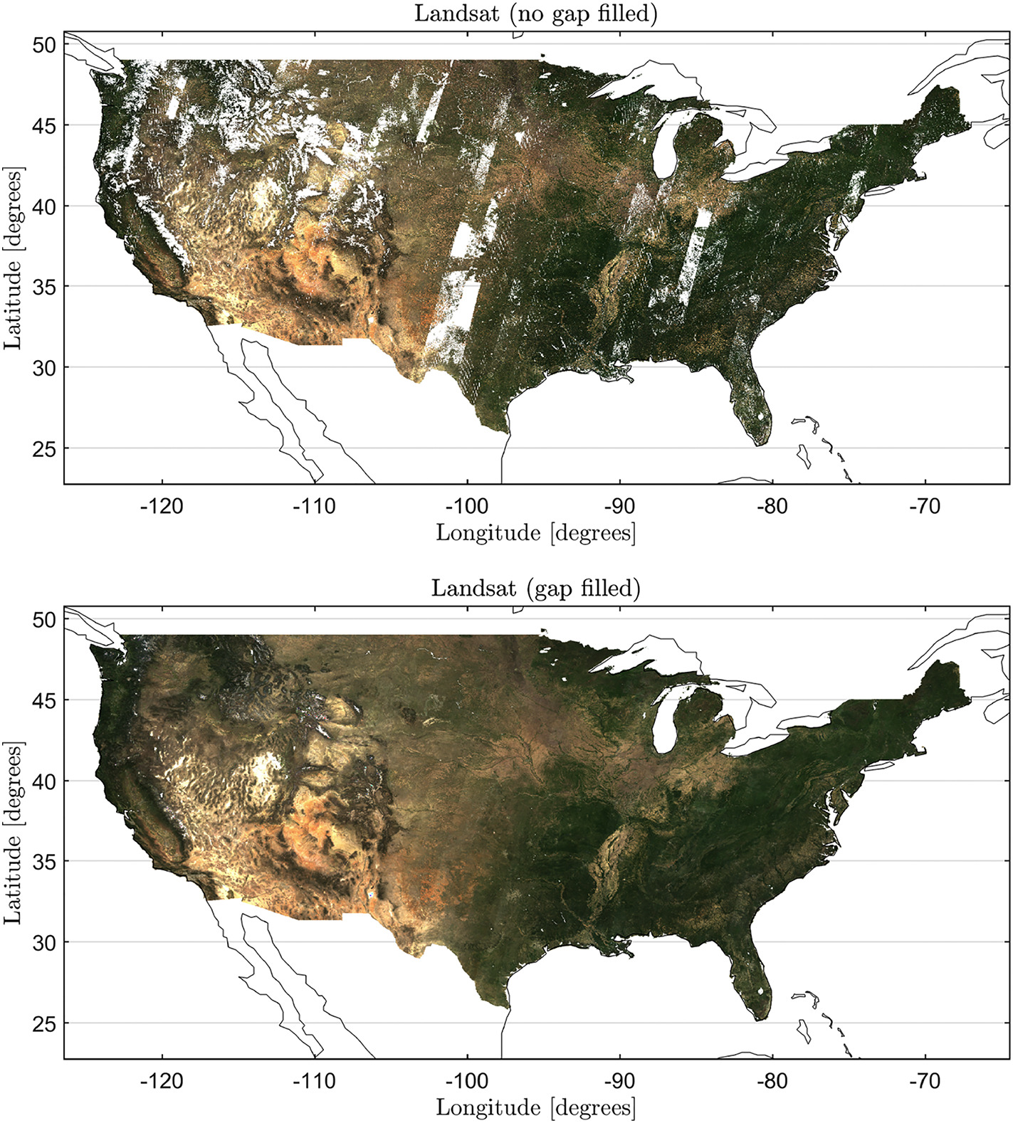
We developed a new data fusion algorithm to produce gap-free Landsat 30-m resolution reflectances over the continental USA. The data record was derived using a new Highly Scalable Temporal Adaptive Reflectance Fusion Model (HISTARFM) to combine similar multispectral information from Landsat and MODIS sensors to reduce noise and produce a continuous monthly record of the Landsat reflectance channels over land. The HISTARFM is highly scalable and runs optimally in a cloud computing environment to mitigate constraints imposed from a massive Landsat data archive. The model uses a bias-aware Kalman filter method in the Google Earth Engine (GEE) platform to obtain fused images at the Landsat 30-m resolution. The added bias correction in the Kalman filter accounts for the fact that both model and observation errors are temporally auto-correlated and may have a non-zero mean. This approach also enables reliable estimation of the uncertainty associated with the final reflectance estimates, allowing for error propagation analyses in higher level remote sensing products (e.g. NDVI, FPAR, GPP). Quantitative and qualitative evaluations of the generated products through comparison with other state-of-the-art methods confirm favorable performance and accuracy, and open the door to operational applications at enhanced spatio-temporal resolutions at broad continental scales.
NTSG Personnel
- Alvaro Moreno-Martinez
- Steve Running
Publication
Moreno-Martínez, Á., Izquierdo-Verdiguier, E., Maneta, M. P., Camps-Valls, G., Robinson, N., Muñoz-Marí, J., ... & Running, S. W. (2020). Multispectral high resolution sensor fusion for smoothing and gap-filling in the cloud. Remote Sensing of Environment, 247, 111901, https://doi.org/10.1016/j.rse.2020.111901.
Data access in Google Earth Engine (GEE):
https://code.earthengine.google.com/?asset=projects/KalmanGFwork/GFLandsat_V1